Couddes
| Couddes | |
|---|---|
|
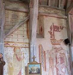
Fresco in the church | |
 Couddes | |
|
Location within Centre-Val de Loire region  Couddes | |
| Coordinates: 47°21′51″N 1°24′16″E / 47.3642°N 1.4044°ECoordinates: 47°21′51″N 1°24′16″E / 47.3642°N 1.4044°E | |
| Country | France |
| Region | Centre-Val de Loire |
| Department | Loir-et-Cher |
| Arrondissement | Romorantin-Lanthenay |
| Canton | Saint-Aignan |
| Intercommunality | Controis |
| Government | |
| • Mayor (2014–2020) | Hubert Marseault |
| Area1 | 18.64 km2 (7.20 sq mi) |
| Population (2013)2 | 521 |
| • Density | 28/km2 (72/sq mi) |
| Time zone | CET (UTC+1) |
| • Summer (DST) | CEST (UTC+2) |
| INSEE/Postal code | 41062 / 41700 |
| Elevation |
94–119 m (308–390 ft) (avg. 91 m or 299 ft) |
|
1 French Land Register data, which excludes lakes, ponds, glaciers > 1 km² (0.386 sq mi or 247 acres) and river estuaries. 2 Population without double counting: residents of multiple communes (e.g., students and military personnel) only counted once. | |
Couddes is a commune in the Loir-et-Cher department of central France.
Population
| Historical population | ||
|---|---|---|
| Year | Pop. | ±% |
| 1793 | 295 | — |
| 1806 | 309 | +4.7% |
| 1821 | 317 | +2.6% |
| 1831 | 326 | +2.8% |
| 1841 | 364 | +11.7% |
| 1851 | 463 | +27.2% |
| 1861 | 537 | +16.0% |
| 1872 | 556 | +3.5% |
| 1881 | 610 | +9.7% |
| 1891 | 642 | +5.2% |
| 1901 | 707 | +10.1% |
| 1911 | 738 | +4.4% |
| 1921 | 718 | −2.7% |
| 1931 | 657 | −8.5% |
| 1946 | 698 | +6.2% |
| 1954 | 601 | −13.9% |
| 1962 | 577 | −4.0% |
| 1968 | 528 | −8.5% |
| 1975 | 518 | −1.9% |
| 1982 | 520 | +0.4% |
| 1990 | 485 | −6.7% |
| 2008 | 516 | +6.4% |
| 2013 | 521 | +1.0% |
See also
References
| Wikimedia Commons has media related to Couddes. |
This article is issued from Wikipedia - version of the 11/15/2016. The text is available under the Creative Commons Attribution/Share Alike but additional terms may apply for the media files.