Vernou-en-Sologne
| Vernou-en-Sologne | ||
|---|---|---|
|
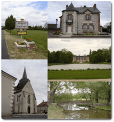
Clockwise from top left: Road sign, the town hall and post office, the chateau, footbridge, the church | ||
| ||
 Vernou-en-Sologne | ||
|
Location within Centre-Val de Loire region  Vernou-en-Sologne | ||
| Coordinates: 47°30′07″N 1°40′51″E / 47.5019°N 1.6808°ECoordinates: 47°30′07″N 1°40′51″E / 47.5019°N 1.6808°E | ||
| Country | France | |
| Region | Centre-Val de Loire | |
| Department | Loir-et-Cher | |
| Arrondissement | Romorantin-Lanthenay | |
| Canton | Romorantin-Lanthenay-Nord | |
| Intercommunality | Communauté de communes de la Sologne des étangs | |
| Government | ||
| • Mayor (2008–2014) | Jack Terrier | |
| Area1 | 51.31 km2 (19.81 sq mi) | |
| Population (1999)2 | 524 | |
| • Density | 10/km2 (26/sq mi) | |
| Time zone | CET (UTC+1) | |
| • Summer (DST) | CEST (UTC+2) | |
| INSEE/Postal code | 41271 / 41230 | |
| Elevation |
82–116 m (269–381 ft) (avg. 95 m or 312 ft) | |
|
1 French Land Register data, which excludes lakes, ponds, glaciers > 1 km² (0.386 sq mi or 247 acres) and river estuaries. 2 Population without double counting: residents of multiple communes (e.g., students and military personnel) only counted once. | ||
Vernou-en-Sologne is a commune in the Loir-et-Cher department in central France.
See also
| Wikimedia Commons has media related to Vernou-en-Sologne. |
This article is issued from Wikipedia - version of the 4/13/2016. The text is available under the Creative Commons Attribution/Share Alike but additional terms may apply for the media files.