Saint-Denis-sur-Loire
| Saint-Denis-sur-Loire | |
|---|---|
|
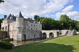
The Château of Saint-Denis-sur-Loire | |
 Saint-Denis-sur-Loire | |
|
Location within Centre-Val de Loire region  Saint-Denis-sur-Loire | |
| Coordinates: 47°37′33″N 1°23′14″E / 47.6258°N 1.3872°ECoordinates: 47°37′33″N 1°23′14″E / 47.6258°N 1.3872°E | |
| Country | France |
| Region | Centre-Val de Loire |
| Department | Loir-et-Cher |
| Arrondissement | Blois |
| Canton | Blois-1 |
| Intercommunality | Blois |
| Government | |
| • Mayor | Benoit Simonnin |
| Area1 | 12.4 km2 (4.8 sq mi) |
| Population (1999)2 | 884 |
| • Density | 71/km2 (180/sq mi) |
| Time zone | CET (UTC+1) |
| • Summer (DST) | CEST (UTC+2) |
| INSEE/Postal code | 41206 / 41000 |
| Elevation |
69–115 m (226–377 ft) (avg. 120 m or 390 ft) |
|
1 French Land Register data, which excludes lakes, ponds, glaciers > 1 km² (0.386 sq mi or 247 acres) and river estuaries. 2 Population without double counting: residents of multiple communes (e.g., students and military personnel) only counted once. | |
Saint-Denis-sur-Loire is a commune in the Loir-et-Cher department of central France.
It is a suburb of Blois, 7 km north east of the town, and lies on the river Loire, 63 km south west of Orléans.
See also
References
| Wikimedia Commons has media related to Saint-Denis-sur-Loire. |
This article is issued from Wikipedia - version of the 3/2/2015. The text is available under the Creative Commons Attribution/Share Alike but additional terms may apply for the media files.