Congo, Pennsylvania
| Congo, Pennsylvania | |
|---|---|
| Unincorporated community | |
|
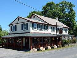
Union Jack's Olde Congo Hotel. | |
 Congo | |
| Coordinates: 40°21′03″N 75°35′02″W / 40.35083°N 75.58389°WCoordinates: 40°21′03″N 75°35′02″W / 40.35083°N 75.58389°W | |
| Country | United States |
| State | Pennsylvania |
| County | Montgomery |
| Township | Douglass |
| Elevation | 427 ft (130 m) |
| Time zone | Eastern (EST) (UTC-5) |
| • Summer (DST) | EDT (UTC-4) |
| ZIP Code | 19504 |
| Area code(s) | 610 and 484 |
| GNIS feature ID | 1172326[1] |
Congo is a village in Douglass Township, Montgomery County. Congo is located at the intersection of Hoffmansville Road and Congo Road northeast of Boyertown. It is drained by the Swamp Creek into the Perkiomen Creek and uses the Barto ZIP Code of 19504.
Name origin
The village was named Cedarville until the 1880s, when the US Post Office decided to rename it due to the existence of at least three other Pennsylvania post offices with "cedar" in their names. The Congo Basin was in the news at the time due to conflicting European claims and measures to settle them. While the Congo post office closed around 1925, the name has remained with the community ever since.[2]
 |
Barto, Bechtelsville | Bally | Niantic | |
| Colebrookdale Township, Berks County | |
New Hanover Township | ||
| ||||
| | ||||
| Boyertown, Gilbertsville | Layfield | Sassamansville |
References
- ↑ "Congo". Geographic Names Information System. United States Geological Survey.
- ↑ Douglass Township Bicentennial Historical Committee. "A History of Douglass Township: 1700 to 1976." 1976, p. 32.
| Wikimedia Commons has media related to Congo, Pennsylvania. |

This article is issued from Wikipedia - version of the 11/9/2016. The text is available under the Creative Commons Attribution/Share Alike but additional terms may apply for the media files.