La Mott, Pennsylvania
| La Mott | |
| Camp Town | |
| Unincorporated community Neighborhood of Cheltenham Township | |
 La Mott, corner of Willow Avenue and Sycamore Avenue. September 2012. | |
| Country | |
|---|---|
| State | |
| County | |
| Township | |
| Elevation | 230 ft (70.1 m) |
| Coordinates | 40°04′04″N 75°08′26″W / 40.06778°N 75.14056°WCoordinates: 40°04′04″N 75°08′26″W / 40.06778°N 75.14056°W |
| Area | .261 sq mi (0.7 km2) |
| - land | .261 sq mi (1 km2) |
| - water | 0.00 sq mi (0 km2), 0% |
| Population | 3,554 (2010) |
| Density | 13,616.9/sq mi (5,257.5/km2) |
| Commissioner | Harvey Portner |
| Timezone | Eastern Standard Time (UTC-5) |
| - summer (DST) | Eastern Daylight Time (UTC-4) |
| Area code | 215 |
 Location of La Mott in Pennsylvania | |
 Location of Pennsylvania in the United States | |
| Website: http://www.historic-lamott-pa.com/ | |
| Official name | Village of La Mott |
| Designated | June, 1973 |
La Mott is an unincorporated residential community in Cheltenham Township, Montgomery County, Pennsylvania, United States. It borders the City of Philadelphia along Cheltenham Avenue. There are 65 locations in the continental United States named Mott, but this is the only one named La Mott. La Mott has the ZIP code of 19027. Formerly known as Camp Town, it is home to Camp William Penn, the first federal training site for black soldiers during the American Civil War. Lucretia Mott lived here from the 1850s to her death in 1880. Her house, Roadside, was a major stop on the Underground Railroad. La Mott is a close-in suburb of Philadelphia.
Gallery
 La Mott AME Church.
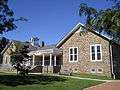 La Mott Community Center and Free Library.
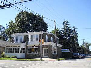
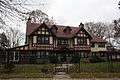 Residence on Old York Road.
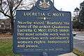 Sign at the site of former Lucretia C. Mott House.
 La Mott historical marker
See also
External links
References
| Wikimedia Commons has media related to La Mott, Pennsylvania. |
Founded 1682 | ||
| Communities | 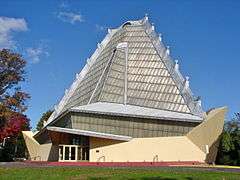  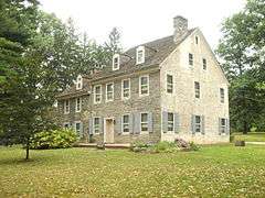  | |
| Education |
| |
| National Historic Sites | ||
| Famous People | ||
| See also | ||
| Historical Railroads | ||
| Regional Rail Lines | ||
| Regional Rail Stations | ||
| SEPTA Bus Routes | ||
| Infrastructure | ||

This article is issued from Wikipedia - version of the 3/14/2016. The text is available under the Creative Commons Attribution/Share Alike but additional terms may apply for the media files.