West Norriton Township, Montgomery County, Pennsylvania
| West Norriton Township | |
| Township | |
 | |
| Country | United States |
|---|---|
| State | Pennsylvania |
| County | Montgomery |
| Elevation | 177 ft (53.9 m) |
| Coordinates | 40°07′24″N 75°22′59″W / 40.12333°N 75.38306°WCoordinates: 40°07′24″N 75°22′59″W / 40.12333°N 75.38306°W |
| Area | 10.1 sq mi (26.2 km2) |
| - land | 10.0 sq mi (26 km2) |
| - water | 0.2 sq mi (1 km2), 1.98% |
| Population | 15,663 (2010) |
| Density | 1,550.8/sq mi (598.8/km2) |
| Timezone | EST (UTC-5) |
| - summer (DST) | EDT (UTC-4) |
| Area code | 610 |
 Location of West Norriton Township in Montgomery County | |
 Location of West Norriton Township in Pennsylvania | |
 Location of Pennsylvania in the United States | |
| Website: http://www.westnorritontwp.org | |
West Norriton Township is a township in Montgomery County, Pennsylvania, United States. It is part of the Norristown Area School District. The population of the township was 15,663 at the 2010 census.
Geography
According to the United States Census Bureau, the township has a total area of 6.2 square miles (16 km2), of which 5.9 square miles (15 km2) is land and 0.3 square miles (0.78 km2), or 5.03%, is water.
Demographics
| Historical population | |||
|---|---|---|---|
| Census | Pop. | %± | |
| 1930 | 2,588 | — | |
| 1940 | 3,016 | 16.5% | |
| 1950 | 4,879 | 61.8% | |
| 1960 | 8,342 | 71.0% | |
| 1970 | 12,456 | 49.3% | |
| 1980 | 14,034 | 12.7% | |
| 1990 | 15,209 | 8.4% | |
| 2000 | 14,901 | −2.0% | |
| 2010 | 15,663 | 5.1% | |
As of the 2010 census, the township was 81.1% White, 9.0% Black or African American, 0.1% Native American, 5.2% Asian, 0.1% Native Hawaiian and Other Pacific Islander, and 1.7% were two or more races. 3.1% of the population were of Hispanic or Latino ancestry.[1]
As of the census[2] of 2000, there were 14,901 people, 6,614 households, and 3,842 families residing in the township. The population density was 2,543.9 people per square mile (981.8/km2). There were 6,890 housing units at an average density of 1,176.3/sq mi (454.0/km2). The racial makeup of the township was 89.49% White, 6.10% African American, 0.07% Native American, 2.73% Asian, 0.05% Pacific Islander, 0.48% from other races, and 1.07% from two or more races. Hispanic or Latino of any race were 1.58% of the population.
There were 6,614 households, out of which 22.2% had children under the age of 18 living with them, 47.7% were married couples living together, 7.7% had a female householder with no husband present, and 41.9% were non-families. 33.3% of all households were made up of individuals, and 10.6% had someone living alone who was 65 years of age or older. The average household size was 2.23 and the average family size was 2.90.
In the township the population was spread out, with 19.0% under the age of 18, 6.7% from 18 to 24, 35.0% from 25 to 44, 23.7% from 45 to 64, and 15.5% who were 65 years of age or older. The median age was 39 years. For every 100 females there were 91.9 males. For every 100 females age 18 and over, there were 86.7 males.
The median income for a household in the township was $55,086, and the median income for a family was $65,701. Males had a median income of $44,211 versus $37,192 for females. The per capita income for the township was $28,497. About 2.1% of families and 3.1% of the population were below the poverty line, including 2.0% of those under age 18 and 6.4% of those age 65 or over.
Government and politics
| Year | Republican | Democratic |
|---|---|---|
| 2012 | 41.3% 3,367 | 57.7% 4,705 |
| 2008 | 39.7% 3,344 | 59.3% 4,991 |
| 2004 | 44.2% 3,510 | 55.4% 4,403 |
| 2000 | 45.1% 2,989 | 52.7% 3,493 |
| 1996 | 42.4% 2,502 | 46.5% 2,741 |
| 1992 | 43.2% 2,857 | 37.6% 2,481 |
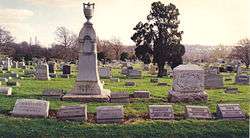
Cemeteries
References
- ↑ Census 2010: Pennsylvania. Usatoday.Com. Retrieved on 2013-07-21.
- ↑ "American FactFinder". United States Census Bureau. Retrieved 2008-01-31.
