Pennsburg, Pennsylvania
| Borough of Pennsburg | |
| Borough | |
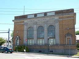 Farmers National Bank Building (1926) | |
| Country | United States |
|---|---|
| State | Pennsylvania |
| County | Montgomery |
| Elevation | 381 ft (116.1 m) |
| Coordinates | 40°23′44″N 75°29′50″W / 40.39556°N 75.49722°WCoordinates: 40°23′44″N 75°29′50″W / 40.39556°N 75.49722°W |
| Area | 0.8 sq mi (2.1 km2) |
| - land | 0.8 sq mi (2 km2) |
| - water | 0.0 sq mi (0 km2), 0% |
| Population | 3,843 (2010) |
| Density | 3,567.8/sq mi (1,377.5/km2) |
| Incorporated | April 9, 1888 |
| Government | Council-manager |
| Mayor | Vicki J. Lightcap |
| Timezone | EST (UTC-5) |
| - summer (DST) | EDT (UTC-4) |
| ZIP Code | 18073 |
| Area code | 215 and 267 |
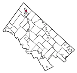 Location of Pennsburg in Montgomery County | |
 Location of Pennsburg in Pennsylvania | |
 Location of Pennsylvania in the United States | |
| Website: http://www.pennsburg.us | |
Pennsburg is a borough in Montgomery County, Pennsylvania, United States. The population was 3,843 at the 2010 census. It is part of the Upper Perkiomen School District.
It is also part of the strip of small towns that run together along Route 29: Red Hill, Pennsburg, and East Greenville. Apocryphal history relates that these towns considered merging around the early 1970s and the combined name may have been 'Red Pennsville' or 'East Pennhill'. The towns are collectively referred to as "Upper Perk".
Geography
Pennsburg is located at 40°23′44″N 75°29′50″W / 40.39556°N 75.49722°W (40.395595, −75.497361).[1] According to the United States Census Bureau, the borough has a total area of 0.8 square miles (2.1 km2), all of it land. Pennsburg is located 40 mi (64 km) northwest of Philadelphia and 5 mi (8.0 km) southwest of Quakertown. Pennsburg's elevation is at 350 ft (110 m) above sea level. There is a nature preserve along Macoby Creek.[2]
Demographics
| Historical population | |||
|---|---|---|---|
| Census | Pop. | %± | |
| 1890 | 627 | — | |
| 1900 | 1,032 | 64.6% | |
| 1910 | 1,141 | 10.6% | |
| 1920 | 1,404 | 23.0% | |
| 1930 | 1,494 | 6.4% | |
| 1940 | 1,543 | 3.3% | |
| 1950 | 1,625 | 5.3% | |
| 1960 | 1,698 | 4.5% | |
| 1970 | 2,260 | 33.1% | |
| 1980 | 2,339 | 3.5% | |
| 1990 | 2,460 | 5.2% | |
| 2000 | 2,732 | 11.1% | |
| 2010 | 3,843 | 40.7% | |
| Est. 2015 | 3,873 | [3] | 0.8% |
| Sources:[4][5][6] | |||
As of the 2010 census, the borough was 90.0% White, 2.0% Black or African American, 0.1% Native American, 5.2% Asian, 0.1% Native Hawaiian, and 1.4% were two or more races. About 4.1% of the population were of Hispanic or Latino ancestry.
As of the census[5] of 2000, 2,732 people, 1,009 households, and 705 families resided in the borough. The population density was 3,567.8 people per square mile (1,369.9/km²). The 1,078 housing units averaged 1,407.8 per square mile (540.5/km²). The racial makeup of the borough was 97.36% White, 0.81% African American, 0.07% Native American, 0.48% Asian, 0.55% from other races, and 0.73% from two or more races. Hispanics or Latinos of any race were 1.61% of the population.
Of the 1,009 households, 38.1% had children under the age of 18 living with them, 55.2% were married couples living together, 9.8% had a female householder with no husband present, and 30.1% were not families. About 24.0% of all households were made up of individuals, and 8.5% had someone living alone who was 65 years of age or older. The average household size was 2.59 and the average family size was 3.08.
In the borough, the population was distributed as 27.0% under the age of 18, 7.4% from 18 to 24, 33.1% from 25 to 44, 18.4% from 45 to 64, and 14.1% who were 65 years of age or older. The median age was 35 years. For every 100 females, there were 90.4 males. For every 100 females age 18 and over, there were 90.9 males.
The median income for a household in the borough was $46,715, and for a family was $56,250. Males had a median income of $37,036 versus $26,190 for females. The per capita income for the borough was $18,977. About 4.4% of families and 6.2% of the population were below the poverty line, including 6.3% of those under age 18 and 3.7% of those age 65 or over.
Politics and government
Pennsburg has a city manager form of government with a mayor and borough council. The borough is part of the Pennsylvania's 6th congressional district (represented by Rep. Ryan Costello), Pennsylvania's 147th Representative District (represented by Rep. Marcy Toepel), and the Pennsylvania Senate, District 24 (represented by Sen. Bob Mensch).
Borough officials
Mayor:[7]
- Ethel G. Ritchey
Council:[7]
- Kristopher Kirkwood, President (through December 2015)
- Joan Wieder, Vice-President (through December 2015)
- Bill Clinton
- Douglas Landis
- Vicki J. Lightcap
- Bruce Lord
- Michael Mensch
| Year | Republican | Democratic |
|---|---|---|
| 2012 | 47.7% 594 | 50.5% 629 |
| 2008 | 40.4% 554 | 58.1% 796 |
| 2004 | 47.1% 566 | 52.6% 632 |
| 2000 | 48.4% 380 | 47.0% 369 |
References
- ↑ "US Gazetteer files: 2010, 2000, and 1990". United States Census Bureau. 2011-02-12. Retrieved 2011-04-23.
- ↑ "Parks & Recreation". Borough of Pennsburg.
- ↑ "Annual Estimates of the Resident Population for Incorporated Places: April 1, 2010 to July 1, 2015". Retrieved July 2, 2016.
- ↑ "Census of Population and Housing". U.S. Census Bureau. Retrieved 11 December 2013.
- 1 2 "American FactFinder". United States Census Bureau. Retrieved 2008-01-31.
- ↑ "Incorporated Places and Minor Civil Divisions Datasets: Subcounty Resident Population Estimates: April 1, 2010 to July 1, 2012". Population Estimates. U.S. Census Bureau. Retrieved 11 December 2013.
- 1 2 "Borough Officials & Staff". Borough of Pennsburg.
External links
| Wikimedia Commons has media related to Pennsburg, Pennsylvania. |
-
 Pennsburg travel guide from Wikivoyage
 - Borough of Pennsburg
- Borough Fact Sheet
