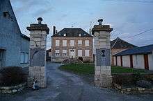
Cuirieux
| Cuirieux | |
|---|---|
 Cuirieux | |
|
Location within Hauts-de-France region  Cuirieux | |
| Coordinates: 49°40′54″N 3°48′56″E / 49.6817°N 3.8156°ECoordinates: 49°40′54″N 3°48′56″E / 49.6817°N 3.8156°E | |
| Country | France |
| Region | Hauts-de-France |
| Department | Aisne |
| Arrondissement | Laon |
| Canton | Marle |
| Intercommunality | Pays de la Serre |
| Government | |
| • Mayor (2008–2014) | Patrick Felzinger |
| Area1 | 6.46 km2 (2.49 sq mi) |
| Population (2008)2 | 164 |
| • Density | 25/km2 (66/sq mi) |
| Time zone | CET (UTC+1) |
| • Summer (DST) | CEST (UTC+2) |
| INSEE/Postal code | 02248 / 02350 |
| Elevation |
74–121 m (243–397 ft) (avg. 83 m or 272 ft) |
|
1 French Land Register data, which excludes lakes, ponds, glaciers > 1 km² (0.386 sq mi or 247 acres) and river estuaries. 2 Population without double counting: residents of multiple communes (e.g., students and military personnel) only counted once. | |
Cuirieux is a commune in the Aisne department in Hauts-de-France in northern France.
Population
| Historical population | ||
|---|---|---|
| Year | Pop. | ±% |
| 1962 | 169 | — |
| 1968 | 147 | −13.0% |
| 1975 | 119 | −19.0% |
| 1982 | 131 | +10.1% |
| 1990 | 142 | +8.4% |
| 1999 | 143 | +0.7% |
| 2008 | 164 | +14.7% |
See also
Town hall, war memorials.
References
| Wikimedia Commons has media related to Cuirieux. |
This article is issued from Wikipedia - version of the 11/8/2016. The text is available under the Creative Commons Attribution/Share Alike but additional terms may apply for the media files.