Haution
| Haution | |
|---|---|
 | |
 Haution | |
|
Location within Hauts-de-France region  Haution | |
| Coordinates: 49°52′02″N 3°50′28″E / 49.8672°N 3.8411°ECoordinates: 49°52′02″N 3°50′28″E / 49.8672°N 3.8411°E | |
| Country | France |
| Region | Hauts-de-France |
| Department | Aisne |
| Arrondissement | Vervins |
| Canton | Vervins |
| Intercommunality | Thiérache du Centre |
| Government | |
| • Mayor (2001–2008) | Bernard Faucheux |
| Area1 | 9.34 km2 (3.61 sq mi) |
| Population (2008)2 | 146 |
| • Density | 16/km2 (40/sq mi) |
| Time zone | CET (UTC+1) |
| • Summer (DST) | CEST (UTC+2) |
| INSEE/Postal code | 02377 / 02140 |
| Elevation |
130–199 m (427–653 ft) (avg. 127 m or 417 ft) |
|
1 French Land Register data, which excludes lakes, ponds, glaciers > 1 km² (0.386 sq mi or 247 acres) and river estuaries. 2 Population without double counting: residents of multiple communes (e.g., students and military personnel) only counted once. | |
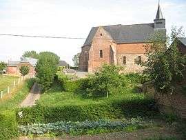
Haution is a commune in the Aisne department in Hauts-de-France in northern France.
Population
| Historical population | ||
|---|---|---|
| Year | Pop. | ±% |
| 1793 | 825 | — |
| 1800 | 667 | −19.2% |
| 1806 | 704 | +5.5% |
| 1821 | 787 | +11.8% |
| 1831 | 641 | −18.6% |
| 1836 | 492 | −23.2% |
| 1841 | 490 | −0.4% |
| 1846 | 498 | +1.6% |
| 1851 | 473 | −5.0% |
| 1856 | 436 | −7.8% |
| 1861 | 394 | −9.6% |
| 1866 | 394 | +0.0% |
| 1872 | 372 | −5.6% |
| 1876 | 338 | −9.1% |
| 1881 | 300 | −11.2% |
| 1886 | 283 | −5.7% |
| 1891 | 239 | −15.5% |
| 1896 | 246 | +2.9% |
| 1901 | 246 | +0.0% |
| 1906 | 250 | +1.6% |
| 1911 | 260 | +4.0% |
| 1921 | 249 | −4.2% |
| 1926 | 289 | +16.1% |
| 1931 | 279 | −3.5% |
| 1936 | 263 | −5.7% |
| 1946 | 240 | −8.7% |
| 1954 | 242 | +0.8% |
| 1962 | 226 | −6.6% |
| 1968 | 202 | −10.6% |
| 1975 | 157 | −22.3% |
| 1982 | 145 | −7.6% |
| 1990 | 184 | +26.9% |
| 1999 | 153 | −16.8% |
| 2008 | 146 | −4.6% |
See also
References
| Wikimedia Commons has media related to Haution. |
This article is issued from Wikipedia - version of the 11/8/2016. The text is available under the Creative Commons Attribution/Share Alike but additional terms may apply for the media files.