Vassens
| Vassens | |
|---|---|
|
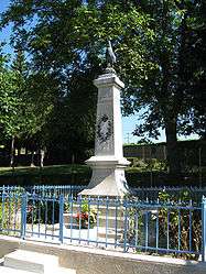
War memorial | |
 Vassens | |
|
Location within Hauts-de-France region  Vassens | |
| Coordinates: 49°28′07″N 3°09′16″E / 49.4686°N 3.1544°ECoordinates: 49°28′07″N 3°09′16″E / 49.4686°N 3.1544°E | |
| Country | France |
| Region | Hauts-de-France |
| Department | Aisne |
| Arrondissement | Laon |
| Canton | Coucy-le-Château-Auffrique |
| Intercommunality | Pays de la Vallée de l'Aisne |
| Government | |
| • Mayor (2008–2014) | Jean-Louis Toublan |
| Area1 | 9.87 km2 (3.81 sq mi) |
| Population (2008)2 | 169 |
| • Density | 17/km2 (44/sq mi) |
| Time zone | CET (UTC+1) |
| • Summer (DST) | CEST (UTC+2) |
| INSEE/Postal code | 02762 / 02290 |
| Elevation |
59–156 m (194–512 ft) (avg. 80 m or 260 ft) |
|
1 French Land Register data, which excludes lakes, ponds, glaciers > 1 km² (0.386 sq mi or 247 acres) and river estuaries. 2 Population without double counting: residents of multiple communes (e.g., students and military personnel) only counted once. | |
Vassens is a commune in the Aisne department in Hauts-de-France in northern France near the town of Laon.
Population
| Historical population | ||
|---|---|---|
| Year | Pop. | ±% |
| 1962 | 169 | — |
| 1968 | 138 | −18.3% |
| 1975 | 110 | −20.3% |
| 1982 | 91 | −17.3% |
| 1990 | 105 | +15.4% |
| 1999 | 126 | +20.0% |
| 2008 | 169 | +34.1% |
See also
References
| Wikimedia Commons has media related to Vassens. |
This article is issued from Wikipedia - version of the 11/8/2016. The text is available under the Creative Commons Attribution/Share Alike but additional terms may apply for the media files.