Douglas, Massachusetts
| Douglas, Massachusetts | ||
|---|---|---|
| Town | ||
|
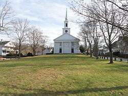
Second Congregational Church | ||
| ||
| Nickname(s): D-town, The Big D | ||
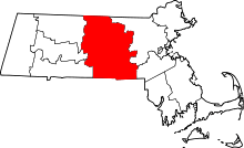
 Location in Worcester County and the state of Massachusetts. | ||
| Coordinates: 42°03′15″N 71°44′24″W / 42.05417°N 71.74000°WCoordinates: 42°03′15″N 71°44′24″W / 42.05417°N 71.74000°W | ||
| Country | United States | |
| State | Massachusetts | |
| County | Worcester | |
| Settled | 1721 | |
| Incorporated | 1746 | |
| Government | ||
| • Type | Open town meeting | |
| Area | ||
| • Total | 37.7 sq mi (97.7 km2) | |
| • Land | 36.4 sq mi (94.2 km2) | |
| • Water | 1.3 sq mi (3.5 km2) | |
| Elevation | 582 ft (177 m) | |
| Population (2010) | ||
| • Total | 8,471 | |
| • Density | 220/sq mi (87/km2) | |
| Time zone | Eastern (UTC-5) | |
| • Summer (DST) | Eastern (UTC-4) | |
| ZIP code | 01516 | |
| Area code(s) | 508 / 774 | |
| FIPS code | 25-17300 | |
| GNIS feature ID | 0619479 | |
| Website |
www www | |

Douglas is a town in Worcester County, Massachusetts, United States. The population was 8,471 at the 2010 census. It includes the sizable Douglas State Forest, managed by the Massachusetts Department of Conservation and Recreation (DCR).
History
The name of Douglas was first given to the territory of the town in the year 1746. New Sherburn or "New Sherburn Grant" had previously been its designation, since its first occupancy by the English settlers which was as early as 1715. The original settlers came primarily from Sherburn, although many hailed from Natick as well. New Sherburn was removed from Suffolk County (or Middlesex county?) to Worcester County at its formation on April 2, 1731. The name Douglas was given in 1746, when Dr. William Douglas,[1] an eminent physician of Boston, in consideration of the privilege of naming the township offered the inhabitants the sum of $500.00 as a fund for the establishment of free schools together with a tract of 30 acres (12 ha) of land with a dwelling house and barn thereon.
Douglas's forests gave rise to a woodcutting industry and the Douglas axe company.[2] A woolen manufacturing company, on the Mumford River in East Douglas, in recent times held by the Schuster family, has been prominent in the history of this community. General Lafayette, of France, stopped here during the Revolutionary War, to change horses, on his way to Boston to join General Washington. Lafayette was a hero of the American Revolution and the French Revolution.
From a very early period reaching beyond 1635, bands of Native Americans, principally the Nipmuc tribe, dominated this region of Worcester County. The Blackstone River was once called the Nipmuc River. Most of Douglas is part of the Blackstone River Valley National Heritage Corridor.[2]
The underlying geology consists of rocks rich in quartz, feldspar, and mica. Boulders are plentifully scattered all over town, and gold and silver ores are said to be found in some localities. Large quantities of building and ornamental stone are quarried from the granite ledges found in the center of town which is shipped to almost every section of New England.
Police Chief Patrick Foley of Douglas was elected Vice President of the International Association of Chiefs of Police (IACP), at the annual convention in Denver, Colorado, in 2009.
A common misconception in Douglas is in regard to the New England Trunkline Trail. Many believe that railroad tracks were laid here for commuting from northern Connecticut to northern Massachusetts. In fact, they were used to haul ice from Wallum Lake as interstate commerce. Today you can hike these trails through Massachusetts and Connecticut. The New England trunkline was originally planned as a railroad, but the financier died in the sinking of the Titanic.
Geography
According to the United States Census Bureau, the town has a total area of 37.7 square miles (98 km2), of which 36.4 square miles (94 km2) is land and 1.3 square miles (3.4 km2), or 14.55%, is water. It includes the Douglas State Forest and is home to Wallum Lake and Whitins Reservoir.
The town is bounded on the north by Oxford, Sutton and Uxbridge, on the east by Sutton and Uxbridge, on the south by Burrillville, Rhode Island, and on the west by Webster, Massachusetts and a small portion of Thompson, Connecticut.
The principal elevations are Bald Hill, 711 feet (217 m), Wallum Pond Hill, 778 feet (237 m), and Mount Daniel, 735 feet (224 m). There are numerous ponds in Douglas: Wallum Pond in the southwest section, covering about 150 acres (61 ha); Badluck Pond in the western part of town, covering about 110 acres (45 ha); the largest pond is Whitin Reservoir also in the western part of town, covering about 400 acres (160 ha); and Manchaug Pond in the northern part, about 93 acres (38 ha).
Education
Douglas has four public schools for children grade PK-12 to attend. Douglas Primary School enrolls 236 students (2014-2015)[3] in grades PK, Kindergarten, and 1st grade. Douglas Elementary School enrolls 481 students (2014-2015)[4] in 2nd through 5th grade. Douglas Middle School enrolls 418 students (2014-2015)[5] in 5th, 7th, and 8th grade. Douglas High School enrolls 409 students (2014-2015)[6] in 9th through 12th grade.
Neighborhoods
Demographics
| Historical population | ||
|---|---|---|
| Year | Pop. | ±% |
| 1850 | 1,878 | — |
| 1860 | 2,442 | +30.0% |
| 1870 | 2,182 | −10.6% |
| 1880 | 2,241 | +2.7% |
| 1890 | 1,908 | −14.9% |
| 1900 | 2,113 | +10.7% |
| 1910 | 2,152 | +1.8% |
| 1920 | 2,181 | +1.3% |
| 1930 | 2,195 | +0.6% |
| 1940 | 2,617 | +19.2% |
| 1950 | 2,624 | +0.3% |
| 1960 | 2,559 | −2.5% |
| 1970 | 2,947 | +15.2% |
| 1980 | 3,730 | +26.6% |
| 1990 | 5,438 | +45.8% |
| 2000 | 7,045 | +29.6% |
| 2010 | 8,471 | +20.2% |
| * = population estimate. Source: United States Census records and Population Estimates Program data.[7][8][9][10][11][12][13][14][15][16] | ||
As of the census[17] of 2000, there were 7,045 people, 2,476 households, and 1,936 families residing in the town. The population density was 193.7 people per square mile (74.8/km²). There were 2,588 housing units at an average density of 71.2 per square mile (27.5/km²). The racial makeup of the town was 97.36% White, 0.48% African American, 0.13% Native American, 0.64% Asian, 0.07% Pacific Islander, 0.28% from other races, and 1.04% from two or more races. Hispanic or Latino of any race were 0.95% of the population. From 2000 to 2010 there was a population increase of 20.24%.
There were 2,476 households out of which 43.1% had children under the age of 18 living with them, 66.6% were married couples living together, 8.1% had a female householder with no husband present, and 21.8% were non-families. 17.3% of all households were made up of individuals and 6.7% had someone living alone who was 65 years of age or older. The average household size was 2.85 and the average family size was 3.23.
In the town the population was spread out with 29.6% under the age of 18, 6.1% from 18 to 24, 36.4% from 25 to 44, 20.1% from 45 to 64, and 7.7% who were 65 years of age or older. The median age was 34 years. For every 100 females there were 100.7 males. For every 100 females age 18 and over, there were 97.7 males.
The median income for a household in the town was $60,529, and the median income for a family was $67,210. Males had a median income of $45,893 versus $31,287 for females. The per capita income for the town was $23,036. About 2.3% of families and 4.6% of the population were below the poverty line, including 4.4% of those under age 18 and 13.0% of those age 65 or over.
Government
The town has an open town meeting form of government. The government broadcasts many of its meetings on the Apple TV platform[18] as well as internet and local cable TV. State, Federal and county level elected state officials are shown in the infobox.
| County-level state agency heads | |
|---|---|
| Clerk of Courts: | Dennis P. McManus (D) |
| District Attorney: | Joseph D. Early, Jr. (D) |
| Register of Deeds: | Anthony J. Vigliotti (D) |
| Register of Probate: | Stephanie K. Fattman (R) |
| County Sheriff: | Lew Evangelidis (R) |
| State government | |
| State Representative(s): | Joseph D. McKenna (R) |
| State Senator(s): | Ryan Fattman (R) |
| Governor's Councilor(s): | Jen Caissie (R) |
| Federal government | |
| U.S. Representative(s): | Jim McGovern (D-2nd District), |
| U.S. Senators: | Elizabeth Warren (D), Ed Markey (D) |
Points of interest
- Douglas is the starting point for the Rhode Island North-South Trail and Massachusetts Midstate Trail.
- Jenckes Store & Museum
- Douglas Flea Market
- The Shed
See also
References
- ↑ Gannett, Henry (1905). The Origin of Certain Place Names in the United States. Govt. Print. Off. p. 108.
- 1 2 "Plan your visit/valley sites/Douglas, Northbridge, Sutton". National Park Service. Retrieved 2007-12-26.
- ↑ "Enrollment Data (2013-14) - Douglas Primary School (00770005)". profiles.doe.mass.edu. Retrieved 2015-12-18.
- ↑ "Enrollment Data (2013-14) - Douglas Elementary School (00770015)". profiles.doe.mass.edu. Retrieved 2015-12-18.
- ↑ "Enrollment Data (2013-14) - Douglas Middle School (00770305)". profiles.doe.mass.edu. Retrieved 2015-12-18.
- ↑ "Enrollment Data (2013-14) - Douglas High School (00770505)". profiles.doe.mass.edu. Retrieved 2015-12-18.
- ↑ "TOTAL POPULATION (P1), 2010 Census Summary File 1". American FactFinder, All County Subdivisions within Massachusetts. United States Census Bureau. 2010.
- ↑ "Massachusetts by Place and County Subdivision - GCT-T1. Population Estimates". United States Census Bureau. Retrieved July 12, 2011.
- ↑ "1990 Census of Population, General Population Characteristics: Massachusetts" (PDF). US Census Bureau. December 1990. Table 76: General Characteristics of Persons, Households, and Families: 1990. 1990 CP-1-23. Retrieved July 12, 2011.
- ↑ "1980 Census of the Population, Number of Inhabitants: Massachusetts" (PDF). US Census Bureau. December 1981. Table 4. Populations of County Subdivisions: 1960 to 1980. PC80-1-A23. Retrieved July 12, 2011.
- ↑ "1950 Census of Population" (PDF). Bureau of the Census. 1952. Section 6, Pages 21-10 and 21-11, Massachusetts Table 6. Population of Counties by Minor Civil Divisions: 1930 to 1950. Retrieved July 12, 2011.
- ↑ "1920 Census of Population" (PDF). Bureau of the Census. Number of Inhabitants, by Counties and Minor Civil Divisions. Pages 21-5 through 21-7. Massachusetts Table 2. Population of Counties by Minor Civil Divisions: 1920, 1910, and 1920. Retrieved July 12, 2011.
- ↑ "1890 Census of the Population" (PDF). Department of the Interior, Census Office. Pages 179 through 182. Massachusetts Table 5. Population of States and Territories by Minor Civil Divisions: 1880 and 1890. Retrieved July 12, 2011.
- ↑ "1870 Census of the Population" (PDF). Department of the Interior, Census Office. 1872. Pages 217 through 220. Table IX. Population of Minor Civil Divisions, &c. Massachusetts. Retrieved July 12, 2011.
- ↑ "1860 Census" (PDF). Department of the Interior, Census Office. 1864. Pages 220 through 226. State of Massachusetts Table No. 3. Populations of Cities, Towns, &c. Retrieved July 12, 2011.
- ↑ "1850 Census" (PDF). Department of the Interior, Census Office. 1854. Pages 338 through 393. Populations of Cities, Towns, &c. Retrieved July 12, 2011.
- ↑ "American FactFinder". United States Census Bureau. Retrieved 2008-01-31.
- ↑ Town of Douglas Apple TV App
Further reading
- Emerson, William A. History of the Town of Douglas, (Massachusetts), From the Earliest Period to the Close of 1878. Boston, 1879.[1]
External links
| Wikimedia Commons has media related to Douglas, Massachusetts. |
- Douglas official website
- John H. Chafee Blackstone River Valley National Heritage Corridor: Valley sites - Douglas, Sutton, Northbridge (National Park Service)
- Manchaug Pond Association and Foundation
- Nipmuck Nation