Gardner, Massachusetts
| Gardner, Massachusetts | ||
|---|---|---|
| City | ||
 | ||
| ||
| Nickname(s): Chair City | ||
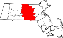
 Location in Worcester County and the state of Massachusetts. | ||
 Gardner, Massachusetts Location in the United States | ||
| Coordinates: 42°34′30″N 71°59′55″W / 42.57500°N 71.99861°WCoordinates: 42°34′30″N 71°59′55″W / 42.57500°N 71.99861°W | ||
| Country | United States | |
| State | Massachusetts | |
| County | Worcester | |
| Settled | 1764 | |
| Incorporated | 1785 | |
| Government | ||
| • Type | Mayor-council city | |
| • Mayor | Mark P. Hawke (R)[1][2] | |
| • City Council |
Ronald Cormier Scott Graves James Boone Marc Morgan Craig Cormier Matthew Vance James Walsh(Ward 1) Nathan Boudreau(Ward 2) Paul Tassone (Ward 3) Karen Hardern (Ward 4) James Johnson (Ward 5) | |
| Area | ||
| • Total | 23.0 sq mi (59.6 km2) | |
| • Land | 22.2 sq mi (57.5 km2) | |
| • Water | 0.8 sq mi (2.1 km2) | |
| Elevation | 1,100 ft (324 m) | |
| Population (2010) | ||
| • Total | 20,228 | |
| • Density | 880/sq mi (340/km2) | |
| Time zone | Eastern (UTC-5) | |
| • Summer (DST) | Eastern (UTC-4) | |
| ZIP code | 01440 | |
| Area code(s) | 978 / 351 | |
| FIPS code | 25-25485 | |
| GNIS feature ID | 0610059 | |
| Website | http://www.gardner-ma.gov/ | |

Gardner is a city in Worcester County, Massachusetts, United States. The population was 20,228 at the 2010 census. Gardner is home to Dunn State Park, Gardner Heritage State Park, Lake Wampanoag Wildlife Sanctuary, and Mount Wachusett Community College.
History
Named in honor of Col. Thomas Gardner,[3] the community was first settled in 1764 and officially incorporated as a town in 1785 after receiving land grants from the surrounding towns of Ashburnham, Westminster, Templeton and Winchendon.[4]:2 Dating from about 1805, it became a center for lumber and furniture industries. Gardner is known as the "Chair City" and "The Furniture Capital of New England", due to its long history in furniture production. By 1910 it had 20 chair factories which produced 4 million chairs per year. It was also noted for silversmithing. The Gardner State Colony for the Insane pioneered the use of cottage residences. Gardner was incorporated as a city in 1923.
Gardner is the birthplace of Heywood-Wakefield furniture, dating from 1826 when the five Heywood brothers began to fashion furniture in a barn near their father's farm. Brothers Walter, Levi, Seth, Benjamin and William began that year making wooden chairs. In the early years, Walter fashioned chairs by hand, also using a foot lathe. He was soon joined by his brothers Levi and Benjamin, part-time, while running a nearby country store. A new store was built across the street from the original store. In 1831 Levi moved to Boston where he established an outlet store to sell the chairs, while Benjamin and William remained in Gardner to manufacture the chairs. A fire destroyed the Heywoods' chair shop in 1834. In 1835 the partnership of B. F. Heywood & Co. was formed, composed of Benjamin, Walter and William, with Moses Wood and James W. Gates. Gardner was also the home of the Conant-Ball furniture factory. Nichols & Stone Chair Company traces their origin to 1762 in Westminster, Massachusetts. The company moved to Gardner at the turn of the 20th century. As of July 2008, it was announced they would terminate production. The Nichols & Stone name, the intellectual property and the design rights were purchased by the L. & J.G. Stickley of Manlius, New York.[5]
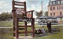 Biggest Chair, c. 1910
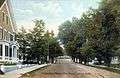 Elm Street, c. 1908
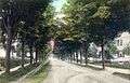 Chestnut Street, c. 1906
City seal
The seal of Gardner was designed in 1898 by native-born illustrator Walter Harrison Cady, at the age of 21. According to the city code, the seal shows a portrayal of Col. Thomas Gardner standing in front of Crystal Lake with Mount Monadnock in the background. Within five smaller circles we see a chair, representing the importance of the furniture industry to the city's economy, as well as the letters W, W, A, and T, representing the surrounding towns of Westminster, Winchendon, Ashburnham, and Templeton which all contributed land to the city at its founding.[6][7]
Geography
Gardner is located at 42°34′26″N 71°59′27″W / 42.57389°N 71.99083°W (42.573920, -71.990818).[8]
According to the United States Census Bureau, the city has a total area of 23.0 square miles (60 km2), of which 22.2 square miles (57 km2) is land and 0.8 square miles (2.1 km2), or 3.52%, is water. Gardner is situated on Crystal Lake. The highest point in the city is the summit of Reservoir Hill, close to the center of the city, with an elevation of over 1,280 feet (390 m) above sea level.[9]
Gardner is bordered by Winchendon and Ashburnham to the north, Westminster to the east, Hubbardston to the south, and Templeton to the west, all in Massachusetts.
Demographics
| Historical population | ||
|---|---|---|
| Year | Pop. | ±% |
| 1790 | 531 | — |
| 1800 | 667 | +25.6% |
| 1810 | 815 | +22.2% |
| 1820 | 911 | +11.8% |
| 1830 | 1,023 | +12.3% |
| 1840 | 1,260 | +23.2% |
| 1850 | 1,533 | +21.7% |
| 1860 | 2,646 | +72.6% |
| 1870 | 3,333 | +26.0% |
| 1880 | 4,988 | +49.7% |
| 1890 | 3,424 | −31.4% |
| 1900 | 10,813 | +215.8% |
| 1910 | 14,699 | +35.9% |
| 1920 | 16,971 | +15.5% |
| 1930 | 19,399 | +14.3% |
| 1940 | 20,206 | +4.2% |
| 1950 | 19,581 | −3.1% |
| 1960 | 19,038 | −2.8% |
| 1970 | 19,748 | +3.7% |
| 1980 | 17,900 | −9.4% |
| 1990 | 20,125 | +12.4% |
| 2000 | 20,770 | +3.2% |
| 2010 | 20,228 | −2.6% |
| 2014 | 20,381 | +0.8% |
| 2015 | 20,333 | −0.2% |
| * = population estimate. Source: United States Census records and Population Estimates Program data.[10][11][12][13][14][15][16][17][18][19][20] Source: | ||
As of the census[22] of 2000, there were 20,770 people, 8,282 households, and 5,085 families residing in the city. The population density was 936.0 people per square mile (361.4/km²). There were 8,838 housing units at an average density of 398.3 per square mile (153.8/km²). The racial makeup of the city was 93.13% White, 2.29% African American, 0.34% Native American, 1.37% Asian, 0.08% Pacific Islander, 1.22% from other races, and 1.58% from two or more races. Hispanic or Latino of any race were 4.08% of the population. 19.6% were of French Canadian, 17.6% French, 12.7% Irish, 6.7% English, 6.3% Polish and 6.2% Italian ancestry according to Census 2000.
There were 8,282 households out of which 30.3% had children under the age of 18 living with them, 44.4% were married couples living together, 12.7% had a female householder with no husband present, and 38.6% were non-families. 32.4% of all households were made up of individuals and 13.5% had someone living alone who was 65 years of age or older. The average household size was 2.35 and the average family size was 2.97.
In the city the population was spread out with 23.7% under the age of 18, 7.7% from 18 to 24, 31.8% from 25 to 44, 20.7% from 45 to 64, and 16.1% who were 65 years of age or older. The median age was 38 years. For every 100 females there were 105.1 males. For every 100 females age 18 and over, there were 103.7 males.
The median income for a household in the city was $37,334, and the median income for a family was $47,164. Males had a median income of $35,804 versus $26,913 for females. The per capita income for the city was $18,624. About 7.0% of families and 9.6% of the population were below the poverty line, including 12.8% of those under age 18 and 11.7% of those age 65 or over.
The town is home to Gardner High School, which has a student population of about 800.
Library
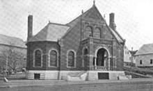
The public library in Gardner opened in 1885.[23][24] The original library building is now a museum of Gardner's history. In fiscal year 2008, the city of Gardner spent 1.84% ($734,164) of its budget on its public library—some $35 per person.[25]
Public transportation
Public transportation for Gardner is largely supplied by the Montachusett Regional Transit Authority (MART). MART operates local fixed-route bus services, shuttle services, as well as paratransit services within the Montachusett Region.[26] MAX provides intercity bus service to Boston, Worcester, Fitchburg, and Brattleboro, Vermont with intermediate stops.[27]
Beginning in 1871, the Boston, Barre and Gardner Railroad provided rail service to the town. Gardner station was the terminus of the MBTA's Fitchburg Line from 1980 to 1986, but the line was cut back to Fitchburg at the beginning of 1987.[28] MART began weekday van service from Gardner to the new Wachusett terminus of the Fitchburg line in 2016.[29]
Events
| County-level state agency heads | |
|---|---|
| Clerk of Courts: | Dennis P. McManus (D) |
| District Attorney: | Joseph D. Early, Jr. (D) |
| Register of Deeds: | Anthony J. Vigliotti (D) |
| Register of Probate: | Stephanie K. Fattman (R) |
| County Sheriff: | Lew Evangelidis (R) |
| State government | |
| State Representative(s): | Jonathan Zlotnik (D) |
| State Senator(s): | Jennifer L. Flanagan (D) |
| Governor's Councilor(s): | Jen Caissie (R) |
| Federal government | |
| U.S. Representative(s): | Niki Tsongas (D-3rd District), |
| U.S. Senators: | Elizabeth Warren (D), Ed Markey (D) |
- For many years, the Gardner Municipal Golf Course has been home to the Central Massachusetts High School Cross Country District Championships. Every three years, it is also home to the Massachusetts High School State Cross Country Championships. The course record for the hilly 2.9-mile (4.7 km) course is 14:00 set by Andy Powell in 1998 while Lynn Jennings has the girls' record with a time of 15:50 from 1977.
- Home of the largest Relay For Life event in New England.
Notable people
- Larry Alexander, Massachusetts state legislator
- Walter Harrison Cady, American illustrator
- Jacques Cesaire, former NFL Defensive End for the San Diego Chargers
- Oliver Drake, minor league pitcher in the Baltimore Orioles organization
- Mark Gearan, former head of the Peace Corps under President Bill Clinton and current president of Hobart and William Smith Colleges
- Levi H. Greenwood, President of the Massachusetts Senate from 1912-1913
- Hadassah Lieberman, wife of U.S. Senator from Connecticut and 2000 Democratic nominee for Vice President Joseph Lieberman
- Bob Menne, PGA Tour Golfer
- Lucy Stone, women's rights activist, whose house still stands on Elm Street
See also
In popular culture
Gardner was a filming location for the 1992 movie School Ties.
References
- ↑ Barnes, George (17 October 2014). "Republican mayor of Gardner endorses Democratic senator". Telegram & Gazette. Retrieved 17 September 2015.
- ↑ "Mayor's Office". Gardner Massachusetts. Retrieved 17 September 2015.
- ↑ Gannett, Henry (1905). The Origin of Certain Place Names in the United States. Govt. Print. Off. p. 134.
- ↑ Glazier, Lewis (1860). History of Gardner, Massachusetts: from its earliest settlement to 1860. Worcester: Chas. Hamilton.
- ↑ Stickley.com
- ↑ Faust, James A.; Kadlik, Gayle (2012). Heywood Hospital. Arcadia Publishing. p. 19.
- ↑ "Chapter 252: Seal, City of Gardner Code". eCode360. 9 October 2016. Archived from the original on 2016-09-08. Retrieved 17 September 2015.
- ↑ "US Gazetteer files: 2010, 2000, and 1990". United States Census Bureau. 2011-02-12. Retrieved 2011-04-23.
- ↑ U.S. Geological Survey 7.5 x 15 minute topographic map series, Gardner quadrangle
- ↑ "TOTAL POPULATION (P1), 2010 Census Summary File 1". American FactFinder, All County Subdivisions within Massachusetts. United States Census Bureau. 2010.
- ↑ "Massachusetts by Place and County Subdivision - GCT-T1. Population Estimates". United States Census Bureau. Retrieved July 12, 2011.
- ↑ "1990 Census of Population, General Population Characteristics: Massachusetts" (PDF). US Census Bureau. December 1990. Table 76: General Characteristics of Persons, Households, and Families: 1990. 1990 CP-1-23. Retrieved July 12, 2011.
- ↑ "1980 Census of the Population, Number of Inhabitants: Massachusetts" (PDF). US Census Bureau. December 1981. Table 4. Populations of County Subdivisions: 1960 to 1980. PC80-1-A23. Retrieved July 12, 2011.
- ↑ "1950 Census of Population" (PDF). Bureau of the Census. 1952. Section 6, Pages 21-10 and 21-11, Massachusetts Table 6. Population of Counties by Minor Civil Divisions: 1930 to 1950. Retrieved July 12, 2011.
- ↑ "1920 Census of Population" (PDF). Bureau of the Census. Number of Inhabitants, by Counties and Minor Civil Divisions. Pages 21-5 through 21-7. Massachusetts Table 2. Population of Counties by Minor Civil Divisions: 1920, 1910, and 1920. Retrieved July 12, 2011.
- ↑ "1890 Census of the Population" (PDF). Department of the Interior, Census Office. Pages 179 through 182. Massachusetts Table 5. Population of States and Territories by Minor Civil Divisions: 1880 and 1890. Retrieved July 12, 2011.
- ↑ "1870 Census of the Population" (PDF). Department of the Interior, Census Office. 1872. Pages 217 through 220. Table IX. Population of Minor Civil Divisions, &c. Massachusetts. Retrieved July 12, 2011.
- ↑ "1860 Census" (PDF). Department of the Interior, Census Office. 1864. Pages 220 through 226. State of Massachusetts Table No. 3. Populations of Cities, Towns, &c. Retrieved July 12, 2011.
- ↑ "1850 Census" (PDF). Department of the Interior, Census Office. 1854. Pages 338 through 393. Populations of Cities, Towns, &c. Retrieved July 12, 2011.
- ↑ "1950 Census of Population" (PDF). 1: Number of Inhabitants. Bureau of the Census. 1952. Section 6, Pages 21-7 through 21-09, Massachusetts Table 4. Population of Urban Places of 10,000 or more from Earliest Census to 1920. Retrieved July 12, 2011.
- ↑ "Census of Population and Housing". Census.gov. Retrieved June 4, 2015.
- ↑ "American FactFinder". United States Census Bureau. Retrieved 2008-01-31.
- ↑ C.B. Tillinghast. The free public libraries of Massachusetts. 1st Report of the Free Public Library Commission of Massachusetts. Boston: Wright & Potter, 1891. Google books
- ↑ Levi Heywood Memorial Library Retrieved 2010-11-10
- ↑ July 1, 2007 through June 30, 2008; cf. The FY2008 Municipal Pie: What’s Your Share? Commonwealth of Massachusetts, Board of Library Commissioners. Boston: 2009. Available: Municipal Pie Reports. Retrieved 2010-08-04
- ↑ "Montachusett Regional Transit Authority". Retrieved 4 October 2012.
- ↑ "MAX Schedule". TrueNorth Transit Group. Retrieved 1 October 2016.
- ↑ Belcher, Jonathan (31 August 2012). "Changes to Transit Service in the MBTA district" (PDF). NETransit. Retrieved 4 October 2012.
- ↑ "Wachusett Shuttles Montachusett Regional Transit Authority". Montachusett Regional Transit Authority. Retrieved 24 Nov 2016.
- Rouland, Steve Heywood-Wakefield Modern Furniture, 1994.
External links
| Wikimedia Commons has media related to Gardner, Massachusetts. |
| Wikisource has the text of The New Student's Reference Work article Gardner. |
- Gardner official website
- Gardner Public Schools
- Gardner Online Magazine
- Greater Gardner Chamber of Commerce
- Dunn Pond State Park
- Gardner Heritage State Park
- Lake Wampanoag Wildlife Sanctuary
- Mount Wachusett Community College
Boston (capital) | |
| Topics |
|
| Society | |
| Regions | |
| Counties | |
| Cities |
|