Eastern Suburbs (Mumbai)
| Eastern Suburbs | |
|---|---|
| Precinct of Greater Mumbai | |
|
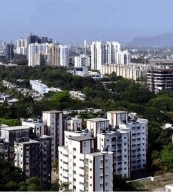
View of Kanjurmarg looking toward the South West | |
 The Eastern Suburbs precinct is shown in pink | |
| Coordinates (Kanjurmarg): 19°08′N 72°56′E / 19.13°N 72.94°E | |
| Country | India |
| State | Maharashtra |
| District | Mumbai Suburban |
| Metro | Mumbai |
| Wards |
L, ME, MW, N, S, T |
| Area | |
| • Total | 203.3 km2 (78.5 sq mi) |
| Population (2011) | |
| • Total | 4,160,000 |
| • Density | 20,000/km2 (53,000/sq mi) |
| Time zone | IST (UTC+5:30) |
| Eastern Suburbs: Population Growth | |||
|---|---|---|---|
| Census | Pop. | %± | |
| 1971 | 1,194,710 | — | |
| 1981 | 2,100,220 | 75.8% | |
| 1991 | 2,803,030 | 33.5% | |
| 2001 | 3,491,890 | 24.6% | |
| Est. 2011 | 4,160,000 | 19.1% | |
| Source: MMRDA[1] Data is based on Government of India Census. | |||
The Eastern Suburbs (or Central Suburbs) is the eastern precinct of the city of Mumbai, India. The Eastern Suburbs are also known as the Central Suburbs because the area is served by the Central Line. The Eastern Suburbs consist of Bhandup, Ghatkopar, Kanjurmarg, Kurla, Mulund, Nahur, Powai, Vidyavihar and Vikhroli. To the south-east lie the suburbs of Chembur, Govandi, Mankhurd and Trombay. These suburbs are sometimes not considered as part of the Eastern Suburbs and are often referred to as the Harbour Suburbs.
Division
The city of Mumbai lies on Salsette Island. Administratively it has two official divisions: Mumbai City district and Mumbai Suburban district. Mumbai City district consists of the southernmost part of Salsette Island. This region is called South Mumbai. The western part of Mumbai Suburban district (to the west of Sanjay Gandhi National Park) is called the Western Suburbs and the eastern part of the district is called the Eastern Suburbs.
The northernmost portion of the island which is outside Mumbai city limits, lies in Thane District.
South Mumbai, the Western suburbs and the Eastern Suburbs are not officially defined divisions of Mumbai and as such different people may include different areas in each division. This article uses the most popular divisions.
Transport
Rail
The Eastern Suburbs is served by the Central Line. With the exception of Powai, each of the suburbs has a railway station. Kurla is an interchange point for the Harbour Line.
Road
The Eastern Express Highway (EEH) is a major road in the Eastern Suburbs.
Lal Bahadur Shastri Marg (LBS Marg) is a 21 km long, major arterial road in the Eastern Suburbs. LBS Marg connects the neighbouring city of Thane with the suburb of Sion in Mumbai.
However, connectivity from the Western Suburbs is poor. The Andheri-Ghatkopar Link Road, Jogeshwari - Vikhroli Link Road (JVLR) and the Andheri-Kurla Road are the major road links between the Eastern and Western Suburbs. Santa Cruz – Chembur Link Road (SCLR) which was completed in April 2014 links the suburb of Santa Cruz to Chembur.
Bus services are provided by Brihanmumbai Electric Supply and Transport (BEST). There are bus depots at Ghatkopar, Mulund and Vikhroli.
See also
Notes
References
- "Population and Employment profile of Mumbai Metropolitan Region". Mumbai Metropolitan Region Development Authority (MMRDA). Archived from the original (PDF) on 28 December 2009. Retrieved 4 June 2010.
| Pre-colonial | |
|---|---|
| Colonial | |
| Beaches | |
| Places of worship | |
| Cultural | |
| Boulevards | |
| Districts | |
| Shopping | |
| Buildings | |
| Parks, zoos and stadia | |
| Museums | |
| Forts | |
| Restaurants & Bars | |
