Evren, Ankara
| Evren | |
|---|---|
| District | |
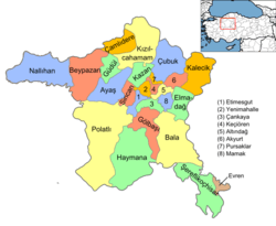 Location of Evren, Ankara within Turkey. | |
 Evren Location of Evren, Ankara within Turkey. | |
| Coordinates: 39°01′N 33°48′E / 39.017°N 33.800°E | |
| Country |
|
| Province | Ankara |
| Government | |
| • Governor | Harun Yücel |
| • Mayor | Nedim Keskin (MHP) |
| Area[1] | |
| • District | 179.74 km2 (69.40 sq mi) |
| Elevation | 922 m (3,025 ft) |
| Population (2012)[2] | |
| • Urban | 1,885 |
| • District | 3,011 |
| • District density | 17/km2 (43/sq mi) |
| Time zone | EET (UTC+2) |
| • Summer (DST) | EEST (UTC+3) |
| Postal code | 06xxx |
| Area code(s) | 0312 |
| Licence plate | 06 |
| Website | www.evren.gov.tr |
Evren, formerly Çıkınağıl, is a town and district of Ankara Province in the Central Anatolia region of Turkey, 178 km from the city of Ankara. According to 2010 census, population of the district is 3,343 of which 2,175 live in the town of Evren..[3][4] The district covers an area of 218 km². Since April 2009 this municipality is governed by the MHP.
Name
This small remote town on the banks of Hirfanlı reservoir, was formerly known as Çıkınağıl, and was renamed in honor of Kenan Evren, former president of Turkey.
Villages in the district
Notes
- ↑ "Area of regions (including lakes), km²". Regional Statistics Database. Turkish Statistical Institute. 2002. Retrieved 2013-03-05.
- ↑ "Population of province/district centers and towns/villages by districts - 2012". Address Based Population Registration System (ABPRS) Database. Turkish Statistical Institute. Retrieved 2013-02-27.
- ↑ Statistical Institute
- ↑ GeoHive. "Statistical information on Turkey's administrative units". Retrieved 2008-03-27.
References
- Falling Rain Genomics, Inc. "Geographical information on Çıkınağıl, Turkey". Retrieved 2008-03-27.
- Kenthaber Uluslararası İnternet Med.Yay.Ltd.Şti. "General information on Evren, Turkey" (in Turkish). Retrieved 2008-03-27.
External links
- District governor's official website (Turkish)
- District municipality's official website (Turkish)
Coordinates: 39°01′N 33°48′E / 39.017°N 33.800°E
This article is issued from Wikipedia - version of the 10/28/2016. The text is available under the Creative Commons Attribution/Share Alike but additional terms may apply for the media files.