Gölbaşı, Ankara
| Gölbaşı | |
|---|---|
| District | |
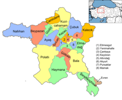 Location of Gölbaşı, Ankara within Turkey. | |
| Coordinates: 39°47′43″N 32°48′10″E / 39.79528°N 32.80278°ECoordinates: 39°47′43″N 32°48′10″E / 39.79528°N 32.80278°E | |
| Country |
|
| Region | Central Anatolia |
| Province | Ankara |
| Government | |
| • Governor | Raşit Zengin |
| • Mayor | Yakup Obabaşı (MHP) |
| Area[1] | |
| • District | 738.30 km2 (285.06 sq mi) |
| Elevation | 970 m (3,180 ft) |
| Population (2012)[2] | |
| • Urban | 109,261 |
| • District | 110,643 |
| • District density | 150/km2 (390/sq mi) |
| Time zone | EET (UTC+2) |
| • Summer (DST) | EEST (UTC+3) |
| Postal code | 06xxx |
| Area code(s) | 0312 |
| Licence plate | 06 |
| Website | Ankara Gölbaşı MUNICIPALITY |

Gölbaşı is a town and district of the Ankara Province in the Central Anatolia region of Turkey, 20 km (12 mi) south of the city of Ankara. According to a 2010 census, the population of the district is 95,109, 93,852 of whom live in the town of Gölbaşı.[3] [4] The district covers an area of 738 km2 (285 sq mi),[5] and the average elevation is 970 m (3,182 ft). The district includes the Mogan and Eymir lakes.
Although the lakes are polluted and infested with mosquitoes, the picnic areas and lakeside restaurants of Gölbaşı serve as a popular retreat from the city for the people of Ankara. A number of government departments have accommodations here, and the town is slowly but surely joining up with the city as the green space between the two disappears. Türk Telekom have their satellite ground control in the area.
History
Archaeological research in the area has revealed occupation since 3000 BC by a succession of civilısations including Early Bronze Age, Hittites, Phrygians, Romans, and Byzantines. Excavated sites include Selametli, Tuluntaş, Tuluntaş-Ortaçayır, Kızılcaşar-Gökçepınar, Karagedik, Bacılar, Bezirhane Kültepe, Bezirhane-Kepenekçi and İncek-Harmantepe.
The area has long been occupied by Turks, and it was here that Timur hid his elephants in the woods before the Battle of Ankara.
Places of interest
- Tulumtaş caves - 15 km (9 mi) from Ankara, 5 km (3 mi) of limestone cave with stalagmites and stalactites
- Gölbaşı Ground Station, satellite telecommunication center of Türksat
- Turkish Satellite Assembly, Integration and Test Center (Turkish: Uydu Montaj, Entegrasyon ve Test Merkezi) operated by the Turkish Aerospace Industries (TAI)
Administrative divisions
Neighborhoods
Villages
Notes
- ↑ "Area of regions (including lakes), km²". Regional Statistics Database. Turkish Statistical Institute. 2002. Retrieved 2013-03-05.
- ↑ "Population of province/district centers and towns/villages by districts - 2012". Address Based Population Registration System (ABPRS) Database. Turkish Statistical Institute. Retrieved 2013-02-27.
- ↑ Statistical Institute
- ↑ GeoHive. "Statistical information on Turkey's administrative units". Retrieved 2008-03-30.
- ↑ Statoids. "Statistical information on districts of Turkey". Retrieved 2008-05-02.
References
- Falling Rain Genomics, Inc. "Geographical information on Gölbaşı, Turkey". Retrieved 2008-03-30.
- Kenthaber.com. "General information on Gölbaşı, Ankara" (in Turkish). Retrieved 2008-03-30.
External links
- District governor's official website (Turkish)
- District municipality's official website (Turkish)