Halstead, Kansas
| Halstead, Kansas | |
|---|---|
| City | |
|
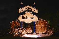
Greeting Sign (2011) | |
 Location within Harvey County and Kansas | |
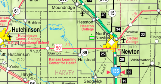 KDOT map of Harvey County (legend) | |
| Coordinates: 38°0′4″N 97°30′30″W / 38.00111°N 97.50833°WCoordinates: 38°0′4″N 97°30′30″W / 38.00111°N 97.50833°W[1] | |
| Country | United States |
| State | Kansas |
| County | Harvey |
| Government | |
| • Type | Mayor–Council |
| • Mayor | William Ewert |
| • City Admin | J.R. Hatfield |
| Area[2] | |
| • Total | 1.31 sq mi (3.39 km2) |
| • Land | 1.31 sq mi (3.39 km2) |
| • Water | 0 sq mi (0 km2) |
| Elevation[1] | 1,391 ft (424 m) |
| Population (2010)[3] | |
| • Total | 2,085 |
| • Estimate (2015)[4] | 2,093 |
| • Density | 1,600/sq mi (620/km2) |
| Time zone | CST (UTC-6) |
| • Summer (DST) | CDT (UTC-5) |
| ZIP code | 67056 |
| Area code | 316 |
| FIPS code | 20-29600 [1] |
| GNIS feature ID | 0473677 [1] |
| Website | halsteadks.com |
Halstead is a city in Harvey County, Kansas, United States.[1] Halstead was named in honor of Murat Halstead, a respected Civil War correspondent and newspaper editor.[5][6] As of the 2010 census, the city population was 2,085.[7]
History


For millennia, the land now known as Kansas was inhabited by Native Americans. In 1803, most of modern Kansas was secured by the United States as part of the Louisiana Purchase. In 1854, the Kansas Territory was organized, then in 1861 Kansas became the 34th U.S. state. In 1872, Harvey County was founded.
Halstead was laid out in 1873.[8] The first post office at Halstead was established in April 1873.[9] Halstead was incorporated as a city in 1877.[10]
Dr. Arthur Hertzler, the "Horse-and-Buggy Doctor," devoted much of his life and energies to the medical environment of Halstead, founding a clinic and hospital for the area residents.[11]
Geography
According to the United States Census Bureau, the city has a total area of 1.31 square miles (3.39 km2), all land.[2]
Climate
The climate in this area is characterized by hot, humid summers and generally mild to cool winters. According to the Köppen Climate Classification system, Halstead has a humid subtropical climate, abbreviated "Cfa" on climate maps.[12]
Demographics
| Historical population | |||
|---|---|---|---|
| Census | Pop. | %± | |
| 1890 | 1,071 | — | |
| 1900 | 914 | −14.7% | |
| 1910 | 1,004 | 9.8% | |
| 1920 | 1,163 | 15.8% | |
| 1930 | 1,373 | 18.1% | |
| 1940 | 1,397 | 1.7% | |
| 1950 | 1,328 | −4.9% | |
| 1960 | 1,598 | 20.3% | |
| 1970 | 1,716 | 7.4% | |
| 1980 | 1,994 | 16.2% | |
| 1990 | 2,015 | 1.1% | |
| 2000 | 1,873 | −7.0% | |
| 2010 | 2,085 | 11.3% | |
| Est. 2015 | 2,093 | [4] | 0.4% |
| U.S. Decennial Census | |||
2010 census
As of the census[3] of 2010, there were 2,085 people, 825 households, and 572 families residing in the city. The population density was 1,591.6 inhabitants per square mile (614.5/km2). There were 917 housing units at an average density of 700.0 per square mile (270.3/km2). The racial makeup of the city was 96.7% White, 0.5% African American, 0.2% Native American, 0.3% Asian, 0.7% from other races, and 1.5% from two or more races. Hispanic or Latino of any race were 3.9% of the population.
There were 825 households of which 36.4% had children under the age of 18 living with them, 53.7% were married couples living together, 12.2% had a female householder with no husband present, 3.4% had a male householder with no wife present, and 30.7% were non-families. 28.1% of all households were made up of individuals and 13.2% had someone living alone who was 65 years of age or older. The average household size was 2.47 and the average family size was 3.00.
The median age in the city was 37.6 years. 28.5% of residents were under the age of 18; 6.1% were between the ages of 18 and 24; 24.4% were from 25 to 44; 24.3% were from 45 to 64; and 16.7% were 65 years of age or older. The gender makeup of the city was 48.0% male and 52.0% female.
2000 census
As of the census[13] of 2000, there were 1,873 people, 760 households, and 528 families residing in the city. The population density was 1,438.1 people per square mile (556.3/km²). There were 849 housing units at an average density of 651.9 per square mile (252.2/km²). The racial makeup of the city was 96.74% White, 0.21% African American, 0.43% Native American, 0.43% Asian, 0.64% from other races, and 1.55% from two or more races. Hispanic or Latino of any race were 2.19% of the population.
There were 760 households out of which 33.8% had children under the age of 18 living with them, 59.7% were married couples living together, 7.9% had a female householder with no husband present, and 30.4% were non-families. 26.8% of all households were made up of individuals and 13.2% had someone living alone who was 65 years of age or older. The average household size was 2.44 and the average family size was 2.98.
In the city the population was spread out with 26.1% under the age of 18, 8.0% from 18 to 24, 26.3% from 25 to 44, 21.6% from 45 to 64, and 18.0% who were 65 years of age or older. The median age was 38 years. For every 100 females there were 88.2 males. For every 100 females age 18 and over, there were 87.4 males.
As of 2000 the median income for a household in the city was $42,411, and the median income for a family was $51,458. Males had a median income of $33,239 versus $22,554 for females. The per capita income for the city was $20,252. About 2.2% of families and 5.8% of the population were below the poverty line, including 5.5% of those under age 18 and 7.2% of those age 65 or over.
Area events
- Halstead Old Settlers.[14]
Area attractions
- Halstead Heritage Museum and Depot. In August 1988, the Halstead Historical Society was formed for the sole purpose of purchasing and restoring the Halstead Santa Fe Train Depot Railway Station. After dedicated efforts and generous sponsorship, the Halstead Heritage Museum and Depot opened on March 18, 1995. The museum has worked to carefully preserve Halstead history and offers exhibits detailing the founding and naming of Halstead, Bernard Warkentin, local Mennonite Heritage, Dr. Arthur E. Hertzler, and the Halstead Hospital School of Nursing. The museum also features the original "swan boat" from Picnic (1955 film) which was primarily filmed in Halstead, as well as many historic artifacts and photos.[15]
Parks and recreation
- Scout Park
- Riverside Park
- Williams Park[16]
Films
- Picnic (1955) An ex-college football star turned drifter arrives in a small Kansas town on Labor Day. It was primarily filmed in Halstead.
- The Parade (1984) A made-for-television movie in which an ex-con returns to his Kansas hometown days before the town's annual Fourth of July parade. It was filmed in Halstead.[17]
Education
Primary and secondary education
Halstead is part of Unified School District 440.[18][19]
- Halstead High School in Halstead.
- Halstead Middle School in Halstead.
- Bentley Primary School in Bentley.
Notable people
- Edward Benjamin Krehbiel, Stanford University professor and peace activist [20]
- Jim Roper, NASCAR driver
- Adolph Rupp, NCAA basketball coach
Gallery
- Historic Images of Halstead, Special Photo Collections at Wichita State University Library
 Halstead city limits in 2007
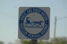 Sign north of city in 2007
See also
- National Register of Historic Places listings in Harvey County, Kansas
- Threshing Stone
- La Junta Subdivision, branch of the BNSF Railway
- Arkansas Valley Interurban Railway
Further reading
References
- 1 2 3 4 5 Geographic Names Information System (GNIS) details for Halstead, Kansas; United States Geological Survey (USGS); October 13, 1978.
- 1 2 "US Gazetteer files 2010". United States Census Bureau. Retrieved 2012-07-06.
- 1 2 "American FactFinder". United States Census Bureau. Retrieved 2012-07-06.
- 1 2 "Annual Estimates of the Resident Population for Incorporated Places: April 1, 2010 to July 1, 2015". Retrieved July 2, 2016.
- ↑ Kansas State Historical Society (1916). Biennial Report of the Board of Directors of the Kansas State Historical Society. Kansas State Printing Plant. p. 204.
- ↑ http://www.hcgsks.org/Homesteader/Homesteader10.pdf
- ↑ "2010 City Population and Housing Occupancy Status". U.S. Census Bureau. Retrieved March 6, 2011.
- ↑ History of the State of Kansas: Containing a Full Account of Its Growth from an Uninhabited Territory to a Wealthy and Important State. A. T. Andreas. 1883. p. 784.
- ↑ "Kansas Post Offices, 1828-1961 (archived)". Kansas Historical Society. Archived from the original on October 9, 2013. Retrieved 11 June 2014.
- ↑ Blackmar, Frank Wilson (1912). Kansas: A Cyclopedia of State History, Embracing Events, Institutions, Industries, Counties, Cities, Towns, Prominent Persons, Etc. Standard Publishing Company. p. 802.
- ↑ Arthur Emanual Hertzler, A Kansas Portrait
- ↑ Climate Summary for Halstead, Kansas
- ↑ "American FactFinder". United States Census Bureau. Retrieved 2008-01-31.
- ↑ Halstead Old Settlers
- ↑ Halstead Heritage Museum and Depot
- ↑ http://www.halsteadks.com/parks_and_recreation.htm
- ↑ TV Movie - The Parade
- ↑ USD 440
- ↑ Kansas School District Boundary Map
- ↑ https://www.questia.com/library/journal/1G1-202919427/edward-benjamin-krehbiel-progressive-peace-advocate
External links
| Wikimedia Commons has media related to Halstead, Kansas. |
Municipalities and communities of Harvey County, Kansas, United States | ||
|---|---|---|
| Cities | 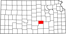 | |
| Unincorporated communities | ||
| Ghost town |
| |
| Townships | ||
| Footnotes | ‡This populated place also has portions in an adjacent county or counties | |