Hazen, North Dakota
| Hazen, North Dakota | |
|---|---|
| City | |
|
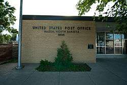
Post office in Hazen | |
| Motto: "The Heart of Sakakawea South Shore" | |
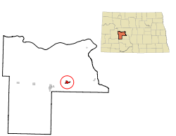 Location of Hazen, North Dakota | |
| Coordinates: 47°17′49″N 101°37′25″W / 47.29694°N 101.62361°WCoordinates: 47°17′49″N 101°37′25″W / 47.29694°N 101.62361°W | |
| Country | United States |
| State | North Dakota |
| County | Mercer |
| Area[1] | |
| • Total | 1.27 sq mi (3.29 km2) |
| • Land | 1.27 sq mi (3.29 km2) |
| • Water | 0 sq mi (0 km2) |
| Elevation | 1,742 ft (531 m) |
| Population (2010)[2] | |
| • Total | 2,411 |
| • Estimate (2015)[3] | 2,488 |
| • Density | 1,898.4/sq mi (733.0/km2) |
| Time zone | Central (CST) [4] (UTC-6) |
| • Summer (DST) | CDT (UTC-5) |
| ZIP code | 58545 |
| Area code(s) | 701 |
| FIPS code | 38-36780 |
| GNIS feature ID | 1029361[5] |
| Highways | ND 200 |
| Website | http://www.hazennd.org/ |
Hazen is a city in Mercer County, North Dakota, United States. The population was 2,411 at the 2010 census.[6] Hazen was founded in 1913. Hazen has a K-12 school system.
It is located about fifteen minutes south of Lake Sakakawea, the largest lake in North Dakota and the third largest man-made lake in the United States.
History
A post office has been in operation at Hazen since 1885.[7] A. D. Hazen, an early postmaster, gave the settlement its name.[8] Hazen was laid out in 1913, when the railroad was extended to that point.[9]
Geography
Hazen is located at 47°17′49″N 101°37′25″W / 47.29694°N 101.62361°W (47.297083, -101.623616).[10]
According to the United States Census Bureau, the city has a total area of 1.27 square miles (3.29 km2), all of it land.[1]
Demographics
| Historical population | |||
|---|---|---|---|
| Census | Pop. | %± | |
| 1920 | 520 | — | |
| 1930 | 689 | 32.5% | |
| 1940 | 662 | −3.9% | |
| 1950 | 1,230 | 85.8% | |
| 1960 | 1,222 | −0.7% | |
| 1970 | 1,240 | 1.5% | |
| 1980 | 2,365 | 90.7% | |
| 1990 | 2,818 | 19.2% | |
| 2000 | 2,457 | −12.8% | |
| 2010 | 2,411 | −1.9% | |
| Est. 2015 | 2,488 | [11] | 3.2% |
| U.S. Decennial Census[12] 2015 Estimate[3] | |||
2010 census
As of the census[2] of 2010, there were 2,411 people, 1,020 households, and 742 families residing in the city. The population density was 1,898.4 inhabitants per square mile (733.0/km2). There were 1,074 housing units at an average density of 845.7 per square mile (326.5/km2). The racial makeup of the city was 96.6% White, 0.4% African American, 1.8% Native American, 0.3% Asian, 0.1% Pacific Islander, 0.3% from other races, and 0.6% from two or more races. Hispanic or Latino of any race were 1.2% of the population.
There were 1,020 households of which 29.0% had children under the age of 18 living with them, 63.1% were married couples living together, 6.5% had a female householder with no husband present, 3.1% had a male householder with no wife present, and 27.3% were non-families. 24.6% of all households were made up of individuals and 9.1% had someone living alone who was 65 years of age or older. The average household size was 2.33 and the average family size was 2.75.
The median age in the city was 45.2 years. 22.6% of residents were under the age of 18; 5.2% were between the ages of 18 and 24; 21.9% were from 25 to 44; 35.8% were from 45 to 64; and 14.6% were 65 years of age or older. The gender makeup of the city was 50.1% male and 49.9% female.
2000 census
As of the census of 2000, there were 2,457 people, 937 households, and 684 families residing in the city. The population density was 1,981.6 inhabitants per square mile (765.0/km²). There were 1,131 housing units at an average density of 912.2 per square mile (352.2/km²). The racial makeup of the city was 97.07% White, 0.12% African American, 1.75% Native American, 0.28% Asian, 0.16% Pacific Islander, 0.08% from other races, and 0.53% from two or more races. Hispanic or Latino of any race were 0.37% of the population.
The top 6 ancestry groups in the city are German (71.7%), Norwegian (18.4%), Russian (9.4%), Irish (8.8%), English (6.0%), Swedish (4.0%).
There were 937 households out of which 39.1% had children under the age of 18 living with them, 67.1% were married couples living together, 4.8% had a female householder with no husband present, and 26.9% were non-families. 25.0% of all households were made up of individuals and 11.4% had someone living alone who was 65 years of age or older. The average household size was 2.58 and the average family size was 3.12.
In the city the population was spread out with 30.0% under the age of 18, 4.1% from 18 to 24, 27.9% from 25 to 44, 24.9% from 45 to 64, and 13.0% who were 65 years of age or older. The median age was 40 years. For every 100 females there were 97.8 males. For every 100 females age 18 and over, there were 95.6 males.
The median income for a household in the city was $44,028, and the median income for a family was $55,859. Males had a median income of $46,792 versus $23,011 for females. The per capita income for the city was $18,908. About 2.8% of families and 5.9% of the population were below the poverty line, including 3.1% of those under age 18 and 22.7% of those age 65 or over.
Education
References
- 1 2 "US Gazetteer files 2010". United States Census Bureau. Retrieved 2012-06-14.
- 1 2 "American FactFinder". United States Census Bureau. Retrieved 2012-06-14.
- 1 2 "Population Estimates". United States Census Bureau. Retrieved June 3, 2016.
- ↑ "Relocation of Standard Time Zone Boundary in the State of North Dakota: Mercer County". Department of Transportation. 2010-09-29. Retrieved 2014-09-26.
- ↑ "US Board on Geographic Names". United States Geological Survey. 2007-10-25. Retrieved 2008-01-31.
- ↑ "2010 Census Redistricting Data (Public Law 94-171) Summary File". American FactFinder. United States Census Bureau. Retrieved 2 May 2011.
- ↑ "Mercer County". Jim Forte Postal History. Retrieved 23 October 2015.
- ↑ Federal Writers' Project (1938). North Dakota, a Guide to the Northern Prairie State,. WPA. p. 319. ISBN 978-1-62376-033-5.
- ↑ North Dakota: Counties - Towns & People, Part III. Watchmaker Publishing, Ltd. 2008. p. 215. ISBN 978-1-60386-342-1.
- ↑ "US Gazetteer files: 2010, 2000, and 1990". United States Census Bureau. 2011-02-12. Retrieved 2011-04-23.
- ↑ "Annual Estimates of the Resident Population for Incorporated Places: April 1, 2010 to July 1, 2015". Retrieved July 2, 2016.
- ↑ "U.S. Decennial Census". Census.gov. Retrieved June 1, 2013.
External links
Municipalities and communities of Mercer County, North Dakota, United States | ||
|---|---|---|
| Cities | 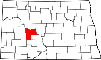 | |
| Unorganized territories |
| |
| Unincorporated community |
| |