Rolla, North Dakota
| Rolla, North Dakota | |
|---|---|
| City | |
| Motto: "Pride Of The Prairie" | |
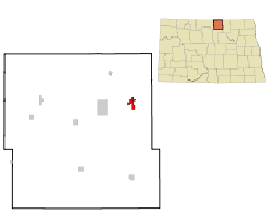 Location of Rolla, North Dakota | |
| Coordinates: 48°51′35″N 99°36′55″W / 48.85972°N 99.61528°WCoordinates: 48°51′35″N 99°36′55″W / 48.85972°N 99.61528°W | |
| Country | United States |
| State | North Dakota |
| County | Rolette |
| Area[1] | |
| • Total | 1.43 sq mi (3.70 km2) |
| • Land | 1.43 sq mi (3.70 km2) |
| • Water | 0 sq mi (0 km2) |
| Elevation | 1,814 ft (553 m) |
| Population (2010)[2] | |
| • Total | 1,280 |
| • Estimate (2015)[3] | 1,325 |
| • Density | 895.1/sq mi (345.6/km2) |
| Time zone | Central (CST) (UTC-6) |
| • Summer (DST) | CDT (UTC-5) |
| ZIP code | 58367 |
| Area code(s) | 701 |
| FIPS code | 38-67820 |
| GNIS feature ID | 1030958[4] |
| Highways | US 281, ND 5, ND 30 |
| Website | http://rolla.nd.utma.com/ |
Rolla (/ˈrɒlə/ ROL-ə) is a city in Rolette County, North Dakota, United States. It is the county seat of Rolette County.[5] The population was 1,280 at the 2010 census.[6] The city contains a small park and a small outdoor pool.
History
Rolla was laid out in 1888.[7] The name Rolla was most likely derived from Rolette, the county in which the city is located.[8] A post office has been in operation in Rolla since 1888.[9] The city was incorporated in 1907.[7]
Geography and climate
Rolla is located at 48°51′35″N 99°36′55″W / 48.859842°N 99.615187°W.[10]
According to the United States Census Bureau, the city has a total area of 1.43 square miles (3.70 km2), all of it land.[1]
| Climate data for Rolla, North Dakota (1981–2010) | |||||||||||||
|---|---|---|---|---|---|---|---|---|---|---|---|---|---|
| Month | Jan | Feb | Mar | Apr | May | Jun | Jul | Aug | Sep | Oct | Nov | Dec | Year |
| Average high °F (°C) | 15.3 (−9.3) |
20.0 (−6.7) |
30.1 (−1.1) |
48.8 (9.3) |
62.2 (16.8) |
70.2 (21.2) |
75.0 (23.9) |
74.6 (23.7) |
64.2 (17.9) |
50.1 (10.1) |
31.7 (−0.2) |
18.8 (−7.3) |
46.7 (8.2) |
| Average low °F (°C) | −2.4 (−19.1) |
1.9 (−16.7) |
13.6 (−10.2) |
28.0 (−2.2) |
39.7 (4.3) |
50.3 (10.2) |
55.7 (13.2) |
53.5 (11.9) |
43.4 (6.3) |
30.8 (−0.7) |
15.9 (−8.9) |
2.4 (−16.4) |
27.7 (−2.4) |
| Average precipitation inches (mm) | 0.44 (11.2) |
0.36 (9.1) |
0.68 (17.3) |
1.00 (25.4) |
2.42 (61.5) |
3.57 (90.7) |
2.96 (75.2) |
2.35 (59.7) |
1.62 (41.1) |
1.27 (32.3) |
0.75 (19) |
0.48 (12.2) |
17.88 (454.2) |
| Average snowfall inches (cm) | 5.2 (13.2) |
4.2 (10.7) |
4.7 (11.9) |
1.3 (3.3) |
0.5 (1.3) |
0.0 (0) |
0.0 (0) |
0.0 (0) |
0.0 (0) |
0.6 (1.5) |
3.0 (7.6) |
5.9 (15) |
25.4 (64.5) |
| Source: NOAA[11] | |||||||||||||
Demographics
| Historical population | |||
|---|---|---|---|
| Census | Pop. | %± | |
| 1890 | 255 | — | |
| 1900 | 400 | 56.9% | |
| 1910 | 587 | 46.8% | |
| 1920 | 675 | 15.0% | |
| 1930 | 852 | 26.2% | |
| 1940 | 1,008 | 18.3% | |
| 1950 | 1,176 | 16.7% | |
| 1960 | 1,398 | 18.9% | |
| 1970 | 1,458 | 4.3% | |
| 1980 | 1,538 | 5.5% | |
| 1990 | 1,286 | −16.4% | |
| 2000 | 1,417 | 10.2% | |
| 2010 | 1,280 | −9.7% | |
| Est. 2015 | 1,325 | [12] | 3.5% |
| U.S. Decennial Census[13] 2015 Estimate[3] | |||
2010 census
As of the census[2] of 2010, there were 1,280 people, 563 households, and 321 families residing in the city. The population density was 895.1 inhabitants per square mile (345.6/km2). There were 619 housing units at an average density of 432.9 per square mile (167.1/km2). The racial makeup of the city was 54.1% White, 0.1% African American, 40.9% Native American, 0.6% Asian, 0.2% from other races, and 4.2% from two or more races. Hispanic or Latino of any race were 1.8% of the population.
There were 563 households of which 30.2% had children under the age of 18 living with them, 35.3% were married couples living together, 16.7% had a female householder with no husband present, 5.0% had a male householder with no wife present, and 43.0% were non-families. 40.3% of all households were made up of individuals and 18.8% had someone living alone who was 65 years of age or older. The average household size was 2.24 and the average family size was 2.98.
The median age in the city was 36.5 years. 27.6% of residents were under the age of 18; 8.3% were between the ages of 18 and 24; 22.1% were from 25 to 44; 24.9% were from 45 to 64; and 17.1% were 65 years of age or older. The gender makeup of the city was 47.3% male and 52.7% female.
2000 census
As of the census of 2000, there were 1,417 people, 599 households, and 357 families residing in the city. The population density was 1,141.2 people per square mile (441.2/km2). There were 656 housing units at an average density of 528.3 per square mile (204.3/km2). The racial makeup of the city was 66.83% White, 0.07% African American, 28.44% Native American, 0.56% Asian, 0.21% from other races, and 3.88% from two or more races. Hispanic or Latino of any race were 0.64% of the population. 20.4% were of German, 15.8% Norwegian, 9.2% Finnish and 7.3% French ancestry according to Census 2000. 96.5% spoke English, 1.4% Finnish and 1.4% Spanish as their first language.
There were 599 households out of which 31.2% had children under the age of 18 living with them, 44.6% were married couples living together, 13.7% had a female householder with no husband present, and 40.4% were non-families. 36.4% of all households were made up of individuals and 21.5% had someone living alone who was 65 years of age or older. The average household size was 2.34 and the average family size was 3.10.
In the city the population was spread out with 27.8% under the age of 18, 7.3% from 18 to 24, 24.1% from 25 to 44, 21.7% from 45 to 64, and 19.1% who were 65 years of age or older. The median age was 39 years. For every 100 females there were 84.7 males. For every 100 females age 18 and over, there were 80.7 males.
The median income for a household in the city was $32,222, and the median income for a family was $41,550. Males had a median income of $25,096 versus $20,391 for females. The per capita income for the city was $16,614. About 16.0% of families and 19.4% of the population were below the poverty line, including 35.6% of those under age 18 and 10.6% of those age 65 or over.
Notable people
References
- 1 2 "US Gazetteer files 2010". United States Census Bureau. Retrieved 2012-06-14.
- 1 2 "American FactFinder". United States Census Bureau. Retrieved 2012-06-14.
- 1 2 "Population Estimates". United States Census Bureau. Retrieved June 8, 2016.
- ↑ "US Board on Geographic Names". United States Geological Survey. 2007-10-25. Retrieved 2008-01-31.
- ↑ "Find a County". National Association of Counties. Retrieved 2011-06-07.
- ↑ "2010 Census Redistricting Data (Public Law 94-171) Summary File". American FactFinder. United States Census Bureau. Retrieved 2 May 2011.
- 1 2 "Explain Origin of All County Towns". Turtle Mountain Star. September 5, 1940. p. 7. Retrieved 2 May 2015.
- ↑ Federal Writers' Project (1938). North Dakota, a Guide to the Northern Prairie State,. WPA. p. 236. ISBN 978-1-62376-033-5.
- ↑ "Rolette County". Jim Forte Postal History. Retrieved 14 February 2015.
- ↑ "US Gazetteer files: 2010, 2000, and 1990". United States Census Bureau. 2011-02-12. Retrieved 2011-04-23.
- ↑ "NOWData - NOAA Online Weather Data". National Oceanic and Atmospheric Administration. Retrieved May 4, 2013.
- ↑ "Annual Estimates of the Resident Population for Incorporated Places: April 1, 2010 to July 1, 2015". Retrieved July 2, 2016.
- ↑ United States Census Bureau. "Census of Population and Housing". Retrieved January 19, 2014.
External links
| Wikimedia Commons has media related to Rolla, North Dakota. |
Municipalities and communities of Rolette County, North Dakota, United States | ||
|---|---|---|
| Cities | 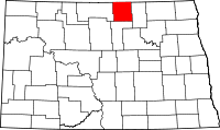 | |
| Townships |
| |
| CDPs | ||
| Unorganized territories |
| |
| Unincorporated communities | ||