Inman Park-Moreland Historic District
|
Inman Park--Moreland Historic District | |
|
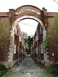
Pendleton Apartments, Euclid Avenue | |
   | |
| Location |
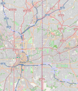
Roughly bounded by N. Highland, Seminole and Euclid, DeKalb, and Degress and Washita Aves. (original) Roughly bounded by Cleburne, Moreland and DeKalb Aves., Battery Place and a city park. (increase) |
|---|---|
| Coordinates | 33°45′50″N 84°21′7″W / 33.76389°N 84.35194°WCoordinates: 33°45′50″N 84°21′7″W / 33.76389°N 84.35194°W |
| Built | 1870 (original) and 1889 (increase) |
| Architect | Willis F. Denny[1] |
| Architectural style | Colonial Revival, Bungalow/Craftsman, Beaux Arts (original) and Mid 19th Century Revival, Late 19th And 20th Century Revivals (increase) |
| NRHP Reference # |
86001209 [2] (original) 03001016 [2] (increase) |
| Significant dates | |
| Added to NRHP | June 5, 1986 (original) |
| Boundary increase | October 13, 2003 (increase) |
Inman Park-Moreland Historic District is a historic district in Inman Park, Atlanta, Georgia that was listed on the National Register of Historic Places (NRHP) in 1986. It includes the Kriegshaber House, now the Wrecking Ball Brewpub, which is separately NRHP-listed.[2]
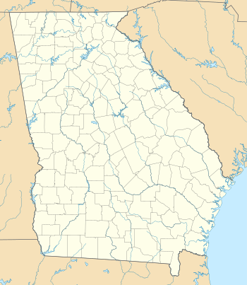
The district spans the Fulton County-DeKalb County border.
The district was increased in 2003.[2]
References
- ↑ "W.F. Denny", New Georgia Encyclopedia" There are misordering and misspelling of name on NRHP records.
- 1 2 3 4 National Park Service (2009-03-13). "National Register Information System". National Register of Historic Places. National Park Service.
| Topics | |
|---|---|
| Lists by states |
|
| Lists by insular areas | |
| Lists by associated states | |
| Other areas | |
| |

This article is issued from Wikipedia - version of the 11/27/2016. The text is available under the Creative Commons Attribution/Share Alike but additional terms may apply for the media files.