Irouléguy
| Irouléguy | |
|---|---|
|
Vineyards | |
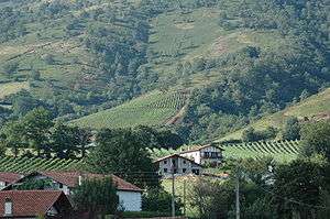
 Irouléguy | |
|
Location within Nouvelle-Aquitaine region  Irouléguy | |
| Coordinates: 43°10′43″N 1°17′57″W / 43.1786°N 1.2992°WCoordinates: 43°10′43″N 1°17′57″W / 43.1786°N 1.2992°W | |
| Country | France |
| Region | Nouvelle-Aquitaine |
| Department | Pyrénées-Atlantiques |
| Arrondissement | Bayonne |
| Canton | Saint-Étienne-de-Baïgorry |
| Intercommunality | Garazi-Baïgorri |
| Government | |
| • Mayor (2001–2008) | Jacques Irume |
| Area1 | 9.38 km2 (3.62 sq mi) |
| Population (2006)2 | 324 |
| • Density | 35/km2 (89/sq mi) |
| Time zone | CET (UTC+1) |
| • Summer (DST) | CEST (UTC+2) |
| INSEE/Postal code | 64274 / 64220 |
| Elevation |
166–810 m (545–2,657 ft) (avg. 223 m or 732 ft) |
|
1 French Land Register data, which excludes lakes, ponds, glaciers > 1 km² (0.386 sq mi or 247 acres) and river estuaries. 2 Population without double counting: residents of multiple communes (e.g., students and military personnel) only counted once. | |
Irouléguy (Basque: Irulegi) is a commune in the Pyrénées-Atlantiques department in south-western France.
It is located in the former province of Lower Navarre.
It is mainly known for the Irouléguy AOC wine which is grown on the vineyards of the area.
See also
References
External links
| Wikimedia Commons has media related to Irouléguy. |
This article is issued from Wikipedia - version of the 2/12/2016. The text is available under the Creative Commons Attribution/Share Alike but additional terms may apply for the media files.