Khabarovsk Krai
| Khabarovsk Krai Хабаровский край (Russian) | |||
|---|---|---|---|
| — Krai — | |||
| |||
|
| |||
| |||
|
| |||
| Political status | |||
| Country | Russia | ||
| Federal district | Far Eastern[2] | ||
| Economic region | Far Eastern[3] | ||
| Established | October 20, 1938[4] | ||
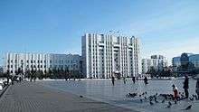
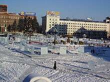
| Administrative center | Khabarovsk[5] | ||
| Government (as of May 2015) | |||
| • Governor[6] | Vyacheslav Shport[7] | ||
| • Legislature | Legislative Duma[6] | ||
| Statistics | |||
| Area (as of the 2002 Census)[8] | |||
| • Total | 788,600 km2 (304,500 sq mi) | ||
| Area rank | 4th | ||
| Population (2010 Census)[9] | |||
| • Total | 1,343,869 | ||
| • Rank | 34th | ||
| • Density[10] | 1.7/km2 (4.4/sq mi) | ||
| • Urban | 81.8% | ||
| • Rural | 18.2% | ||
| Population (January 2015 est.) | |||
| • Total |
1,338,305 | ||
| Time zone(s) | VLAT (UTC+10:00)[12] | ||
| ISO 3166-2 | RU-KHA | ||
| License plates | 27 | ||
| Official languages | Russian[13] | ||
| Official website | |||


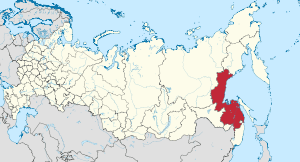
Khabarovsk Krai (Russian: Хаба́ровский край, tr. Khabarovsky kray; IPA: [xɐˈbarəfskʲɪj kraj]) is a federal subject of Russia (a krai), located in the Russian Far East. It lies mostly in the basin of the lower Amur River, but also occupies a vast mountainous area along the coastline of the Sea of Okhotsk, an arm of the Pacific Ocean. The administrative center of the krai is the city of Khabarovsk. Population: 1,343,869 (2010 Census).[9]
The indigenous people of the area are various Tungusic peoples (Evenks, Negidals, Ulchs, Nanai, Oroch, Udege) and Amur Nivkhs.[14]
Geography
Khabarovsk Krai shares its borders with Magadan Oblast in the north, with the Sakha Republic and Amur Oblast in the west, with the Jewish Autonomous Oblast, China, and Primorsky Krai in the south, and is limited by the Sea of Okhotsk in the east. In terms of area, it is the fourth-largest federal subject within Russia. Major islands include Shantar Islands.
Taiga and tundra in the north, swampy forest in the central depression, and deciduous forest in the south are the natural vegetation in the area.
History
According to various Chinese and Korean records, the southern part of Khabarovsk Krai was originally occupied by one of the five semi-nomadic Shiwei, the Bo Shiwei tribes and the Black Water Mohe tribes living respectively on the west and the east of the Bureinsky and the Lesser Khingan ranges.
In 1643, Vassili Poyarkov's boats descended the Amur, returning to Yakutsk by the Sea of Okhotsk and the Aldan River, and in 1649–1650 Yerofey Khabarov occupied the banks of the Amur. The resistance of the Chinese, however, obliged the Cossacks to quit their forts, and by the Treaty of Nerchinsk (1689) Russia abandoned her advance into the basin of the river.
Although the Russians were thus deprived of the right to navigate the Amur River, the territorial claim over the lower courses of the river was not settled in the Treaty of Nerchinsk of 1689. The area between Uda River and Greater Khingan mountain range (i.e. most of Lower Amuria) was left undemarcated and the Sino-Russian border was allowed to fluctuate.[15][16]
Later in the nineteenth century, Nikolay Muravyov would conduct an aggressive policy with China by claiming that the lower reaches of the Amur River belonged to Russia. In 1852, a Russian military expedition under Muravyov explored the Amur, and by 1857 a chain of Russian Cossacks and peasants had been settled along the whole course of the river. In 1858, in the Treaty of Aigun, China recognized the Amur River downstream as far as the Ussuri River as the boundary between Russia and the Qing Empire, and granted Russia free access to the Pacific Ocean.[17] The Sino-Russian border was later further delineated in the Treaty of Peking of 1860 when the Ussuri Territory (the Maritime Territory), which was previously a joint possession, became Russian.[18]
Modern Khabarovsk Krai was established on October 20, 1938, when the Far Eastern Krai was split into the Khabarovsk and Primorsky Krais.[4]
Administrative divisions
Politics
During the Soviet period, the high authority in the oblast was shared between three persons: The first secretary of the Khabarovsk CPSU Committee (who in reality had the biggest authority), the chairman of the oblast Soviet (legislative power), and the Chairman of the oblast Executive Committee (executive power). Since 1991, CPSU lost all the power, and the head of the Oblast administration, and eventually the governor was appointed/elected alongside elected regional parliament.
The Charter of Khabarovsk Krai is the fundamental law of the krai. The Legislative Duma of Khabarovsk Krai is the regional standing legislative (representative) body. The Legislative Duma exercises its authority by passing laws, resolutions, and other legal acts and by supervising the implementation and observance of the laws and other legal acts passed by it. The highest executive body is the Krai Government, which includes territorial executive bodies such as district administrations, committees, and commissions that facilitate development and run the day to day matters of the province. The Krai Administration supports the activities of the Governor who is the highest official and acts as guarantor of the observance of the Charter in accordance with the Constitution of Russia.
Economy
Khabarovsk Krai is the most industrialized territory of the Far East of Russia, producing 30% of the total industrial products in the Far Eastern Economic Region. The machine construction industry consists primarily of a highly developed military-industrial complex of large-scale aircraft- and shipbuilding enterprises.[19] The Komsomolsk-on-Amur Aircraft Production Association is currently one of among the krai's most successful enterprises, and for years has been the largest taxpayer of the territory.[19] Other major industries include timberworking and fishing, along with metallurgy in the main cities, although the krai's own mineral resources are poorly developed. Komsomolsk-on-Amur is the iron and steel center of the Far East; a pipeline from northern Sakhalin supplies the petroleum-refining industry in the city of Khabarovsk. In the Amur basin, there is also some cultivation of wheat and soybeans. The administrative center, Khabarovsk, is at the junction of the Amur River and the Trans-Siberian Railway.
Demographics
Population: 1,343,869 (2010 Census);[9] 1,436,570 (2002 Census);[20] 1,824,506 (1989 Census).[21]
According to the 2010 Census,[9] 91.8% of the population are Russians, 2.1% Ukrainians, 0.8% Nanais, 0.6% Tatars, 0.6% Koreans, and 0.4% Belarusians. 55,038 people were registered from administrative databases, and could not declare an ethnicity. It is estimated that the proportion of ethnicities in this group is the same as that of the declared group.[22]
In addition to the Nanai, other indigenous groups include the Evenks and Evens in the northern part of the province, and Ulchs in the lower Amur river (Ulchsky District). Some Nivkhs (Gilyak), an indigenous fishing people speaking an isolate language, live around the Amur river delta as well. Smaller groups indigenous to the area are Negidals (567), Orochs (686), and Udege (1,657) and Taz people (3) according to the 2002 census.
- Births (2009): 17,573 (12.5 per 1000)
- Deaths (2009): 19,115 (13.6 per 1000)[23]
- Urban Births (2009): 13,612 (12.1 per 1000)
- Rural Births (2009): 3,961 (14.5 per 1000)
- Urban Deaths (2009): 15,472 (13.7 per 1000)
- Rural Deaths (2009): 3,643 (13.3 per 1000)[24]
The birth rate for 2008 is 5.2% higher than that in 2007, and the death rate is 1.4% lower. Birth rate was recorded at 11.6 for 2007 (11.1 for Urban areas and 13.8 for Rural areas) per 1000 people. The death rate was 14.2 in 2007 (14.3 for Urban areas and 14.0 for Rural areas). Rural locations of Khabarovsk Krai had a positive natural growth of population in 2008 (for the first time in the last 16 years).[24]
- Vital statistics for 2012
- Births: 18 324 (13.6 per 1000)
- Deaths: 18 169 (13.5 per 1000) [25]
Total fertility rate:[26]
2009 - 1.59 | 2010 - 1.56 | 2011 - 1.57 | 2012 - 1.70 | 2013 - 1.74 | 2014 - 1.79 | 2015 - 1.86(e)
Religion

According to a 2012 official survey,[27] 26.2% of the population of Khabarovsk Krai adheres to the Russian Orthodox Church, 4% are unaffiliated generic Christians, 1% adheres to other Orthodox churches or is a believer in Orthodox Christianity who doesn't belong to any church, 1% is an adherent of Islam. In addition, 28% of the population declares to be "spiritual but not religious", 23% is atheist, and 16.8% follows other religions or did not give an answer to the question.[27]
Education
There are the following institutions of higher education in Khabarovsk Krai.[29][30]
- Pacific National University
- Far Eastern State University of Humanities
- Far Eastern State Medical University
- Khabarovsk State Academy of Economics and Law
- Far Eastern State Transport University
- Far Eastern Academy of Government Services
- Far Eastern State Physical Education University
- Khabarovsk State Institute of Arts and Culture
- Komsomolsk-on-Amur State Technical University
- Komsomolsk-on-Amur State Pedagogical institute
Sport
Amur Khabarovsk, a professional hockey club of the international Kontinental Hockey League and plays its home games at the Platinum Arena.
FC SKA-Energiya Khabarovsk is a professional association football team playing in the Russian Football National League, the second tier of Russian association football.
SKA-Neftyanik is a professional bandy club which plays in the top-tier Russian Bandy Super League at its own indoor venue Arena Yerofey.
The city was a host to the 1981 Bandy World Championship. The 2015 Bandy World Championship was organized in Khabarovsk. Twenty-one teams were expected, which would have been four more than the record-making seventeen from the 2014 tournament.
Sister relations
See also
References
Notes
- ↑ Article 10 of the Charter of Khabarovsk Krai states that the krai may have an anthem, providing a law is adopted to that effect. As of 2015, no such law is in place.
- ↑ Президент Российской Федерации. Указ №849 от 13 мая 2000 г. «О полномочном представителе Президента Российской Федерации в федеральном округе». Вступил в силу 13 мая 2000 г. Опубликован: "Собрание законодательства РФ", №20, ст. 2112, 15 мая 2000 г. (President of the Russian Federation. Decree #849 of May 13, 2000 On the Plenipotentiary Representative of the President of the Russian Federation in a Federal District. Effective as of May 13, 2000.).
- ↑ Госстандарт Российской Федерации. №ОК 024-95 27 декабря 1995 г. «Общероссийский классификатор экономических регионов. 2. Экономические районы», в ред. Изменения №5/2001 ОКЭР. (Gosstandart of the Russian Federation. #OK 024-95 December 27, 1995 Russian Classification of Economic Regions. 2. Economic Regions, as amended by the Amendment #5/2001 OKER. ).
- 1 2 Decree of October 20, 1938
- ↑ Charter of Khabarovsk Krai, Article 12
- 1 2 Charter of Khabarovsk Krai, Article 4
- ↑ Official website of Khabarovsk Krai. Vyacheslav Ivanovich Shport, Governor of Khabarovsk Krai (Russian)
- ↑ Федеральная служба государственной статистики (Federal State Statistics Service) (2004-05-21). "Территория, число районов, населённых пунктов и сельских администраций по субъектам Российской Федерации (Territory, Number of Districts, Inhabited Localities, and Rural Administration by Federal Subjects of the Russian Federation)". Всероссийская перепись населения 2002 года (All-Russia Population Census of 2002) (in Russian). Federal State Statistics Service. Retrieved 2011-11-01.
- 1 2 3 4 Russian Federal State Statistics Service (2011). "Всероссийская перепись населения 2010 года. Том 1" [2010 All-Russian Population Census, vol. 1]. Всероссийская перепись населения 2010 года (2010 All-Russia Population Census) (in Russian). Federal State Statistics Service. Retrieved June 29, 2012.
- ↑ The density value was calculated by dividing the population reported by the 2010 Census by the area shown in the "Area" field. Please note that this value may not be accurate as the area specified in the infobox is not necessarily reported for the same year as the population.
- ↑ Khabarovsk Krai Territorial Branch of the Federal State Statistics Service. Численность населения Хабаровского края по муниципальным образованиям на 1 января 2015 года (Russian)
- ↑ Правительство Российской Федерации. Федеральный закон №107-ФЗ от 3 июня 2011 г. «Об исчислении времени», в ред. Федерального закона №271-ФЗ от 03 июля 2016 г. «О внесении изменений в Федеральный закон "Об исчислении времени"». Вступил в силу по истечении шестидесяти дней после дня официального опубликования (6 августа 2011 г.). Опубликован: "Российская газета", №120, 6 июня 2011 г. (Government of the Russian Federation. Federal Law #107-FZ of June 31, 2011 On Calculating Time, as amended by the Federal Law #271-FZ of July 03, 2016 On Amending Federal Law "On Calculating Time". Effective as of after sixty days following the day of the official publication.).
- ↑ Official on the whole territory of Russia according to Article 68.1 of the Constitution of Russia.
- ↑ Chaussonnet, p.109
- ↑ "1689, Nerchinsk - Russia". China's External Relations.
- ↑ Alexei D. Voskressenski (2002). Russia and China: A Theory of Inter-State Relations. Routledge. pp. 107–108. ISBN 978-0700714957.
- ↑ "1858, Aigun - Russia". China's External Relations.
- ↑ Alexei D. Voskressenski (2002). Russia and China: A Theory of Inter-State Relations. Routledge. pp. 112–113. ISBN 978-0700714957.
- 1 2 http://www.globalsecurity.org/military/world/russia/knaapo.htm
- ↑ Russian Federal State Statistics Service (May 21, 2004). "Численность населения России, субъектов Российской Федерации в составе федеральных округов, районов, городских поселений, сельских населённых пунктов – районных центров и сельских населённых пунктов с населением 3 тысячи и более человек" [Population of Russia, Its Federal Districts, Federal Subjects, Districts, Urban Localities, Rural Localities—Administrative Centers, and Rural Localities with Population of Over 3,000] (XLS). Всероссийская перепись населения 2002 года [All-Russia Population Census of 2002] (in Russian). Retrieved August 9, 2014.
- ↑ Demoscope Weekly (1989). "Всесоюзная перепись населения 1989 г. Численность наличного населения союзных и автономных республик, автономных областей и округов, краёв, областей, районов, городских поселений и сёл-райцентров" [All Union Population Census of 1989: Present Population of Union and Autonomous Republics, Autonomous Oblasts and Okrugs, Krais, Oblasts, Districts, Urban Settlements, and Villages Serving as District Administrative Centers]. Всесоюзная перепись населения 1989 года [All-Union Population Census of 1989] (in Russian). Институт демографии Национального исследовательского университета: Высшая школа экономики [Institute of Demography at the National Research University: Higher School of Economics]. Retrieved August 9, 2014.
- ↑ http://www.perepis-2010.ru/news/detail.php?ID=6936
- ↑ http://habstat.gks.ru/digital/region1/OperInfo/Estestvennoe_dvizhenie.htm
- 1 2 http://habstat.gks.ru/digital/region1/OsnPokaz/Demografiia_naselen.htm
- ↑ http://www.gks.ru/free_doc/2012/demo/edn12-12.htm
- ↑ http://www.gks.ru/wps/wcm/connect/rosstat_main/rosstat/ru/statistics/publications/catalog/doc_1137674209312
- 1 2 3 Arena - Atlas of Religions and Nationalities in Russia. Sreda.org
- ↑ 2012 Survey Maps. "Ogonek", № 34 (5243), August 27, /2012. Retrieved September 24, 2012.
- ↑ The Institutions of Higher Education in Khabarovsk Krai
- ↑ The Universities in Khabarovsk
- ↑ Gyeongsangnam-do official website English
- ↑ Sister cities of the Hyogo Prefecture
Sources
- Хабаровская краевая Дума. Постановление №150 от 30 ноября 1995 г. «Устав Хабаровского края», в ред. Закона №152 от 23 декабря 2015 г. «О внесении изменений в статьи 26 и 34 Устава Хабаровского края». Вступил в силу 16 января 1996 г. Опубликован: "Тихоокеанская звезда", №№7–8, 13 и 16 января 1996 г. (Khabarovsk Krai Duma. Resolution #150 of November 30, 1995 Charter of Khabarovsk Krai, as amended by the Law #152 of December 23, 2015 On Amending Articles 26 and 34 of the Charter of Khabarovsk Krai. Effective as of January 16, 1996.).
- Президиум Верховного Совета СССР. Указ от 20 октября 1938 г. «О разделении Дальневосточного края на Приморский и Хабаровский края». (Presidium of the Supreme Soviet of the USSR. Decree of October 20, 1938 On Splitting Far Eastern Krai into Primorsky and Khabarovsk Krais. ).
- Chaussonnet, Valerie (1995) Native Cultures of Alaska and Siberia. Arctic Studies Center. Washington, D.C. 112p. ISBN 1-56098-661-1
External links
| Wikivoyage has a travel guide for Khabarovsk Krai. |
| Wikimedia Commons has media related to Khabarovsk Krai. |
- (Russian)—Official website of Khabarovsk Krai
- Information concerning the Shiwei tribes and their relationship with the Khitans
- (Russian)—Brief history of Khabaovsk Krai
| Cities and towns | ||
|---|---|---|
| Districts | ||
| |||||||||||||||||||||||||||||||
| |||||||||||||||||||||||||||||||
 |
|
|
|
|
| |
|
Sea of Okhotsk | ||
| ||||
| | ||||
| |
Heilongjiang, |
Sea of Okhotsk |