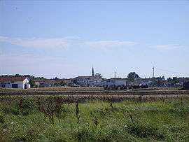
L'Éguille
| L'Éguille | ||
|---|---|---|
 | ||
| ||
 L'Éguille | ||
|
Location within Nouvelle-Aquitaine region  L'Éguille | ||
| Coordinates: 45°42′28″N 0°58′34″W / 45.7078°N 0.9761°WCoordinates: 45°42′28″N 0°58′34″W / 45.7078°N 0.9761°W | ||
| Country | France | |
| Region | Nouvelle-Aquitaine | |
| Department | Charente-Maritime | |
| Arrondissement | Rochefort | |
| Canton | Royan-Ouest | |
| Intercommunality | Royan Atlantique | |
| Government | ||
| • Mayor (2008–2014) | Roger Guillaud | |
| Area1 | 5.49 km2 (2.12 sq mi) | |
| Population (2008)2 | 914 | |
| • Density | 170/km2 (430/sq mi) | |
| Time zone | CET (UTC+1) | |
| • Summer (DST) | CEST (UTC+2) | |
| INSEE/Postal code | 17151 / 17600 | |
| Elevation | 0–11 m (0–36 ft) | |
|
1 French Land Register data, which excludes lakes, ponds, glaciers > 1 km² (0.386 sq mi or 247 acres) and river estuaries. 2 Population without double counting: residents of multiple communes (e.g., students and military personnel) only counted once. | ||

L'Éguille is a commune in the Charente-Maritime department in southwestern France.
Population
| Historical population | ||
|---|---|---|
| Year | Pop. | ±% |
| 1962 | 755 | — |
| 1968 | 767 | +1.6% |
| 1975 | 660 | −14.0% |
| 1982 | 670 | +1.5% |
| 1990 | 722 | +7.8% |
| 1999 | 758 | +5.0% |
| 2008 | 914 | +20.6% |
See also
References
| Wikimedia Commons has media related to L'Éguille. |
This article is issued from Wikipedia - version of the 3/2/2013. The text is available under the Creative Commons Attribution/Share Alike but additional terms may apply for the media files.