Lagoa, Porto Novo
| Lagoa, Porto Novo | |
|---|---|
 | |
| Coordinates: 17°05′15″N 25°08′16″W / 17.0875°N 25.1378°WCoordinates: 17°05′15″N 25°08′16″W / 17.0875°N 25.1378°W | |
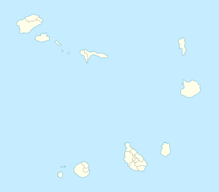
| Country | Cape Verde |
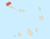
| Island | Santo Antão |
| Municipality | Porto Novo |
| Civil parish | São João Baptista |
| Population (2010)[1] | |
| • Total | 358 |
Lagoa is a settlement in the southcentral part of the island of Santo Antão, Cape Verde. Its 2010 population was 358. It is situated about 15 km northwestwest of the island capital Porto Novo and sits on the island's mountain range. Nearby settlements are Espadana to the north and Lagoinha (rarely as Lagoa) to the east. The settlements sits south of the municipal boundary of Ribeira Grande and its two parishes.
Localities includes Chã Branco de Pinto, Cebola, Espadana do Sul and Pinto.
Lagoa is connected with the road connecting Estrada da Corda at Corda and Moroços, it also has a dirt road linking Porto Novo.
The Espadana Crater is west of Lagoa, the southern part is included in the area, west of the crater is Moroços Natural Park with its mountain features and is bordered with. Northwest of the village is the source of Ribeira Figueira, a 9 km stream that flows in the Atlantic 2/3 of the way between Porto Novo and Chã de Porto Novo. Grasslands dominate the northwest, the rest are dominated by forest. Until the 1990s, grasslands dominated most of the area.
Agriculture is one of the common industry in the settlement.
See also
References
- ↑ "2010 Census results". Instituto Nacional de Estatística Cabo Verde (in Portuguese). 17 March 2014.
Subdivisions of the island of Santo Antão | |||||||||||||||
|---|---|---|---|---|---|---|---|---|---|---|---|---|---|---|---|
| Paul |
|  | |||||||||||||
| Porto Novo | |||||||||||||||
| Ribeira Grande | |||||||||||||||
| Parishes |  | |
|---|---|---|
| Communities and settlements | ||
| Geographical features |
| |
| Landmarks and points of Interests |
| |
| Culture |
| |