Langston, Alabama
| Langston, Alabama | |
|---|---|
| Town | |
 Location in Jackson County and the state of Alabama | |
| Coordinates: 34°32′5″N 86°4′56″W / 34.53472°N 86.08222°WCoordinates: 34°32′5″N 86°4′56″W / 34.53472°N 86.08222°W | |
| Country | United States |
| State | Alabama |
| County | Jackson |
| Area | |
| • Total | 8.2 sq mi (21.5 km2) |
| • Land | 5 sq mi (13.1 km2) |
| • Water | 3.2 sq mi (8.4 km2) |
| Elevation | 630 ft (192 m) |
| Population (2000) | |
| • Total | 254 |
| • Density | 31/sq mi (11.8/km2) |
| Time zone | Central (CST) (UTC-6) |
| • Summer (DST) | CDT (UTC-5) |
| ZIP code | 35755 |
| Area code(s) | 256 |
| FIPS code | 01-41368 |
| GNIS feature ID | 0151989 |
Langston is a town in Jackson County, Alabama, United States, and is included in the Chattanooga-Cleveland-Dalton, TN-GA-AL Combined Statistical Area. Langston initially incorporated in 1899.[1] At some point after 1920, it disincorporated and did not reincorporate again until 1980 (after the census was taken that year, since it did not appear on it). As of the 2010 census, the population of the town was 270, up from 254. Its peak population was in 1920, when it had a population of 500.
Geography
Langston is located at 34°32′05″N 86°04′56″W / 34.534817°N 86.082169°W.[2]
According to the U.S. Census Bureau, the town has a total area of 8.3 square miles (21 km2), of which 5.0 square miles (13 km2) is land and 3.2 square miles (8.3 km2) (39.06%) is water.
Demographics
| Historical population | |||
|---|---|---|---|
| Census | Pop. | %± | |
| 1900 | 270 | — | |
| 1910 | 314 | 16.3% | |
| 1920 | 500 | 59.2% | |
| 1990 | 207 | — | |
| 2000 | 254 | 22.7% | |
| 2010 | 270 | 6.3% | |
| Est. 2015 | 266 | [3] | −1.5% |
| U.S. Decennial Census[4] 2013 Estimate[5] | |||
As of the census[6] of 2000, there were 254 people, 109 households, and 80 families residing in the town. The population density was 50.4 people per square mile (19.5/km²). There were 193 housing units at an average density of 38.3 per square mile (14.8/km²). The racial makeup of the town was 94.09% White, 3.15% Black or African American and 2.76% Native American.
There were 109 households out of which 21.1% had children under the age of 18 living with them, 61.5% were married couples living together, 9.2% had a female householder with no husband present, and 25.7% were non-families. 25.7% of all households were made up of individuals and 12.8% had someone living alone who was 65 years of age or older. The average household size was 2.33 and the average family size was 2.74.
In the town the population was spread out with 19.3% under the age of 18, 6.3% from 18 to 24, 22.4% from 25 to 44, 35.0% from 45 to 64, and 16.9% who were 65 years of age or older. The median age was 46 years. For every 100 females there were 91.0 males. For every 100 females age 18 and over, there were 89.8 males.
The median income for a household in the town was $33,333, and the median income for a family was $42,344. Males had a median income of $26,750 versus $29,375 for females. The per capita income for the town was $16,266. About 2.7% of families and 6.7% of the population were below the poverty line, including none of those under the age of eighteen and 13.9% of those sixty five or over.
References
- ↑ http://www.rootsweb.ancestry.com/~aljackso/timeline.htm
- ↑ "US Gazetteer files: 2010, 2000, and 1990". United States Census Bureau. 2011-02-12. Retrieved 2011-04-23.
- ↑ "Annual Estimates of the Resident Population for Incorporated Places: April 1, 2010 to July 1, 2015". Retrieved July 2, 2016.
- ↑ "U.S. Decennial Census". Census.gov. Retrieved June 6, 2013.
- ↑ "Annual Estimates of the Resident Population: April 1, 2010 to July 1, 2013". Retrieved June 3, 2014.
- ↑ "American FactFinder". United States Census Bureau. Retrieved 2008-01-31.
Municipalities and communities of Jackson County, Alabama, United States | ||
|---|---|---|
| Cities | 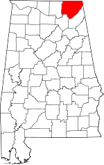 | |
| Towns | ||
| Unincorporated communities | ||
| Ghost towns | ||