Mora County, New Mexico
| Mora County, New Mexico | |
|---|---|
 Mora County Courthouse in Mora | |
 Location in the U.S. state of New Mexico | |
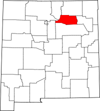
 New Mexico's location in the U.S. | |
| Founded | 1860 |
| Seat | Mora |
| Largest village | Wagon Mound |
| Area | |
| • Total | 1,934 sq mi (5,009 km2) |
| • Land | 1,931 sq mi (5,001 km2) |
| • Water | 2.3 sq mi (6 km2), 0.1% |
| Population | |
| • (2010) | 4,881 |
| • Density | 2.5/sq mi (1/km²) |
| Congressional district | 3rd |
| Time zone | Mountain: UTC-7/-6 |
| Website |
countyofmora |
Mora County is a county located in the U.S. state of New Mexico. As of the 2010 census, the population was 4,881.[1] Its county seat is Mora.[2]
History
Prior to Spanish conquest, the Mora area was Indian country. Although not an area of heavy Indian settlement by such tribes as the Pueblo Indians, the Mora valley was much used by nomadic tribes: the Utes, Navajos and Apache.
The Mora Valley then became a travel-way for various Spanish explorers and others. It was not settled until the early part of the 19th century. The history of the settlement of Mora dates to 1817 when a group of settlers petitioned for a priest.[3]
The next significant event was the Mexican Land Grant through which on September 28, 1835 Governor Albino Pérez, the governor of the New Mexico Territory, gave land title for over 800,000 acres (3,200 km²) to some 25 families.[4]
"Mora" is actually today three plazas and three villages; Mora, Cleveland (originally San Antonio), and Chacon. Holman (originally Agua Negra) lies between Chacon and Cleveland.
Historical and genealogical records for Mora are difficult to obtain for a number of reasons. One is that US Army forces entered the area in 1848 and destroyed Mora while quashing Native American rebellion; most of the archives were lost. "Not until artillery was brought up (by the United States Army) and Mora practically destroyed did the insurgents yield."[5] A US Government Proclamation at the time (February 15, 1847) wrote that the US Army " proceeded with a body of men and one canon to Moro and razed the towns (Upper and Lower Moro) to the ground."[6]
In April 2013, Mora County became the first county in the United States to ban oil and gas drilling on both public and private lands.[7][8]
Geography
According to the U.S. Census Bureau, the county has a total area of 1,934 square miles (5,010 km2), of which 1,931 square miles (5,000 km2) is land and 2.3 square miles (6.0 km2) (0.1%) is water.[9] The highest point in the county is the summit of Truchas Peak at 13,102'.
Adjacent counties
- Colfax County - north
- Harding County - east
- San Miguel County - south
- Santa Fe County - west
- Rio Arriba County - west
- Taos County - northwest
National protected areas
- Carson National Forest (part)
- Fort Union National Monument
- Kiowa National Grassland (part)
- Santa Fe National Forest (part)
Demographics
| Historical population | |||
|---|---|---|---|
| Census | Pop. | %± | |
| 1910 | 12,611 | — | |
| 1920 | 13,915 | 10.3% | |
| 1930 | 10,322 | −25.8% | |
| 1940 | 10,981 | 6.4% | |
| 1950 | 8,720 | −20.6% | |
| 1960 | 6,028 | −30.9% | |
| 1970 | 4,673 | −22.5% | |
| 1980 | 4,205 | −10.0% | |
| 1990 | 4,264 | 1.4% | |
| 2000 | 5,180 | 21.5% | |
| 2010 | 4,881 | −5.8% | |
| Est. 2015 | 4,596 | [10] | −5.8% |
| U.S. Decennial Census[11] 1790-1960[12] 1900-1990[13] 1990-2000[14] 2010-2013[1] | |||
2000 census
As of the census[15] of 2000, there were 5,180 people, 2,017 households, and 1,397 families residing in the county. The population density was 3 people per square mile (1/km²). There were 2,973 housing units at an average density of 2 per square mile (1/km²). The racial makeup of the county was 58.88% White, 0.10% Black or African American, 1.14% Native American, 0.12% Asian, 36.97% from other races, and 2.80% from two or more races. 81.64% of the population were Hispanic or Latino of any race.
There were 2,017 households out of which 31.20% had children under the age of 18 living with them, 50.50% were married couples living together, 11.90% had a female householder with no husband present, and 30.70% were non-families. 26.90% of all households were made up of individuals and 10.60% had someone living alone who was 65 years of age or older. The average household size was 2.54 and the average family size was 3.08.
In the county the population was spread out with 26.70% under the age of 18, 7.50% from 18 to 24, 24.30% from 25 to 44, 26.10% from 45 to 64, and 15.40% who were 65 years of age or older. The median age was 40 years. For every 100 females there were 102.00 males. For every 100 females age 18 and over, there were 100.20 males.
The median income for a household in the county was $24,518, and the median income for a family was $27,648. Males had a median income of $24,483 versus $18,000 for females. The per capita income for the county was $12,340. About 20.90% of families and 25.40% of the population were below the poverty line, including 25.90% of those under age 18 and 18.40% of those age 65 or over.
2010 census
As of the 2010 United States Census, there were 4,881 people, 2,114 households, and 1,295 families residing in the county.[16] The population density was 2.5 inhabitants per square mile (0.97/km2). There were 3,232 housing units at an average density of 1.7 per square mile (0.66/km2).[17] The racial makeup of the county was 70.9% white, 1.3% American Indian, 0.7% black or African American, 0.3% Asian, 23.5% from other races, and 3.3% from two or more races. Those of Hispanic or Latino origin made up 81.0% of the population.[16] In terms of ancestry, and 0.8% were American.[18]
Of the 2,114 households, 26.4% had children under the age of 18 living with them, 43.5% were married couples living together, 10.9% had a female householder with no husband present, 38.7% were non-families, and 33.2% of all households were made up of individuals. The average household size was 2.31 and the average family size was 2.92. The median age was 46.0 years.[16]
The median income for a household in the county was $37,784 and the median income for a family was $42,122. Males had a median income of $42,992 versus $42,630 for females. The per capita income for the county was $22,035. About 10.5% of families and 11.9% of the population were below the poverty line, including 10.8% of those under age 18 and 20.6% of those age 65 or over.[19]
Places of interest
Communities
Village
Census-designated places
Unincorporated communities
See also
References
- 1 2 "State & County QuickFacts". United States Census Bureau. Retrieved September 30, 2013.
- ↑ "Find a County". National Association of Counties. Retrieved June 7, 2011.
- ↑
- ↑ Workers of the Writers Program of the Work Projects Administration in the State of New Mexico, ed. (1945). New Mexico, a Guide to the Colorful State. Albuquerque, NM: University of New Mexico Press. p. 378. ISBN 978-1-62376-030-4. Retrieved October 19, 2014.
- ↑ Lavender, David Sievert (1954). Bent's Fort. Garden City, NY: Doubleday and Company, Inc. p. 285. ASIN B002K7JFP2. Retrieved October 19, 2014.
- ↑ McNierney, Michael (1980). Taos 1847, the Revolt in Contemporary Accounts. Boulder, Colorado: Johnson Books. p. 35. ISBN 978-0-933472-07-5.
- ↑ Baynham, Jacob (June 2014). "Blowout". Outside: 28.
- ↑ Jacob Baynham (June 2014). "The Mother of All Anti-Fracking Tools - Deep Green Resistance Southwest Coalition". Outside Magazine. deepgreenresistance.org. Retrieved October 19, 2014.
- ↑ "2010 Census Gazetteer Files". United States Census Bureau. August 22, 2012. Retrieved January 2, 2015.
- ↑ "County Totals Dataset: Population, Population Change and Estimated Components of Population Change: April 1, 2010 to July 1, 2015". Retrieved July 2, 2016.
- ↑ "U.S. Decennial Census". United States Census Bureau. Retrieved January 2, 2015.
- ↑ "Historical Census Browser". University of Virginia Library. Retrieved January 2, 2015.
- ↑ "Population of Counties by Decennial Census: 1900 to 1990". United States Census Bureau. Retrieved January 2, 2015.
- ↑ "Census 2000 PHC-T-4. Ranking Tables for Counties: 1990 and 2000" (PDF). United States Census Bureau. Retrieved January 2, 2015.
- ↑ "American FactFinder". United States Census Bureau. Retrieved January 31, 2008.
- 1 2 3 "DP-1 Profile of General Population and Housing Characteristics: 2010 Demographic Profile Data". United States Census Bureau. Retrieved 2016-01-24.
- ↑ "Population, Housing Units, Area, and Density: 2010 - County". United States Census Bureau. Retrieved 2016-01-24.
- ↑ "DP02 SELECTED SOCIAL CHARACTERISTICS IN THE UNITED STATES – 2006-2010 American Community Survey 5-Year Estimates". United States Census Bureau. Retrieved 2016-01-24.
- ↑ "DP03 SELECTED ECONOMIC CHARACTERISTICS – 2006-2010 American Community Survey 5-Year Estimates". United States Census Bureau. Retrieved 2016-01-24.
External links
 |
Taos County | Colfax County | | |
| Santa Fe County and Rio Arriba County | |
Harding County | ||
| ||||
| | ||||
| San Miguel County |
Municipalities and communities of Mora County, New Mexico, United States | ||
|---|---|---|
| Village | | |
| CDPs | ||
| Other unincorporated communities | ||
Santa Fe (capital) | |
| Topics |
|
| Society | |
| Regions | |
| Cities | |
| Counties | |
Coordinates: 36°01′N 104°56′W / 36.02°N 104.94°W