| [3] |
Name on the Register[4] |
Image |
Date listed[5] |
Location |
City or town |
Description |
|---|
| 1 |
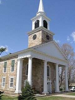
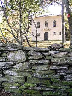
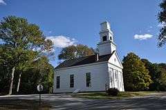
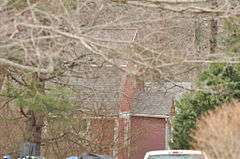
Abington Congregational Church |
|
000000001977-09-19-0000September 19, 1977
(#77001413) |
CT 97
41°51′27″N 72°00′29″W / 41.8575°N 72.008056°W / 41.8575; -72.008056 (Abington Congregational Church) |
Pomfret |
|
| 2 |
Aldrich Free Public Library |
|
000000001994-07-27-0000July 27, 1994
(#94000768) |
299 Main St.
41°43′08″N 71°52′32″W / 41.718889°N 71.875556°W / 41.718889; -71.875556 (Aldrich Free Public Library) |
Plainfield |
|
| 3 |
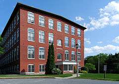
American Thread Company |
|
000000002014-07-30-0000July 30, 2014
(#14000434) |
322, 440, 480, 560 Main & 157 Union Sts.
41°42′39″N 72°12′19″W / 41.7107°N 72.2052°W / 41.7107; -72.2052 (American Thread Company) |
Windham |
In the Willimantic section of Windham
|
| 4 |
Ashford Academy |
|
000000001988-12-29-0000December 29, 1988
(#88002649) |
Fitts Rd.
41°52′22″N 72°07′25″W / 41.872778°N 72.123611°W / 41.872778; -72.123611 (Ashford Academy) |
Ashford |
|
| 5 |
Benjamin Bosworth House |
|
000000001978-02-17-0000February 17, 1978
(#78002857) |
John Perry Rd.
41°53′59″N 72°05′03″W / 41.899722°N 72.084167°W / 41.899722; -72.084167 (Benjamin Bosworth House) |
Eastford |
|
| 6 |
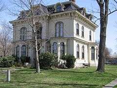
Henry C. Bowen House |
|
000000001977-08-24-0000August 24, 1977
(#77001414) |
CT 169
41°56′57″N 71°58′37″W / 41.949167°N 71.976944°W / 41.949167; -71.976944 (Henry C. Bowen House) |
Woodstock |
Gothic revival summer cottage visited by three U.S. presidents. Also known as Roseland Cottage.
|
| 7 |
Mathew Bowen Homestead |
|
000000001987-09-10-0000September 10, 1987
(#87000859) |
94 Plaine Hill Rd.
41°56′33″N 71°58′25″W / 41.9425°N 71.973611°W / 41.9425; -71.973611 (Mathew Bowen Homestead) |
Woodstock |
Now the Inn at Woodstock.
|
| 8 |
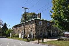
Brayton Grist Mill |
|
000000001986-06-13-0000June 13, 1986
(#86001257) |
U.S. Route 44
41°51′39″N 71°58′57″W / 41.86074°N 71.982404°W / 41.86074; -71.982404 (Brayton Grist Mill) |
Pomfret |
At the entrance to Mashamoquet Brook State Park
|
| 9 |
Broad Street – Davis Park Historic District |
|
000000001998-12-31-0000December 31, 1998
(#98001556) |
Roughly along Broad St. from Dorrane St. to Winter St.
41°48′27″N 71°52′50″W / 41.8075°N 71.880556°W / 41.8075; -71.880556 (Broad Street – Davis Park Historic District) |
Killingly |
|
| 10 |
Brooklyn Green Historic District |
|
000000001982-09-23-0000September 23, 1982
(#82004401) |
CT 169, 205, and 6, Wolf Den, Brown, Prince Hill, and Hyde Rds.
41°47′18″N 71°56′57″W / 41.788333°N 71.949167°W / 41.788333; -71.949167 (Brooklyn Green Historic District) |
Brooklyn |
|
| 11 |
Bush Hill Historic District |
|
000000001987-02-10-0000February 10, 1987
(#87000012) |
Parts of Bush Hill Rd., CT 169, and Wolf Den Rd.
41°48′43″N 71°57′52″W / 41.811944°N 71.964444°W / 41.811944; -71.964444 (Bush Hill Historic District) |
Brooklyn |
|
| 12 |
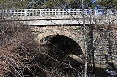
Butts Bridge |
|
000000002010-05-24-0000May 24, 2010
(#10000272) |
Butts Bridge Rd. over Quinebaug River
41°39′05″N 71°58′15″W / 41.651364°N 71.970789°W / 41.651364; -71.970789 (Butts Bridge) |
Canterbury |
|
| 13 |
Cady-Copp House |
|
000000002001-09-03-0000September 3, 2001
(#01000939) |
115 Liberty Highway
41°53′27″N 71°51′56″W / 41.890833°N 71.865556°W / 41.890833; -71.865556 (Cady-Copp House) |
Putnam |
|
| 14 |
Canterbury Center Historic District |
|
000000001998-04-10-0000April 10, 1998
(#97001446) |
Roughly along Elmdale, Library, N. Canterbury, S. Canterbury, and Westminster Rds.
41°42′06″N 71°58′22″W / 41.701667°N 71.972778°W / 41.701667; -71.972778 (Canterbury Center Historic District) |
Canterbury |
|
| 15 |
Cargill Falls Mill (Wilkinson Mill) |
|
000000002014-07-29-0000July 29, 2014
(#14000435) |
52-58 Pomfret St.
41°54′54″N 71°54′42″W / 41.9150°N 71.9116°W / 41.9150; -71.9116 (Cargill Falls Mill (Wilkinson Mill)) |
Putnam |
|
| 16 |
Central Village Historic District |
|
000000001991-08-09-0000August 9, 1991
(#91000949) |
Roughly, School, Main and Water Sts., and Putnam Rd., north to Plainfield High School
41°43′06″N 71°54′21″W / 41.718333°N 71.905833°W / 41.718333; -71.905833 (Central Village Historic District) |
Plainfield |
|
| 17 |
Capt. Seth Chandler House |
|
000000001993-12-15-0000December 15, 1993
(#93001380) |
55 Converse St.
42°00′49″N 71°58′07″W / 42.013611°N 71.968611°W / 42.013611; -71.968611 (Capt. Seth Chandler House) |
Woodstock |
|
| 18 |
Chaplin Historic District |
|
000000001978-10-11-0000October 11, 1978
(#78002856) |
Chaplin St.
41°47′38″N 72°07′40″W / 41.793889°N 72.127778°W / 41.793889; -72.127778 (Chaplin Historic District) |
Chaplin |
|
| 19 |
Church Farm |
|
000000001988-11-17-0000November 17, 1988
(#88002650) |
396 Mansfield Rd.
41°50′21″N 72°10′11″W / 41.839167°N 72.169722°W / 41.839167; -72.169722 (Church Farm) |
Ashford |
Now the Church Center of Eastern Connecticut State University.
|
| 20 |
Capt. John Clark House |
|
000000001970-10-06-0000October 6, 1970
(#70000699) |
Route 169, south of Canterbury
41°39′46″N 71°58′25″W / 41.662778°N 71.973611°W / 41.662778; -71.973611 (Capt. John Clark House) |
Canterbury |
|
| 21 |
Prudence Crandall House |
|
000000001970-10-22-0000October 22, 1970
(#70000696) |
Junction of CT 14 and 169
41°41′52″N 71°58′19″W / 41.697778°N 71.971944°W / 41.697778; -71.971944 (Prudence Crandall House) |
Canterbury |
Home of abolitionist and educator Prudence Crandall; also known as the Elisha Payne House
|
| 22 |
Daniel's Village Archeological Site |
|
000000001978-03-30-0000March 30, 1978
(#78002861) |
north side of Five Mile River near Stone Road[6]
41°52′58″N 71°51′03″W / 41.8829°N 71.8507°W / 41.8829; -71.8507 (Daniel's Village Archeological Site) |
Killingly |
|
| 23 |
Danielson Main Street Historic District |
|
000000001992-04-08-0000April 8, 1992
(#92000265) |
Main St. from Water St. to Spring St.
41°48′18″N 71°53′04″W / 41.805°N 71.884444°W / 41.805; -71.884444 (Danielson Main Street Historic District) |
Killingly |
|
| 24 |
Dayville Historic District |
|
000000001988-08-25-0000August 25, 1988
(#88001422) |
Main and Pleasant Sts.
41°50′45″N 71°53′08″W / 41.845833°N 71.885556°W / 41.845833; -71.885556 (Dayville Historic District) |
Killingly |
|
| 25 |
Dorrance Inn |
|
000000002002-08-23-0000August 23, 2002
(#02000867) |
748 Plainfield Pike
41°41′28″N 71°50′48″W / 41.691111°N 71.846667°W / 41.691111; -71.846667 (Dorrance Inn) |
Sterling |
|
| 26 |
Elliottville Lower Mill |
|
000000001982-04-15-0000April 15, 1982
(#82004406) |
Peep Toad Rd.
41°50′21″N 71°50′33″W / 41.839167°N 71.8425°W / 41.839167; -71.8425 (Elliottville Lower Mill) |
Killingly |
|
| 27 |
First Congregational Church of Plainfield |
|
000000001986-07-31-0000July 31, 1986
(#86002116) |
CT 12
41°41′06″N 71°54′55″W / 41.685°N 71.915278°W / 41.685; -71.915278 (First Congregational Church of Plainfield) |
Plainfield |
|
| 28 |
Forty-Seventh Camp of Rochambeau's Army |
|
000000002003-01-23-0000January 23, 2003
(#02001732) |
Bolton Farm, Rt 14 near Mullen Hill Road[7]
41°42′09″N 72°09′00″W / 41.7025°N 72.15°W / 41.7025; -72.15 (Forty-Seventh Camp of Rochambeau's Army) |
Windham |
|
| 29 |
Fourth Camp of Rochambeau's Army |
|
000000002003-01-08-0000January 8, 2003
(#02001680) |
Plains Road near Lovers Lane[7]
41°42′00″N 72°10′52″W / 41.7°N 72.181°W / 41.7; -72.181 (Fourth Camp of Rochambeau's Army) |
Windham |
|
| 30 |
Glen Falls Bridge |
|
000000001999-04-01-0000April 1, 1999
(#99000408) |
Brunswick Ave. over the Moosup River
41°43′01″N 71°51′43″W / 41.716944°N 71.861944°W / 41.716944; -71.861944 (Glen Falls Bridge) |
Plainfield |
|
| 31 |
Gwyn Careg |
|
000000001994-04-08-0000April 8, 1994
(#94000336) |
Wolf Den Rd.
41°51′20″N 71°59′52″W / 41.855556°N 71.997778°W / 41.855556; -71.997778 (Gwyn Careg) |
Pomfret |
|
| 32 |
Hampton Hill Historic District |
|
000000001982-09-23-0000September 23, 1982
(#82004408) |
Main St., Old Route 6, Cedar Swamp Rd.
41°46′57″N 72°03′19″W / 41.7825°N 72.055278°W / 41.7825; -72.055278 (Hampton Hill Historic District) |
Hampton |
|
| 33 |
Hemlock Glen Industrial Archeological District |
|
000000002007-06-05-0000June 5, 2007
(#07000508) |
Address Restricted
|
Hampton |
|
| 34 |
Dr. Chester Hunt Office |
|
000000001970-10-06-0000October 6, 1970
(#70000708) |
Windham Center Rd.
41°42′00″N 72°09′30″W / 41.7°N 72.158333°W / 41.7; -72.158333 (Dr. Chester Hunt Office) |
Windham |
|
| 35 |
Samuel Huntington Birthplace |
|
000000001971-11-11-0000November 11, 1971
(#71001009) |
CT 14, 2 mi (3.2 km) west of CT 97
41°41′57″N 72°05′10″W / 41.699167°N 72.086111°W / 41.699167; -72.086111 (Samuel Huntington Birthplace) |
Scotland |
Boyhood saltbox home of the American statesman, a signer of the Declaration of Independence, Governor of Connecticut and first presiding officer of the Congress of the Confederation
|
| 36 |
Israel Putnam School |
|
000000001984-12-13-0000December 13, 1984
(#84000788) |
School and Oak Sts.
41°54′57″N 71°54′23″W / 41.915833°N 71.906389°W / 41.915833; -71.906389 (Israel Putnam School) |
Putnam |
|
| 37 |
William Jillson Stone House |
|
000000001971-08-05-0000August 5, 1971
(#71000912) |
561 Main St.
41°42′40″N 72°12′38″W / 41.711111°N 72.210556°W / 41.711111; -72.210556 (William Jillson Stone House) |
Windham |
In the Willimantic section of the town
|
| 38 |
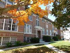
Old Killingly High School |
|
000000001992-03-26-0000March 26, 1992
(#92000266) |
185 Broad St.
41°48′13″N 71°53′08″W / 41.803611°N 71.885556°W / 41.803611; -71.885556 (Old Killingly High School) |
Killingly |
|
| 39 |
Knowlton Memorial Hall |
|
000000001994-03-17-0000March 17, 1994
(#94000252) |
25 Pompey Hollow Rd.
41°51′45″N 72°09′02″W / 41.8625°N 72.150556°W / 41.8625; -72.150556 (Knowlton Memorial Hall) |
Ashford |
|
| 40 |
Lawton Mills Historic District |
|
000000001996-02-16-0000February 16, 1996
(#96000028) |
Roughly bounded by 2nd St., Railroad Ave., Norwich Rd., and 5th and 9th Sts.
41°40′32″N 71°55′13″W / 41.675556°N 71.920278°W / 41.675556; -71.920278 (Lawton Mills Historic District) |
Plainfield |
|
| 41 |
Main Street Historic District |
|
000000001982-06-28-0000June 28, 1982
(#82004410) |
21-65 Church St., 667-1009 Main St., 24-28 N. St., and 20-22 Walnut St.; also 32, 50, and 54 North St.
41°42′44″N 72°12′54″W / 41.712222°N 72.215°W / 41.712222; -72.215 (Main Street Historic District) |
Windham |
In the Willimantic section of the town. Second set of boundaries represents a boundary increase of 000000001992-07-29-0000July 29, 1992
|
| 42 |
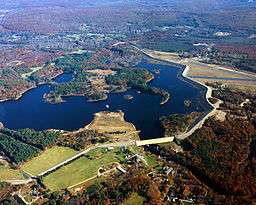
Mansfield Hollow Dam |
|
000000002009-04-12-0000April 12, 2009
(#03000194) |
141 Mansfield Hollow Rd.
41°45′20″N 72°10′54″W / 41.75569°N 72.18163°W / 41.75569; -72.18163 (Mansfield Hollow Dam) |
Windham and Mansfield |
Extends into Tolland County
|
| 43 |
March Route of Rochambeau's Army: Manship Road-Barstow Road |
|
000000002003-01-08-0000January 8, 2003
(#02001678) |
Manship Rd., Barstow Rd. from its junction with Manship Rd. to Westminister Rd.
41°42′07″N 72°00′13″W / 41.702012°N 72.003665°W / 41.702012; -72.003665 (March Route of Rochambeau's Army: Manship Road-Barstow Road) |
Canterbury |
|
| 44 |
March Route of Rochambeau's Army: Old Canterbury Road |
|
000000002003-06-06-0000June 6, 2003
(#03000310) |
Old Canterbury Rd: Canterbury Rd. from its junction with Old Canterbury Rd.
41°41′22″N 71°57′04″W / 41.689444°N 71.951111°W / 41.689444; -71.951111 (March Route of Rochambeau's Army: Old Canterbury Road) |
Plainfield |
|
| 45 |
March Route of Rochambeau's Army: Palmer Road |
|
000000002003-06-06-0000June 6, 2003
(#03000311) |
Palmer Rd, from intersection with Miller Rd. to east of its junction with Pudding Hill Rd.
41°41′57″N 72°03′47″W / 41.699167°N 72.063056°W / 41.699167; -72.063056 (March Route of Rochambeau's Army: Palmer Road) |
Scotland |
|
| 46 |
March Route of Rochambeau's Army: Plainfield Pike |
|
000000002003-06-06-0000June 6, 2003
(#03000312) |
Plainfield Pike from intersection with Industrial Dr., east to its junction with Ledge Hill Rd.
41°40′55″N 71°53′53″W / 41.682015°N 71.897964°W / 41.682015; -71.897964 (March Route of Rochambeau's Army: Plainfield Pike) |
Plainfield |
|
| 47 |
March Route of Rochambeau's Army: Scotland Road |
|
000000002003-06-06-0000June 6, 2003
(#03000314) |
Scotland Rd., from intersection with Back Rd. to 80 Scotland Rd.
41°42′03″N 72°08′43″W / 41.700833°N 72.145278°W / 41.700833; -72.145278 (March Route of Rochambeau's Army: Scotland Road) |
Windham |
|
| 48 |
Mixer Tavern |
|
000000001994-03-17-0000March 17, 1994
(#94000253) |
14 Westford Rd.
41°51′56″N 72°09′33″W / 41.865556°N 72.159167°W / 41.865556; -72.159167 (Mixer Tavern) |
Ashford |
|
| 49 |
Natchaug Forest Lumber Shed |
|
000000001986-09-04-0000September 4, 1986
(#86001732) |
Kingsbury Rd., Natchaug State Forest
41°50′21″N 72°05′04″W / 41.839167°N 72.084444°W / 41.839167; -72.084444 (Natchaug Forest Lumber Shed) |
Eastford |
|
| 50 |
New Roxbury Ironworks Site |
Upload image |
000000001996-02-23-0000February 23, 1996
(#96000130) |
Address Restricted
|
Woodstock |
|
| 51 |
George Pickering Nichols House |
|
000000001991-07-31-0000July 31, 1991
(#91000990) |
42 Thompson Rd.
41°56′51″N 71°53′04″W / 41.9475°N 71.884444°W / 41.9475; -71.884444 (George Pickering Nichols House) |
Thompson |
|
| 52 |
North Grosvenordale Mill Historic District |
|
000000001993-04-16-0000April 16, 1993
(#93000288) |
Riverside Dr. (CT 12), Buckley Hill Rd., Floral Ave., Market La., and Marshall, Central, River, and Holmes Sts.
41°59′09″N 71°53′53″W / 41.985833°N 71.898056°W / 41.985833; -71.898056 (North Grosvenordale Mill Historic District) |
Thompson |
|
| 53 |
Old Westfield Cemetery |
|
000000002010-08-26-0000August 26, 2010
(#10000578) |
320 North St.
41°49′08″N 71°53′21″W / 41.818889°N 71.889167°W / 41.818889; -71.889167 (Old Westfield Cemetery) |
Killingly |
|
| 54 |
Packerville Bridge |
|
000000001992-11-27-0000November 27, 1992
(#92001565) |
Packerville Rd. over Mill Brook
41°40′01″N 71°56′56″W / 41.666944°N 71.948889°W / 41.666944; -71.948889 (Packerville Bridge) |
Plainfield |
|
| 55 |
Plainfield Street Historic District |
|
000000001991-04-11-0000April 11, 1991
(#91000350) |
Roughly Norwich Rd. from Railroad Ave. to Academy Hill Rd.
41°41′09″N 71°54′54″W / 41.685833°N 71.915°W / 41.685833; -71.915 (Plainfield Street Historic District) |
Plainfield |
|
| 56 |
Plainfield Woolen Company Mill |
|
000000001985-08-29-0000August 29, 1985
(#85001919) |
Main St.
41°43′11″N 71°54′25″W / 41.719722°N 71.906944°W / 41.719722; -71.906944 (Plainfield Woolen Company Mill) |
Plainfield |
|
| 57 |
Pomfret Street Historic District |
|
000000001998-04-23-0000April 23, 1998
(#98000372) |
Roughly along Pomfret St. and CT 169, from Bradley Rd. to Woodstock Rd.
41°53′19″N 71°57′51″W / 41.888611°N 71.964167°W / 41.888611; -71.964167 (Pomfret Street Historic District) |
Pomfret |
|
| 58 |
Pomfret Town House |
|
000000001989-01-19-0000January 19, 1989
(#88003221) |
Town House Rd.
41°51′53″N 71°57′50″W / 41.864722°N 71.963889°W / 41.864722; -71.963889 (Pomfret Town House) |
Pomfret |
Home to the local historical society.
|
| 59 |
Prospect Hill Historic District |
|
000000002003-08-29-0000August 29, 2003
(#03000814) |
Roughly bounded by Bolivia St., Jackson St., Valley St. and Birch St.
41°43′09″N 72°12′12″W / 41.719152°N 72.203264°W / 41.719152; -72.203264 (Prospect Hill Historic District) |
Windham |
In the Willimantic section of the town
|
| 60 |
Putnam Farm |
|
000000001982-03-11-0000March 11, 1982
(#82004399) |
Spaulding Rd.
41°49′24″N 71°57′03″W / 41.823333°N 71.950833°W / 41.823333; -71.950833 (Putnam Farm) |
Brooklyn |
|
| 61 |
Putnam Town Hall |
|
000000001993-12-10-0000December 10, 1993
(#93001343) |
126 Church St.
41°55′06″N 71°54′47″W / 41.918333°N 71.913056°W / 41.918333; -71.913056 (Putnam Town Hall) |
Putnam |
Former location of Putnam High School
|
| 62 |
Putnam Railroad Station |
|
000000002007-07-24-0000July 24, 2007
(#07000742) |
35 and 45-47 Main St.
41°54′51″N 71°54′30″W / 41.914108°N 71.908296°W / 41.914108; -71.908296 (Putnam Railroad Station) |
Putnam |
|
| 63 |
Israel Putnam Wolf Den |
|
000000001985-05-02-0000May 2, 1985
(#85000949) |
Off Wolf Den Rd. in Mashamoquet Brook State Park
41°50′36″N 71°59′04″W / 41.843333°N 71.984444°W / 41.843333; -71.984444 (Israel Putnam Wolf Den) |
Pomfret |
|
| 64 |
Quinebaug Mill-Quebec Square Historic District |
|
000000001985-08-29-0000August 29, 1985
(#85001921) |
Roughly bounded by the Quinebaug River, Quebec Square, and Elm and S. Main Sts.
41°47′54″N 71°53′21″W / 41.798333°N 71.889167°W / 41.798333; -71.889167 (Quinebaug Mill-Quebec Square Historic District) |
Brooklyn and Killingly |
|
| 65 |
Quinebaug River Prehistoric Archeological District |
|
000000002009-09-07-0000September 7, 2009
(#09000696) |
Between Connecticut Route 169 and the Quinebaug River
41°40′24″N 71°57′26″W / 41.6732°N 71.9571°W / 41.6732; -71.9571 (Quinebaug River Prehistoric Archeological District) |
Canterbury |
|
| 66 |
Hezekiah S. Ramsdell Farm |
|
000000001990-08-23-0000August 23, 1990
(#90000442) |
Ramsdell Rd.
41°57′07″N 71°54′39″W / 41.951944°N 71.910833°W / 41.951944; -71.910833 (Hezekiah S. Ramsdell Farm) |
Thompson |
|
| 67 |
Sterling Hill Historic District |
|
000000001986-02-06-0000February 6, 1986
(#86000152) |
Green Ln. and CT 14A
41°41′23″N 71°50′56″W / 41.689722°N 71.848889°W / 41.689722; -71.848889 (Sterling Hill Historic District) |
Plainfield and Sterling |
|
| 68 |
Sumner-Carpenter House |
|
000000001991-12-26-0000December 26, 1991
(#91001854) |
333 Old Colony Rd.
41°54′11″N 72°04′01″W / 41.903056°N 72.066944°W / 41.903056; -72.066944 (Sumner-Carpenter House) |
Eastford |
|
| 69 |
Taylor's Corner |
|
000000001989-01-19-0000January 19, 1989
(#88003220) |
Route 171
41°56′57″N 72°00′43″W / 41.949261°N 72.011862°W / 41.949261; -72.011862 (Taylor's Corner) |
Woodstock |
|
| 70 |
Temple Beth Israel |
|
000000002013-04-16-0000April 16, 2013
(#13000162) |
39 Killingly Dr.
41°48′14″N 71°52′40″W / 41.803832°N 71.877693°W / 41.803832; -71.877693 (Temple Beth Israel) |
Killingly |
|
| 71 |
Thompson Hill Historic District |
|
000000001987-12-31-0000December 31, 1987
(#87002186) |
Chase and Quaddick Rds. and CT 193 and CT 200
41°57′27″N 71°52′06″W / 41.9575°N 71.868333°W / 41.9575; -71.868333 (Thompson Hill Historic District) |
Thompson |
|
| 72 |
Trinity Church |
|
000000001970-10-15-0000October 15, 1970
(#70000703) |
Church St.
41°48′00″N 71°55′28″W / 41.8°N 71.924444°W / 41.8; -71.924444 (Trinity Church) |
Brooklyn |
|
| 73 |
Union Society of Phoenixville House |
|
000000002007-12-11-0000December 11, 2007
(#07001247) |
4 Hartford Turnpike
41°52′37″N 72°05′12″W / 41.876944°N 72.086667°W / 41.876944; -72.086667 (Union Society of Phoenixville House) |
Eastford |
|
| 74 |
Unitarian Meetinghouse |
|
000000001972-11-09-0000November 9, 1972
(#72001335) |
Junction of CT 169 and 6
41°46′42″N 71°57′00″W / 41.778333°N 71.95°W / 41.778333; -71.95 (Unitarian Meetinghouse) |
Brooklyn |
|
| 75 |
Edward Waldo House |
|
000000001978-11-21-0000November 21, 1978
(#78002879) |
South of Scotland on Waldo Rd.
41°39′33″N 72°06′05″W / 41.659167°N 72.101389°W / 41.659167; -72.101389 (Edward Waldo House) |
Scotland |
|
| 76 |
Wauregan Historic District |
|
000000001979-08-24-0000August 24, 1979
(#79003789) |
Roughly bounded by CT 12, CT 205, 3rd St., the Quinebaug River, and Chestnut St.
41°44′38″N 71°54′38″W / 41.743889°N 71.910556°W / 41.743889; -71.910556 (Wauregan Historic District) |
Plainfield |
|
| 77 |
Jonathan Wheeler House |
|
000000001982-02-11-0000February 11, 1982
(#82004405) |
N. Society Rd.
41°45′03″N 71°59′26″W / 41.750833°N 71.990556°W / 41.750833; -71.990556 (Jonathan Wheeler House) |
Canterbury |
|
| 78 |
Willimantic Armory |
|
000000001985-09-12-0000September 12, 1985
(#85002310) |
255 Pleasant St.
41°42′35″N 72°12′54″W / 41.709722°N 72.215°W / 41.709722; -72.215 (Willimantic Armory) |
Windham |
In the Willimantic section of the town
|
| 79 |
Willimantic Elks Club |
|
000000002005-09-21-0000September 21, 2005
(#05001045) |
198 Pleasant St.
41°42′39″N 72°12′45″W / 41.710855°N 72.212448°W / 41.710855; -72.212448 (Willimantic Elks Club) |
Windham |
In the Willimantic section of the town
|
| 80 |
Willimantic Footbridge |
|
000000001979-04-19-0000April 19, 1979
(#79002654) |
Railroad St.
41°42′42″N 72°12′49″W / 41.711667°N 72.213611°W / 41.711667; -72.213611 (Willimantic Footbridge) |
Windham |
In the Willimantic section of the town
|
| 81 |
Willimantic Freight House and Office |
|
000000001982-06-14-0000June 14, 1982
(#82004414) |
Bridge St.
41°42′44″N 72°13′15″W / 41.712222°N 72.220833°W / 41.712222; -72.220833 (Willimantic Freight House and Office) |
Windham |
In the Willimantic section of the town
|
| 82 |
Windham Center Historic District |
|
000000001979-06-04-0000June 4, 1979
(#79002655) |
CT 14 and CT 203
41°42′08″N 72°09′40″W / 41.702222°N 72.161111°W / 41.702222; -72.161111 (Windham Center Historic District) |
Windham |
|
| 83 |
Witter House |
|
000000001970-10-06-0000October 6, 1970
(#70000704) |
Chaplin St.
41°47′47″N 72°07′46″W / 41.796389°N 72.129444°W / 41.796389; -72.129444 (Witter House) |
Chaplin |
|
| 84 |
Woodstock Academy Classroom Building |
|
000000001984-02-16-0000February 16, 1984
(#84001176) |
Academy Rd.
41°57′02″N 71°58′33″W / 41.950556°N 71.975833°W / 41.950556; -71.975833 (Woodstock Academy Classroom Building) |
Woodstock |
|
| 85 |
Woodstock Hill Historic District |
|
000000001999-01-06-0000January 6, 1999
(#98001578) |
Roughly along Plain Hill Rd., and Academy Rd., including parts of Old Hall Rd. and Child Hill Rd.
41°57′04″N 71°58′32″W / 41.951111°N 71.975556°W / 41.951111; -71.975556 (Woodstock Hill Historic District) |
Woodstock |
|







_East_Killingly%2C_CT.jpg)
