| [3] |
Name on the Register[4] |
Image |
Date listed[5] |
Location |
City or town |
Description |
|---|
| 1 |
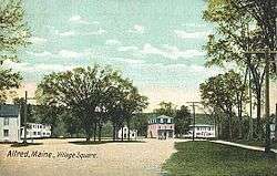
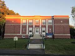
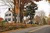
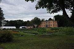
Alfred Historic District |
|
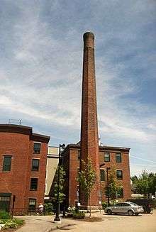
000000001983-04-28-0000April 28, 1983
(#83000479) |
Kennebunk and Saco Rds.
43°28′24″N 70°42′58″W / 43.473333°N 70.716111°W / 43.473333; -70.716111 (Alfred Historic District) |
Alfred |
|
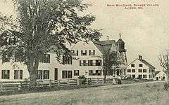
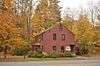
| 2 |
Alfred Shaker Historic District |
|
000000002001-04-11-0000April 11, 2001
(#01000371) |
Both sides of Shaker Hill Rd.
43°29′55″N 70°42′41″W / 43.498611°N 70.711389°W / 43.498611; -70.711389 (Alfred Shaker Historic District) |
Alfred |
|
| 3 |
Arundel Golf Club |
|
000000002009-11-04-0000November 4, 2009
(#09000879) |
19 River Rd.
43°22′26″N 70°28′40″W / 43.374°N 70.477836°W / 43.374; -70.477836 (Arundel Golf Club) |
Kennebunkport |
|
| 4 |
Austin-Hennessey Homestead |
|
000000001979-12-27-0000December 27, 1979
(#79000171) |
433 Branch Rd., at Burnt Mill Rd.
43°20′44″N 70°37′09″W / 43.345556°N 70.619167°W / 43.345556; -70.619167 (Austin-Hennessey Homestead) |
Wells |
Also known as the Storer-Hennessey Homestead
|
| 5 |
Caleb R. Ayer House |
|
000000002002-10-31-0000October 31, 2002
(#02001270) |
7 Main St.
43°48′16″N 70°48′15″W / 43.804444°N 70.804167°W / 43.804444; -70.804167 (Caleb R. Ayer House) |
Cornish |
|
| 6 |
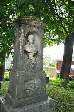
Samuel Badger Monument |
|
000000001998-01-07-0000January 7, 1998
(#97001640) |
in a small graveyard behind 16 Otis Ave
43°05′12″N 70°44′42″W / 43.086555°N 70.745018°W / 43.086555; -70.745018 (Samuel Badger Monument) |
Kittery Foreside |
|
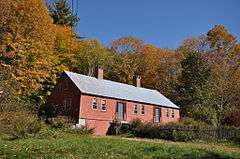
| 7 |
Barrell Homestead |
|
000000001976-12-12-0000December 12, 1976
(#76000195) |
71 Beech Ridge Rd.
43°08′41″N 70°42′28″W / 43.144722°N 70.707778°W / 43.144722; -70.707778 (Barrell Homestead) |
York Beach |
|
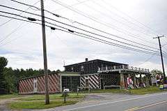
| 8 |
Berwick Academy |
|
000000001978-03-29-0000March 29, 1978
(#78000336) |
Academy St.; also along the eastern side of Academy St., 0.15 miles (0.24 km) south of its junction with State Route 236
43°13′48″N 70°48′18″W / 43.23°N 70.805°W / 43.23; -70.805 (Berwick Academy) |
South Berwick |
Second set of addresses represents a boundary increase March 22, 1996
|
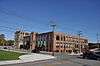
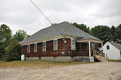
| 9 |
Berwick High School |
|
000000002012-01-27-0000January 27, 2012
(#11001059) |
45 School St.
43°16′08″N 70°51′39″W / 43.268903°N 70.860789°W / 43.268903; -70.860789 (Berwick High School) |
Berwick |
Berwick's high school 1928-2001.
|
| 10 |
Biddeford City Hall |
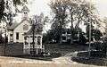
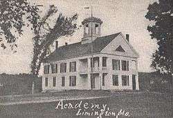
|
000000001973-04-24-0000April 24, 1973
(#73000156) |
205 Main St.
43°29′36″N 70°27′26″W / 43.493333°N 70.457222°W / 43.493333; -70.457222 (Biddeford City Hall) |
Biddeford |
Rebuilt 1895-96, John Calvin Stevens, architect.
|
| 11 |
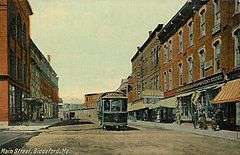
Biddeford Main Street Historic District |
|
000000002009-12-24-0000December 24, 2009
(#09001146) |
29 to 316 Main St., and portions of Elm, Jefferson, Adams, Washington, Franklin, Alfred and Water Sts.
43°29′36″N 70°27′19″W / 43.493347°N 70.455233°W / 43.493347; -70.455233 (Biddeford Main Street Historic District) |
Biddeford |
|
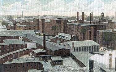
| 12 |
Biddeford-Saco Mills Historic District |
|
000000002008-12-30-0000December 30, 2008
(#08001258) |
Bounded by Pearl, Lincoln, York and Main Sts., Biddeford, Gooch and Saco Sts.
43°29′38″N 70°27′18″W / 43.49387°N 70.45502°W / 43.49387; -70.45502 (Biddeford-Saco Mills Historic District) |
Biddeford |
Detailed aerial map
|
| 13 |
Blazo-Leavitt House |
|
000000001982-02-19-0000February 19, 1982
(#82000791) |
State Route 160
43°45′43″N 70°56′24″W / 43.761944°N 70.94°W / 43.761944; -70.94 (Blazo-Leavitt House) |
Parsonsfield |
|
| 14 |
Boon Island Light Station |
|
000000001988-03-14-0000March 14, 1988
(#88000153) |
Boon Island
43°07′03″N 70°28′06″W / 43.1175°N 70.468333°W / 43.1175; -70.468333 (Boon Island Light Station) |
York |
|
| 15 |
Bourne Mansion |
|
000000001980-01-24-0000January 24, 1980
(#80000381) |
8 Bourne St.
43°23′12″N 70°32′26″W / 43.386667°N 70.540556°W / 43.386667; -70.540556 (Bourne Mansion) |
Kennebunk |
|
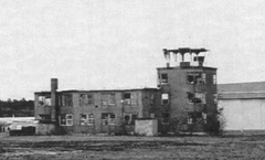
| 16 |
Brave Boat Harbor Farm |
Upload image |
000000002007-10-30-0000October 30, 2007
(#07001153) |
110 Raynes Neck Rd.
43°06′15″N 70°39′03″W / 43.1043°N 70.6508°W / 43.1043; -70.6508 (Brave Boat Harbor Farm) |
York |
|
| 17 |
Bray House |
|
000000001979-10-09-0000October 9, 1979
(#79000271) |
Pepperell Rd.
43°04′58″N 70°42′10″W / 43.082778°N 70.702778°W / 43.082778; -70.702778 (Bray House) |
Kittery Point |
|
| 18 |
Isabella Breckinridge House |
Upload image |
000000001983-04-28-0000April 28, 1983
(#83000480) |
201 U.S. Route 1
43°08′27″N 70°41′18″W / 43.140833°N 70.688333°W / 43.140833; -70.688333 (Isabella Breckinridge House) |
York |
|
| 19 |
Royal Brewster House |
|
000000001975-06-05-0000June 5, 1975
(#75000116) |
Buxton Lower Corner
43°36′22″N 70°32′09″W / 43.606111°N 70.535833°W / 43.606111; -70.535833 (Royal Brewster House) |
Buxton |
|
| 20 |
Buxton Powder House |
|
000000001976-01-02-0000January 2, 1976
(#76000120) |
State Route 22
43°38′54″N 70°32′47″W / 43.648333°N 70.546389°W / 43.648333; -70.546389 (Buxton Powder House) |
Buxton Center |
|
| 21 |
Cape Arundel Summer Colony Historic District |
|
000000001984-08-16-0000August 16, 1984
(#84001549) |
Roughly bounded by Chick's Creek, Ocean Ave., S. Main St., Endcliff Rd., and Walkers Point
43°20′41″N 70°28′04″W / 43.344722°N 70.467778°W / 43.344722; -70.467778 (Cape Arundel Summer Colony Historic District) |
Kennebunkport |
|
| 22 |
Cape Neddick Light Station |
|
000000001985-04-16-0000April 16, 1985
(#85000844) |
Cape Neddick
43°09′55″N 70°35′30″W / 43.165278°N 70.591667°W / 43.165278; -70.591667 (Cape Neddick Light Station) |
York |
|
| 23 |
Capt. Josiah E. Chase Octagon House |
|
000000001987-03-25-0000March 25, 1987
(#87000431) |
Chase's Mill Rd.
43°43′39″N 70°39′40″W / 43.7275°N 70.661111°W / 43.7275; -70.661111 (Capt. Josiah E. Chase Octagon House) |
East Limington |
|
| 24 |
George F. Clifford House |
|
000000002010-04-22-0000April 22, 2010
(#10000230) |
17 High Rd.
43°48′16″N 70°48′10″W / 43.8044°N 70.8028°W / 43.8044; -70.8028 (George F. Clifford House) |
Cornish |
|
| 25 |
Clock Farm |
|
000000001982-02-19-0000February 19, 1982
(#82000792) |
State Route 9 and Goose Rocks Rd.
43°24′20″N 70°25′39″W / 43.405556°N 70.4275°W / 43.405556; -70.4275 (Clock Farm) |
Kennebunkport |
|
| 26 |
Colonial Inn |
|
000000002012-07-31-0000July 31, 2012
(#12000454) |
145 Shore Rd.
43°14′41″N 70°35′48″W / 43.244726°N 70.596666°W / 43.244726; -70.596666 (Colonial Inn) |
Ogunquit |
|
| 27 |
Conant-Sawyer Cottage |
|
000000001992-03-26-0000March 26, 1992
(#92000279) |
14 Kendall Rd.
43°10′22″N 70°35′59″W / 43.172778°N 70.599722°W / 43.172778; -70.599722 (Conant-Sawyer Cottage) |
York Beach |
|
| 28 |
Conway Junction Railroad Turntable Site |
|
000000001989-01-05-0000January 5, 1989
(#88003001) |
Fife Ln. and State Route 236
43°12′33″N 70°47′22″W / 43.209167°N 70.789444°W / 43.209167; -70.789444 (Conway Junction Railroad Turntable Site) |
South Berwick |
|
| 29 |
Cummings' Guest House |
|
000000002004-07-28-0000July 28, 2004
(#04000744) |
110 Portland Ave.
43°31′06″N 70°22′31″W / 43.518333°N 70.375278°W / 43.518333; -70.375278 (Cummings' Guest House) |
Old Orchard Beach |
|
| 30 |
Cummings Shoe Factory |
|
000000002001-12-31-0000December 31, 2001
(#01001420) |
2 Railroad Ave.
43°14′14″N 70°49′18″W / 43.237222°N 70.821667°W / 43.237222; -70.821667 (Cummings Shoe Factory) |
South Berwick |
|
| 31 |
Benjamin and Abigail Dalton House |
|
000000001997-04-14-0000April 14, 1997
(#97000311) |
Middle Rd east of the intersection with Merrill Hill Rd.[6]
43°43′37″N 70°55′42″W / 43.727072°N 70.928379°W / 43.727072; -70.928379 (Benjamin and Abigail Dalton House) |
North Parsonsfield |
Listed as "Address Restricted" in NRHP
|
| 32 |
J.G. Deering House |
|
000000001982-02-17-0000February 17, 1982
(#82000793) |
371 Main St.
43°30′08″N 70°26′36″W / 43.502222°N 70.443333°W / 43.502222; -70.443333 (J.G. Deering House) |
Saco |
|
| 33 |
Dennett Garrison |
|
000000001978-12-22-0000December 22, 1978
(#78000334) |
100 Dennett Rd.
43°06′03″N 70°45′35″W / 43.100833°N 70.759722°W / 43.100833; -70.759722 (Dennett Garrison) |
Kittery |
|
| 34 |
District No. 5 School |
|
000000002009-02-04-0000February 4, 2009
(#09000015) |
781 Gore Rd.
43°31′27″N 70°45′56″W / 43.52409°N 70.76542°W / 43.52409; -70.76542 (District No. 5 School) |
Alfred |
|
| 35 |
Division No. 9 School |
|
000000001995-12-14-0000December 14, 1995
(#95001463) |
1760 N. Berwick Rd; southern side of State Route 9, 0.15 miles (0.24 km) east of its junction with Bragdon Rd.
43°18′23″N 70°41′27″W / 43.306389°N 70.690833°W / 43.306389; -70.690833 (Division No. 9 School) |
Wells |
|
| 36 |
Dorfield Farm |
|
000000001979-12-27-0000December 27, 1979
(#79000172) |
16 Dorfield Lane, off Harrisecket Rd.
43°21′29″N 70°34′02″W / 43.358056°N 70.567222°W / 43.358056; -70.567222 (Dorfield Farm) |
Wells |
|
| 37 |
Dudley Block |
|
000000001982-11-12-0000November 12, 1982
(#82000428) |
28-34 Water St.
43°29′32″N 70°27′01″W / 43.492222°N 70.450278°W / 43.492222; -70.450278 (Dudley Block) |
Biddeford |
|
| 38 |
Early Post Office |
|
000000001979-12-27-0000December 27, 1979
(#79000173) |
88 Crossing Road (Bragdon's Crossing)
43°19′15″N 70°36′13″W / 43.320833°N 70.603611°W / 43.320833; -70.603611 (Early Post Office) |
Wells |
Also known as the Bragdon House
|
| 39 |
Eaton House |
|
000000001979-12-27-0000December 27, 1979
(#79000174) |
Sanford Rd.
43°21′33″N 70°39′49″W / 43.359167°N 70.663611°W / 43.359167; -70.663611 (Eaton House) |
Wells |
Listed as being in the North Berwick vicinity.
|
| 40 |
Elden's Store |
|
000000001983-04-28-0000April 28, 1983
(#83000481) |
State Route 22
43°38′55″N 70°32′31″W / 43.648611°N 70.541944°W / 43.648611; -70.541944 (Elden's Store) |
Buxton |
|
| 41 |
Elder Grey Meetinghouse |
|
000000001979-10-09-0000October 9, 1979
(#79000175) |
North of North Waterboro
43°38′10″N 70°42′50″W / 43.636111°N 70.713889°W / 43.636111; -70.713889 (Elder Grey Meetinghouse) |
North Waterboro |
|
| 42 |
Emery Homestead |
|
000000001980-06-22-0000June 22, 1980
(#80000379) |
1 and 3 Lebanon St.
43°26′26″N 70°46′43″W / 43.4405°N 70.7785°W / 43.4405; -70.7785 (Emery Homestead) |
Sanford |
|
| 43 |
Emery House |
|
000000001979-12-27-0000December 27, 1979
(#79000176) |
2449 Sanford Rd.
43°21′56″N 70°40′10″W / 43.365556°N 70.669444°W / 43.365556; -70.669444 (Emery House) |
Wells (Highpine) |
|
| 44 |
Emery School |
|
000000002011-11-18-0000November 18, 2011
(#11000819) |
116 Hill St.
43°29′19″N 70°27′15″W / 43.488706°N 70.454161°W / 43.488706; -70.454161 (Emery School) |
Biddeford |
|
| 45 |
First Baptist Church |
|
000000001988-06-28-0000June 28, 1988
(#88000886) |
Western side of the junction of West Rd. and Federal St.
43°32′16″N 70°44′12″W / 43.537778°N 70.736667°W / 43.537778; -70.736667 (First Baptist Church) |
Waterboro |
|
| 46 |
First Congregational Church and Parsonage |
|
000000001978-12-18-0000December 18, 1978
(#78000333) |
Pepperrell Rd.; also along both sides of Whipple (Pepperell) Rd., 2.3 miles (3.7 km) east of its junction with U.S. Route 1
43°04′54″N 70°42′56″W / 43.081667°N 70.715556°W / 43.081667; -70.715556 (First Congregational Church and Parsonage) |
Kittery Point |
Second set of addresses represents a boundary increase
|
| 47 |
First Congregational Church of Buxton |
|
000000001980-06-22-0000June 22, 1980
(#80000259) |
State Route 112
43°36′23″N 70°32′14″W / 43.606389°N 70.537222°W / 43.606389; -70.537222 (First Congregational Church of Buxton) |
Buxton |
|
| 48 |
First Congregational Church, Former |
|
000000001991-06-21-0000June 21, 1991
(#91000768) |
938 Post Road; southwestern corner of U.S. Route 1 and Buzzell Rd.
43°18′05″N 70°35′12″W / 43.301389°N 70.586667°W / 43.301389; -70.586667 (First Congregational Church, Former) |
Wells |
Now a historical society museum.
|
| 49 |
First Parish Meetinghouse |
|
000000001972-10-26-0000October 26, 1972
(#72000080) |
Old Pool Rd.
43°28′31″N 70°24′56″W / 43.475278°N 70.415556°W / 43.475278; -70.415556 (First Parish Meetinghouse) |
Biddeford |
|
| 50 |
James Montgomery Flagg House |
|
000000001980-04-23-0000April 23, 1980
(#80000260) |
St. Martin's Lane
43°27′00″N 70°20′38″W / 43.45°N 70.343889°W / 43.45; -70.343889 (James Montgomery Flagg House) |
Biddeford |
|
| 51 |
Fletcher's Neck Lifesaving Station |
Upload image |
000000001974-11-01-0000November 1, 1974
(#74000195) |
Ocean Ave.
43°26′33″N 70°20′33″W / 43.4425°N 70.3425°W / 43.4425; -70.3425 (Fletcher's Neck Lifesaving Station) |
Biddeford Pool |
|
| 52 |
William Fogg Library |
|
000000001991-12-21-0000December 21, 1991
(#91001817) |
Old Rd.
43°07′42″N 70°47′53″W / 43.128333°N 70.798056°W / 43.128333; -70.798056 (William Fogg Library) |
Eliot |
|
| 53 |
Fort McClary |
|
000000001969-10-01-0000October 1, 1969
(#69000025) |
Off State Route 103 near Fort McClary State Park
43°04′54″N 70°42′39″W / 43.081667°N 70.710833°W / 43.081667; -70.710833 (Fort McClary) |
Kittery Point |
|
| 54 |
Levi Foss House |
|
000000001984-03-22-0000March 22, 1984
(#84001550) |
State Route 35
43°30′40″N 70°34′54″W / 43.5111°N 70.5818°W / 43.5111; -70.5818 (Levi Foss House) |
Goodwins Mills |
|
| 55 |
Frank C. Frisbee Elementary School |
|
000000002012-04-25-0000April 25, 2012
(#12000229) |
120 Rogers Rd.
43°05′51″N 70°44′11″W / 43.097426°N 70.736293°W / 43.097426; -70.736293 (Frank C. Frisbee Elementary School) |
Kittery |
|
| 56 |
Frost Garrison and House |
|
000000001971-06-27-0000June 27, 1971
(#71000045) |
Frost's Hill (Garrison Dr.)
43°09′42″N 70°44′56″W / 43.1617°N 70.7489°W / 43.1617; -70.7489 (Frost Garrison and House) |
Eliot |
|
| 57 |
Goat Island Light Station |
|
000000001988-03-23-0000March 23, 1988
(#87002268) |
Goat Island in Cape Porpoise Harbor
43°21′28″N 70°25′33″W / 43.357778°N 70.425833°W / 43.357778; -70.425833 (Goat Island Light Station) |
Cape Porpoise |
|
| 58 |
Goodale-Bourne Farm |
|
000000001979-12-27-0000December 27, 1979
(#79000177) |
N. Village Rd.
43°15′48″N 70°38′05″W / 43.263333°N 70.634722°W / 43.263333; -70.634722 (Goodale-Bourne Farm) |
Ogunquit |
|
| 59 |
Goodale-Stevens Farm |
|
000000001979-12-27-0000December 27, 1979
(#79000178) |
N. Village Rd.
43°15′49″N 70°37′54″W / 43.263611°N 70.631667°W / 43.263611; -70.631667 (Goodale-Stevens Farm) |
Ogunquit |
|
| 60 |
Louis B. Goodall Memorial Library |
|
000000002008-01-24-0000January 24, 2008
(#07001448) |
952 Main St.
43°26′10″N 70°46′24″W / 43.436111°N 70.773333°W / 43.436111; -70.773333 (Louis B. Goodall Memorial Library) |
Sanford |
|
| 61 |
Thomas Goodall House |
|
000000001975-04-28-0000April 28, 1975
(#75000207) |
232 Main St.
43°26′15″N 70°46′24″W / 43.4375°N 70.7733°W / 43.4375; -70.7733 (Thomas Goodall House) |
Sanford |
|
| 62 |
Edmund E. Goodwin House |
|
000000002015-11-09-0000November 9, 2015
(#15000770) |
503 Main St.
43°27′48″N 70°47′45″W / 43.4633°N 70.7957°W / 43.4633; -70.7957 (Edmund E. Goodwin House) |
Sanford |
|
| 63 |
Grant Family House |
|
000000001990-06-21-0000June 21, 1990
(#90000927) |
72 Grant Rd.
43°34′47″N 70°30′15″W / 43.579722°N 70.504167°W / 43.579722; -70.504167 (Grant Family House) |
Saco |
|
| 64 |
Abbott Graves House |
|
000000001980-04-23-0000April 23, 1980
(#80000261) |
Ocean Ave.
43°21′14″N 70°28′22″W / 43.353889°N 70.472778°W / 43.353889; -70.472778 (Abbott Graves House) |
Kennebunkport |
|
| 65 |
Great Falls Manufacturing Company Newichawannock Canal Historic District |
|
000000002014-08-06-0000August 6, 2014
(#14000460) |
Between Great East Lake and Horn Pond
43°34′10″N 70°58′16″W / 43.5694°N 70.971144°W / 43.5694; -70.971144 (Great Falls Manufacturing Company Newichawannock Canal Historic District) |
Acton |
Extends into Wakefield in Carroll County, New Hampshire
|
| 66 |
Grist Mill Bridge |
|
000000001990-12-27-0000December 27, 1990
(#90001905) |
Little River Rd. across the Little River
43°23′30″N 70°51′06″W / 43.391667°N 70.851667°W / 43.391667; -70.851667 (Grist Mill Bridge) |
Lebanon |
|
| 67 |
Jonathan Hamilton House |
|
000000001970-12-30-0000December 30, 1970
(#70000082) |
Vaughan's Lane and Old South Rd.
43°12′48″N 70°48′47″W / 43.213333°N 70.813056°W / 43.213333; -70.813056 (Jonathan Hamilton House) |
South Berwick |
|
| 68 |
John Hancock Warehouse |
|
000000001969-12-02-0000December 2, 1969
(#69000029) |
136 Lindsay Rd.
43°08′12″N 70°39′28″W / 43.136667°N 70.657778°W / 43.136667; -70.657778 (John Hancock Warehouse) |
York |
|
| 69 |
Harper Family House |
|
000000001998-10-08-0000October 8, 1998
(#98001236) |
State Route 5, approximately 0.95 miles (1.53 km) south of its junction with E. Range Rd.
43°40′07″N 70°46′33″W / 43.668611°N 70.775833°W / 43.668611; -70.775833 (Harper Family House) |
Limerick |
|
| 70 |
Hatch House |
|
000000001979-12-27-0000December 27, 1979
(#79000179) |
2104 Sanford Rd.
43°21′32″N 70°39′53″W / 43.358889°N 70.664722°W / 43.358889; -70.664722 (Hatch House) |
Wells |
Listed as being in the "North Berwick vicinity".
|
| 71 |
Hawkes Pharmacy |
|
000000001993-10-14-0000October 14, 1993
(#93001111) |
6 Main St.
43°10′33″N 70°36′40″W / 43.175833°N 70.611111°W / 43.175833; -70.611111 (Hawkes Pharmacy) |
York Beach |
Also known as the Rockaway Hotel
|
| 72 |
Hedden Site |
Upload image |
000000001991-10-16-0000October 16, 1991
(#91001515) |
Address Restricted
|
Kennebunk |
|
| 73 |
Thomas Hobbs, Jr., House |
|
000000001982-02-11-0000February 11, 1982
(#82000794) |
Wells St.
43°18′19″N 70°44′17″W / 43.305278°N 70.738056°W / 43.305278; -70.738056 (Thomas Hobbs, Jr., House) |
North Berwick |
|
| 74 |
Sen. John Holmes House |
|
000000001975-04-24-0000April 24, 1975
(#75000117) |
U.S. Route 202
43°28′39″N 70°43′04″W / 43.4775°N 70.717778°W / 43.4775; -70.717778 (Sen. John Holmes House) |
Alfred |
|
| 75 |
William Dean Howells House |
|
000000001979-10-25-0000October 25, 1979
(#79000270) |
Pepperrell Rd.
43°04′51″N 70°42′45″W / 43.080833°N 70.7125°W / 43.080833; -70.7125 (William Dean Howells House) |
Kittery Point |
|
| 76 |
Mary R. Hurd House |
|
000000001979-09-11-0000September 11, 1979
(#79000180) |
Elm St.
43°18′19″N 70°44′22″W / 43.305278°N 70.739444°W / 43.305278; -70.739444 (Mary R. Hurd House) |
North Berwick |
|
| 77 |
Hussey Plow Company Building |
|
000000001979-12-19-0000December 19, 1979
(#79000181) |
Dyer St.
43°18′15″N 70°43′45″W / 43.304167°N 70.729167°W / 43.304167; -70.729167 (Hussey Plow Company Building) |
North Berwick |
|
| 78 |
Isles of Shoals |
|
000000001974-05-16-0000May 16, 1974
(#74000325) |
6.5 miles (10.5 km) southeast of Kittery
42°59′43″N 70°36′23″W / 42.995278°N 70.606389°W / 42.995278; -70.606389 (Isles of Shoals) |
Kittery |
|
| 79 |
Jacobs Houses and Store |
|
000000001982-03-02-0000March 2, 1982
(#82000795) |
9-17 Elm St.
43°29′56″N 70°27′02″W / 43.498889°N 70.450556°W / 43.498889; -70.450556 (Jacobs Houses and Store) |
Saco |
|
| 80 |
Sarah Orne Jewett House |
|
000000001973-06-04-0000June 4, 1973
(#73000248) |
State Routes 4 and 236
43°14′05″N 70°48′13″W / 43.234722°N 70.803611°W / 43.234722; -70.803611 (Sarah Orne Jewett House) |
South Berwick |
|
| 81 |
Jewett-Eastman House |
|
000000001983-12-29-0000December 29, 1983
(#83003700) |
37 Portland St.
43°14′06″N 70°48′33″W / 43.235°N 70.809167°W / 43.235; -70.809167 (Jewett-Eastman House) |
South Berwick |
Now the visitors center for the Sarah Orne Jewett House
|
| 82 |
Dennis Johnson Lumber Company Mill |
|
000000002007-05-08-0000May 8, 2007
(#07000409) |
Northeastern side of State Route 5, 0.3 miles (0.48 km) north of Silas Brown Rd.
43°37′09″N 70°43′56″W / 43.619167°N 70.732222°W / 43.619167; -70.732222 (Dennis Johnson Lumber Company Mill) |
Waterboro |
|
| 83 |
John Paul Jones Memorial Park |
|
000000001998-01-07-0000January 7, 1998
(#97001639) |
Bounded by Newmarch St. and Hunter Ave.
43°05′06″N 70°45′02″W / 43.085°N 70.750556°W / 43.085; -70.750556 (John Paul Jones Memorial Park) |
Kittery Foreside |
|
| 84 |
Kennebunk High School |
|
000000002011-08-24-0000August 24, 2011
(#11000584) |
14 Park St.
43°23′07″N 70°32′06″W / 43.385278°N 70.535°W / 43.385278; -70.535 (Kennebunk High School) |
Kennebunk |
The town's old high school, built 1921-22.
|
| 85 |
Kennebunk Historic District |
|
000000001974-06-05-0000June 5, 1974
(#74000324) |
Both sides of State Route 35 from the Kennebunk River to U.S. Route 1, radiating streets at intersection
43°22′55″N 70°31′24″W / 43.381944°N 70.523333°W / 43.381944; -70.523333 (Kennebunk Historic District) |
Kennebunk |
|
| 86 |
Kennebunk River Club |
|
000000001975-09-09-0000September 9, 1975
(#75002169) |
Ocean Ave.
43°21′01″N 70°28′24″W / 43.350278°N 70.473333°W / 43.350278; -70.473333 (Kennebunk River Club) |
Kennebunkport |
Frederick W. Stickney, architect.
|
| 87 |
Kennebunkport Historic District |
|
000000001976-05-06-0000May 6, 1976
(#76000121) |
Bounded roughly by South, Maine, North, and Locke Sts., and the Kennebunk River
43°21′46″N 70°28′33″W / 43.362778°N 70.475833°W / 43.362778; -70.475833 (Kennebunkport Historic District) |
Kennebunkport |
|
| 88 |
Lady Pepperrell House |
|
000000001966-10-15-0000October 15, 1966
(#66000094) |
State Route 103
43°04′53″N 70°43′00″W / 43.081389°N 70.716667°W / 43.081389; -70.716667 (Lady Pepperrell House) |
Kittery Point |
|
| 89 |
Laudholm Farm |
|
000000001983-10-20-0000October 20, 1983
(#83003702) |
342 Laudholm Rd.
43°20′14″N 70°33′05″W / 43.337222°N 70.551389°W / 43.337222; -70.551389 (Laudholm Farm) |
Wells |
|
| 90 |
James Leavitt House |
|
000000002004-09-22-0000September 22, 2004
(#04001051) |
6 Old Alfred Rd.
43°35′20″N 70°42′34″W / 43.588889°N 70.709444°W / 43.588889; -70.709444 (James Leavitt House) |
Waterboro Center |
|
| 91 |
Libby's Colonial Tea Room |
|
000000002001-01-19-0000January 19, 2001
(#99000769) |
Junction of U.S. Route 1 and Harrisecket Rd.
43°21′26″N 70°33′32″W / 43.357222°N 70.558889°W / 43.357222; -70.558889 (Libby's Colonial Tea Room) |
Wells |
Now houses the Johnson Hall Museum.
|
| 92 |
Libby-MacArthur House |
|
000000001988-04-20-0000April 20, 1988
(#88000397) |
State Route 11
43°43′54″N 70°42′39″W / 43.731667°N 70.710833°W / 43.731667; -70.710833 (Libby-MacArthur House) |
Limington |
|
| 93 |
Limerick Upper Village Historic District |
|
000000001984-04-05-0000April 5, 1984
(#84001557) |
State Route 5
43°41′17″N 70°47′43″W / 43.688056°N 70.795278°W / 43.688056; -70.795278 (Limerick Upper Village Historic District) |
Limerick |
|
| 94 |
Limington Academy |
|
000000001980-06-23-0000June 23, 1980
(#80000380) |
State Route 117
43°44′N 70°43′W / 43.73°N 70.71°W / 43.73; -70.71 (Limington Academy) |
Limington |
|
| 95 |
Limington Historic District |
|
000000001999-01-15-0000January 15, 1999
(#98001601) |
Junction of State Routes 11 and 117
43°43′57″N 70°42′33″W / 43.7325°N 70.709167°W / 43.7325; -70.709167 (Limington Historic District) |
Limington |
|
| 96 |
Lincoln School |
|
000000002013-04-23-0000April 23, 2013
(#13000189) |
8 Orchard Rd.
43°29′29″N 70°54′40″W / 43.4915°N 70.9112°W / 43.4915; -70.9112 (Lincoln School) |
Acton |
|
| 97 |
Littlefield Homestead |
|
000000001979-12-27-0000December 27, 1979
(#79000182) |
1458 Branch Rd, near Chick's Crossing Rd.
43°22′30″N 70°35′52″W / 43.375°N 70.597778°W / 43.375; -70.597778 (Littlefield Homestead) |
Wells |
|
| 98 |
Littlefield Tavern |
|
000000001979-12-27-0000December 27, 1979
(#79000186) |
1107 Littlefield Rd
43°18′N 70°38′W / 43.3°N 70.64°W / 43.3; -70.64 (Littlefield Tavern) |
Wells |
|
| 99 |
Littlefield-Chase Farmstead |
|
000000001979-12-27-0000December 27, 1979
(#79000183) |
State Route 9, 1485 N. Berwick Rd.
43°18′28″N 70°40′44″W / 43.3079°N 70.6789°W / 43.3079; -70.6789 (Littlefield-Chase Farmstead) |
Wells |
|
| 100 |
Littlefield-Dustin Farm |
|
000000001979-12-27-0000December 27, 1979
(#79000184) |
41 Dodge Rd.
43°18′33″N 70°41′15″W / 43.3091°N 70.6874°W / 43.3091; -70.6874 (Littlefield-Dustin Farm) |
Wells |
|
| 101 |
Littlefield-Keeping House |
|
000000001979-12-27-0000December 27, 1979
(#79000185) |
1673 Littlefield Rd.
43°18′27″N 70°39′52″W / 43.3075°N 70.664444°W / 43.3075; -70.664444 (Littlefield-Keeping House) |
Wells |
|
| 102 |
Lord Farm |
|
000000001979-12-27-0000December 27, 1979
(#79000187) |
317 Laudholm Rd.
43°20′11″N 70°33′06″W / 43.336389°N 70.551667°W / 43.336389; -70.551667 (Lord Farm) |
Wells |
|
| 103 |
Lord Mansion |
|
000000001973-04-02-0000April 2, 1973
(#73000158) |
20 Summer St.
43°23′12″N 70°32′01″W / 43.3868°N 70.533565°W / 43.3868; -70.533565 (Lord Mansion) |
Kennebunk |
|
| 104 |
Capt. Nathaniel Lord Mansion |
|
000000001973-09-20-0000September 20, 1973
(#73000157) |
Pleasant and Green Sts.
43°21′32″N 70°28′27″W / 43.358889°N 70.474167°W / 43.358889; -70.474167 (Capt. Nathaniel Lord Mansion) |
Kennebunkport |
|
| 105 |
Lord-Dane House |
|
000000001992-12-17-0000December 17, 1992
(#92001708) |
Western side of Federal St., 2 miles (3.2 km) north of its junction with U.S. Route 202
43°29′57″N 70°43′47″W / 43.499167°N 70.729722°W / 43.499167; -70.729722 (Lord-Dane House) |
Alfred |
|
| 106 |
Lower Alewive Historic District |
|
000000001994-03-24-0000March 24, 1994
(#94000178) |
Northern side of Winnow Hill Ln, Emmons Rd. Ext., Russell Farm Rd., east of its junction with State Route 35
43°25′51″N 70°33′49″W / 43.4307°N 70.5635°W / 43.4307; -70.5635 (Lower Alewive Historic District) |
Kennebunk |
|
| 107 |
Maine Trolley Cars |
|
000000001980-11-14-0000November 14, 1980
(#80000262) |
Seashore Trolley Museum
43°24′28″N 70°29′22″W / 43.4078°N 70.4894°W / 43.4078; -70.4894 (Maine Trolley Cars) |
Kennebunkport |
Includes ten cars in the collection of the Seashore Trolley Museum.
|
| 108 |
McIntire Garrison House |
|
000000001968-11-24-0000November 24, 1968
(#68000017) |
280 Cider Hill Rd.
43°10′05″N 70°42′49″W / 43.1681°N 70.7136°W / 43.1681; -70.7136 (McIntire Garrison House) |
York |
|
| 109 |
Mill House |
|
000000001979-12-27-0000December 27, 1979
(#79000188) |
502 Post Rd.
43°17′16″N 70°35′39″W / 43.287778°N 70.594167°W / 43.287778; -70.594167 (Mill House) |
Wells |
Listed as being in Ogunquit.
|
| 110 |
Moody Homestead |
|
000000001975-04-28-0000April 28, 1975
(#75000209) |
100 Ridge Rd.
43°09′23″N 70°38′02″W / 43.156389°N 70.633889°W / 43.156389; -70.633889 (Moody Homestead) |
York |
|
| 111 |
Capt. James Morison House |
|
000000001978-07-12-0000July 12, 1978
(#78000335) |
Southeast of Parsonsfield on South Rd.
43°41′30″N 70°52′49″W / 43.6918°N 70.8804°W / 43.6918; -70.8804 (Capt. James Morison House) |
Parsonsfield |
|
| 112 |
Morrell House |
|
000000001976-09-29-0000September 29, 1976
(#76000194) |
North of N. Berwick on Bauneg Beg Pond Rd.
43°21′21″N 70°44′20″W / 43.355833°N 70.738889°W / 43.355833; -70.738889 (Morrell House) |
North Berwick |
|
| 113 |
Newfield (Willowbrook) Historic District |
|
000000001985-02-14-0000February 14, 1985
(#85000275) |
Elm St.
43°39′18″N 70°51′07″W / 43.655°N 70.851944°W / 43.655; -70.851944 (Newfield (Willowbrook) Historic District) |
Newfield |
|
| 114 |
North Berwick Woolen Mill |
|
000000001983-07-21-0000July 21, 1983
(#83000482) |
Canal St.
43°18′16″N 70°44′15″W / 43.304444°N 70.7375°W / 43.304444; -70.7375 (North Berwick Woolen Mill) |
North Berwick |
|
| 115 |
Ocean Park Historic Buildings |
|
000000001982-03-02-0000March 2, 1982
(#82000796) |
Temple Ave.
43°30′20″N 70°23′22″W / 43.505556°N 70.389444°W / 43.505556; -70.389444 (Ocean Park Historic Buildings) |
Ocean Park |
|
| 116 |
Odd Fellows-Rebekah Hall |
|
000000001983-12-29-0000December 29, 1983
(#83003704) |
High St.
43°48′14″N 70°48′12″W / 43.803889°N 70.803333°W / 43.803889; -70.803333 (Odd Fellows-Rebekah Hall) |
Cornish |
|
| 117 |
Ogunquit Memorial Library |
|
000000001983-12-29-0000December 29, 1983
(#83003706) |
166 Shore Rd.
43°14′38″N 70°35′48″W / 43.243926°N 70.596612°W / 43.243926; -70.596612 (Ogunquit Memorial Library) |
Ogunquit |
|
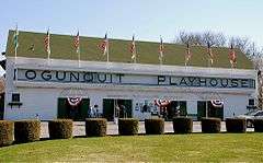
| 118 |
Ogunquit Playhouse |
|
000000001995-12-14-0000December 14, 1995
(#95001458) |
10 Main Street (U.S. Route 1)
43°14′20″N 70°36′02″W / 43.238889°N 70.600556°W / 43.238889; -70.600556 (Ogunquit Playhouse) |
Ogunquit |
|
| 119 |
Old Grist Mill |
|
000000001975-06-05-0000June 5, 1975
(#75000118) |
Little River Rd.
43°23′31″N 70°51′05″W / 43.39196°N 70.8514°W / 43.39196; -70.8514 (Old Grist Mill) |
East Lebanon |
|
| 120 |
Old Schoolhouse |
|
000000001973-04-02-0000April 2, 1973
(#73000247) |
3 Lindsay Rd. (on the Village Green)
43°08′38″N 70°39′13″W / 43.143889°N 70.653611°W / 43.143889; -70.653611 (Old Schoolhouse) |
York |
|
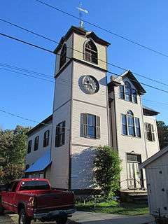
| 121 |
Old Town House |
|
000000002002-07-15-0000July 15, 2002
(#02000785) |
Merrill Hill Rd., north of its junction with Middle Rd.
43°43′42″N 70°55′47″W / 43.728333°N 70.929722°W / 43.728333; -70.929722 (Old Town House) |
Parsonsfield |
|
| 122 |
Old York Gaol |
|
000000001968-11-24-0000November 24, 1968
(#68000016) |
193 York St
43°08′38″N 70°39′10″W / 43.143889°N 70.652778°W / 43.143889; -70.652778 (Old York Gaol) |
York |
|
| 123 |
Parsons-Piper-Lord-Roy Farm |
|
000000002005-02-15-0000February 15, 2005
(#05000054) |
309 Cramm Rd.
43°42′34″N 70°50′47″W / 43.709444°N 70.846389°W / 43.709444; -70.846389 (Parsons-Piper-Lord-Roy Farm) |
Parsonsfield |
|
| 124 |
Parsonsfield Seminary |
|
000000001986-06-20-0000June 20, 1986
(#86001339) |
State Route 160
43°45′46″N 70°56′20″W / 43.762778°N 70.938889°W / 43.762778; -70.938889 (Parsonsfield Seminary) |
Parsonsfield |
|
| 125 |
Paul Family Farm |
|
000000001998-10-20-0000October 20, 1998
(#98001232) |
106 Depot Rd.
43°09′22″N 70°47′25″W / 43.156111°N 70.790278°W / 43.156111; -70.790278 (Paul Family Farm) |
Eliot |
|
| 126 |
Pebbledene |
|
000000001993-10-14-0000October 14, 1993
(#93001110) |
99 Freeman St.
43°10′51″N 70°36′19″W / 43.180833°N 70.605278°W / 43.180833; -70.605278 (Pebbledene) |
York Beach |
|
| 127 |
William Pepperrell House |
|
000000001973-08-14-0000August 14, 1973
(#73000159) |
On State Route 103
43°04′59″N 70°42′13″W / 43.083056°N 70.703611°W / 43.083056; -70.703611 (William Pepperrell House) |
Kittery Point |
|
| 128 |
Perkins Tide Mill |
|
000000001973-09-07-0000September 7, 1973
(#73000160) |
Mill Lane
43°22′01″N 70°28′28″W / 43.366944°N 70.474444°W / 43.366944; -70.474444 (Perkins Tide Mill) |
Kennebunkport |
|
| 129 |
Charles Perkins House |
|
000000001979-12-27-0000December 27, 1979
(#79000189) |
Scotch Hill
43°15′13″N 70°36′08″W / 43.253611°N 70.602222°W / 43.253611; -70.602222 (Charles Perkins House) |
Ogunquit |
|
| 130 |
LeRoy F. Pike Memorial Building |
|
000000002007-02-07-0000February 7, 2007
(#07000010) |
17 Maple St.
43°48′21″N 70°48′22″W / 43.805833°N 70.806111°W / 43.805833; -70.806111 (LeRoy F. Pike Memorial Building) |
Cornish |
|
| 131 |
Porter-Parsonfield Bridge |
|
000000001970-02-16-0000February 16, 1970
(#70000058) |
0.5 miles (0.80 km) south of Porter over the Ossipee River
43°47′30″N 70°56′18″W / 43.791667°N 70.938333°W / 43.791667; -70.938333 (Porter-Parsonfield Bridge) |
Parsonsfield |
Extends into Oxford County
|
| 132 |
Portsmouth Company Cotton Mills: Counting House |
|
000000001975-10-10-0000October 10, 1975
(#75000208) |
State Route 4 at the Salmon Falls River
43°13′37″N 70°48′41″W / 43.226944°N 70.811389°W / 43.226944; -70.811389 (Portsmouth Company Cotton Mills: Counting House) |
South Berwick |
Now the museum for the Old Berwick Historical Society.
|
| 133 |
Portsmouth Naval Shipyard |
|
000000001977-11-17-0000November 17, 1977
(#77000141) |
Seavey's Island
43°04′59″N 70°44′18″W / 43.083056°N 70.738333°W / 43.083056; -70.738333 (Portsmouth Naval Shipyard) |
Kittery |
|
| 134 |
J.L. Prescott House |
|
000000001985-06-20-0000June 20, 1985
(#85001268) |
High St.
43°18′39″N 70°44′19″W / 43.310833°N 70.738611°W / 43.310833; -70.738611 (J.L. Prescott House) |
North Berwick |
|
| 135 |
Rice Public Library |
|
000000001979-10-01-0000October 1, 1979
(#79000190) |
8 Wentworth St.
43°05′12″N 70°44′34″W / 43.086667°N 70.742778°W / 43.086667; -70.742778 (Rice Public Library) |
Kittery |
|
| 136 |
Rock Rest |
|
000000002008-01-24-0000January 24, 2008
(#07001449) |
167 Brave Boat Harbor Rd.
43°06′20″N 70°40′34″W / 43.105556°N 70.676111°W / 43.105556; -70.676111 (Rock Rest) |
Kittery |
|
| 137 |
Robert Rose Tavern |
|
000000001975-10-10-0000October 10, 1975
(#75000206) |
298 Long Sands Rd.
43°09′14″N 70°37′40″W / 43.153889°N 70.627778°W / 43.153889; -70.627778 (Robert Rose Tavern) |
York |
|
| 138 |
Saco Central Fire Station |
|
000000002013-04-16-0000April 16, 2013
(#13000168) |
14 Thornton Ave.
43°29′56″N 70°26′47″W / 43.498761°N 70.446399°W / 43.498761; -70.446399 (Saco Central Fire Station) |
Saco |
|
| 139 |
Saco City Hall |
|
000000001979-10-09-0000October 9, 1979
(#79000192) |
300 Main St.
43°29′57″N 70°26′44″W / 43.499167°N 70.445556°W / 43.499167; -70.445556 (Saco City Hall) |
Saco |
|
| 140 |
Saco High School (old) |
|
000000001983-07-14-0000July 14, 1983
(#83000483) |
Spring St.
43°30′09″N 70°26′21″W / 43.5025°N 70.439167°W / 43.5025; -70.439167 (Saco High School (old)) |
Saco |
|
| 141 |
Saco Historic District |
|
000000001998-06-12-0000June 12, 1998
(#98000594) |
Roughly bounded by Elm, North, Beach, and Main Sts.
43°30′10″N 70°26′51″W / 43.502778°N 70.4475°W / 43.502778; -70.4475 (Saco Historic District) |
Saco |
|
| 142 |
St. Andre's Parish |
|
000000002015-11-10-0000November 10, 2015
(#15000771) |
73, 77 Bacon & 39, 41 Sullivan Sts.
43°29′25″N 70°27′02″W / 43.4904°N 70.4506°W / 43.4904; -70.4506 (St. Andre's Parish) |
Biddeford |
|
| 143 |
St. Joseph's School |
|
000000001983-12-29-0000December 29, 1983
(#83003708) |
Birch St.
43°29′25″N 70°27′31″W / 43.490278°N 70.458611°W / 43.490278; -70.458611 (St. Joseph's School) |
Biddeford |
|
| 144 |
St. Peter's By-The-Sea Protestant Episcopal Church |
|
000000001999-07-01-0000July 1, 1999
(#99000773) |
529 Shore Rd.
43°13′04″N 70°35′03″W / 43.217778°N 70.584167°W / 43.217778; -70.584167 (St. Peter's By-The-Sea Protestant Episcopal Church) |
York (Cape Neddick) |
|
| 145 |
Salmon Falls (East) Historic District |
|
000000001987-10-15-0000October 15, 1987
(#87001859) |
Portions of State Route 117 and Simpson Rd.
43°35′34″N 70°33′04″W / 43.592778°N 70.551111°W / 43.592778; -70.551111 (Salmon Falls (East) Historic District) |
Buxton |
|
| 146 |
Salmon Falls (West) Historic District |
|
000000001987-10-30-0000October 30, 1987
(#87001858) |
Salmon Falls Rd. and portion of U.S. Route 202
43°35′53″N 70°33′24″W / 43.598056°N 70.556667°W / 43.598056; -70.556667 (Salmon Falls (West) Historic District) |
Hollis |
|
| 147 |
Sanford Mills Historic District |
|
000000002009-11-04-0000November 4, 2009
(#09000880) |
Bounded by Washington St., Pioneer Ave., Emery St., and Weaver Dr.
43°26′24″N 70°46′17″W / 43.440044°N 70.771375°W / 43.440044; -70.771375 (Sanford Mills Historic District) |
Sanford |
|
| 148 |
Sanford Naval Air Station Administration Building-Control Tower, Former |
|
000000001997-06-20-0000June 20, 1997
(#97000603) |
Southwestern corner of Sanford Municipal Airport, southwest of the junction of State Routes 99 and 109
43°23′25″N 70°43′00″W / 43.390278°N 70.716667°W / 43.390278; -70.716667 (Sanford Naval Air Station Administration Building-Control Tower, Former) |
South Sanford |
Demolished c. 2006-7.[7]
|
| 149 |
Sanford Town Hall (Former) |
|
000000002007-01-09-0000January 9, 2007
(#06001225) |
505 Main St.
43°27′48″N 70°47′44″W / 43.4632°N 70.79555°W / 43.4632; -70.79555 (Sanford Town Hall (Former)) |
Springvale |
|
| 150 |
A. B. Seavey House |
|
000000001978-03-31-0000March 31, 1978
(#78000332) |
90 Temple St.
43°30′03″N 70°27′00″W / 43.500833°N 70.45°W / 43.500833; -70.45 (A. B. Seavey House) |
Saco |
|
| 151 |
John Sedgley Homestead |
|
000000001976-01-02-0000January 2, 1976
(#76000192) |
44 Chases Pond Rd.
43°09′53″N 70°40′02″W / 43.164722°N 70.667222°W / 43.164722; -70.667222 (John Sedgley Homestead) |
York Beach |
|
| 152 |
James Smith Homestead |
|
000000001982-02-04-0000February 4, 1982
(#82001887) |
State Route 35
43°25′56″N 70°33′54″W / 43.432222°N 70.565°W / 43.432222; -70.565 (James Smith Homestead) |
Kennebunk |
|
| 153 |
Smith-Emery House |
|
000000001998-10-08-0000October 8, 1998
(#98001233) |
253 Main St.
43°28′07″N 70°48′07″W / 43.468611°N 70.801944°W / 43.468611; -70.801944 (Smith-Emery House) |
Springvale |
|
| 154 |
South Berwick Village Historic District |
|
000000002010-03-02-0000March 2, 2010
(#10000058) |
Portions of Main, Portland, Highland and Academy
43°13′57″N 70°48′31″W / 43.232608°N 70.808556°W / 43.232608; -70.808556 (South Berwick Village Historic District) |
South Berwick |
|
| 155 |
Spiller Farm Paleoindian Site |
|
000000002003-09-12-0000September 12, 2003
(#03000922) |
on the Spiller Farm property[8]
43°21′54″N 70°36′18″W / 43.365°N 70.605°W / 43.365; -70.605 (Spiller Farm Paleoindian Site) |
Wells |
|
| 156 |
Staples Inn |
|
000000001987-06-26-0000June 26, 1987
(#86002422) |
8 Portland Ave.
43°31′03″N 70°22′42″W / 43.5175°N 70.378333°W / 43.5175; -70.378333 (Staples Inn) |
Old Orchard Beach |
|
| 157 |
Sunnycroft |
|
000000001984-11-08-0000November 8, 1984
(#84000335) |
Locust Hill
43°41′22″N 70°47′40″W / 43.689444°N 70.794444°W / 43.689444; -70.794444 (Sunnycroft) |
Limerick |
|
| 158 |
John Tarr House |
|
000000001980-04-23-0000April 23, 1980
(#80000263) |
29 Ferry Lane
43°28′09″N 70°23′54″W / 43.469167°N 70.398333°W / 43.469167; -70.398333 (John Tarr House) |
Biddeford |
|
| 159 |
The Temple |
|
000000001975-04-28-0000April 28, 1975
(#75000119) |
Temple Ave. in Ocean Park
43°30′08″N 70°23′22″W / 43.502222°N 70.389444°W / 43.502222; -70.389444 (The Temple) |
Old Orchard Beach |
|
| 160 |
Thacher-Goodale House |
|
000000001976-11-21-0000November 21, 1976
(#76000193) |
121 North St.
43°30′19″N 70°26′47″W / 43.5053°N 70.4464°W / 43.5053; -70.4464 (Thacher-Goodale House) |
Saco |
|
| 161 |
Timber Point |
|
000000002016-11-14-0000November 14, 2016
(#16000786) |
2 Timber Point Rd., Rachel Carson National Wildlife Refuge
43°23′56″N 70°23′51″W / 43.398840°N 70.397584°W / 43.398840; -70.397584 (Timber Point) |
Biddeford |
|
| 162 |
Robert and Louisa Traip House |
|
000000001998-01-07-0000January 7, 1998
(#97001641) |
2 Wentworth St.
43°05′11″N 70°44′35″W / 43.086389°N 70.743056°W / 43.086389; -70.743056 (Robert and Louisa Traip House) |
Kittery Foreside |
|
| 163 |
U.S. Customhouse |
|
000000001974-01-18-0000January 18, 1974
(#74000323) |
Main St.
43°21′42″N 70°28′32″W / 43.361667°N 70.475556°W / 43.361667; -70.475556 (U.S. Customhouse) |
Kennebunkport |
Now Graves Library.
|
| 164 |
U.S. Post Office |
|
000000001973-05-07-0000May 7, 1973
(#73000161) |
35 Washington St.
43°29′32″N 70°27′21″W / 43.492222°N 70.455833°W / 43.492222; -70.455833 (U.S. Post Office) |
Biddeford |
|
| 165 |
US Post Office-Sanford Maine |
|
000000001986-05-02-0000May 2, 1986
(#86000882) |
28 School St.
43°26′16″N 70°46′22″W / 43.43785°N 70.77282°W / 43.43785; -70.77282 (US Post Office-Sanford Maine) |
Sanford |
|
| 166 |
Wallingford Hall |
|
000000002004-04-28-0000April 28, 2004
(#04000372) |
21 York St.
43°22′57″N 70°32′48″W / 43.3825°N 70.546667°W / 43.3825; -70.546667 (Wallingford Hall) |
Kennebunk |
|
| 167 |
Waterboro Grange, No. 432 |
|
000000002012-04-24-0000April 24, 2012
(#12000230) |
31 West Rd.
43°32′12″N 70°43′04″W / 43.536587°N 70.717646°W / 43.536587; -70.717646 (Waterboro Grange, No. 432) |
Waterboro |
|
| 168 |
Way Way General Store |
|
000000001995-12-14-0000December 14, 1995
(#95001462) |
93 Buxton Rd.
43°31′57″N 70°28′21″W / 43.5325°N 70.4725°W / 43.5325; -70.4725 (Way Way General Store) |
Saco |
|
| 169 |
Andrew Welch Homestead |
|
000000002002-04-11-0000April 11, 2002
(#02000352) |
1286 Middle Rd.
43°42′47″N 70°53′22″W / 43.713056°N 70.889444°W / 43.713056; -70.889444 (Andrew Welch Homestead) |
Parsonsfield |
|
| 170 |
Wells Baptist Church Parsonage |
|
000000001979-12-27-0000December 27, 1979
(#79000191) |
1384 Branch Rd (State Route 9A)
43°22′27″N 70°35′58″W / 43.374167°N 70.599444°W / 43.374167; -70.599444 (Wells Baptist Church Parsonage) |
Wells |
|
| 171 |
Wells Homestead |
|
000000001979-12-27-0000December 27, 1979
(#79000193) |
232 Sanford Rd.
43°19′21″N 70°35′10″W / 43.3225°N 70.586111°W / 43.3225; -70.586111 (Wells Homestead) |
Wells |
|
| 172 |
Mark F. and Eliza J. Wentworth House |
|
000000001998-01-07-0000January 7, 1998
(#97001643) |
9 Wentworth St.
43°05′12″N 70°44′36″W / 43.086667°N 70.743333°W / 43.086667; -70.743333 (Mark F. and Eliza J. Wentworth House) |
Kittery Foreside |
|
| 173 |
West Lebanon Historic District |
|
000000001975-06-05-0000June 5, 1975
(#75000210) |
Irregular pattern along W. Lebanon, Rochester, Milton, Shapleigh, and Meeting House Rds.
43°23′03″N 70°57′04″W / 43.384167°N 70.951111°W / 43.384167; -70.951111 (West Lebanon Historic District) |
West Lebanon |
|
| 174 |
Whaleback Light Station |
|
000000001988-03-23-0000March 23, 1988
(#87002278) |
Portsmouth Harbor
43°03′31″N 70°41′48″W / 43.058611°N 70.696667°W / 43.058611; -70.696667 (Whaleback Light Station) |
Kittery Point |
|
| 175 |
Kate Douglas Wiggin House |
|
000000001977-09-16-0000September 16, 1977
(#77000142) |
East of Hollis Center on Salmon Falls Rd.
43°35′50″N 70°33′20″W / 43.597222°N 70.555556°W / 43.597222; -70.555556 (Kate Douglas Wiggin House) |
Hollis Center |
|
| 176 |
Winn House |
|
000000001979-12-27-0000December 27, 1979
(#79000194) |
Obed's Lane[9]
43°14′41″N 70°36′01″W / 43.2447°N 70.6004°W / 43.2447; -70.6004 (Winn House) |
Ogunquit |
Moved in the 1980s; now a local museum
|
| 177 |
Wood Island Light Station |
|
000000001988-01-21-0000January 21, 1988
(#87002274) |
Eastern side of Wood Island
43°27′24″N 70°19′47″W / 43.456667°N 70.329722°W / 43.456667; -70.329722 (Wood Island Light Station) |
Biddeford Pool |
|
| 178 |
York Cliffs Historic District |
|
000000001984-07-26-0000July 26, 1984
(#84001560) |
Agamenticus Ave.
43°11′31″N 70°35′56″W / 43.191944°N 70.598889°W / 43.191944; -70.598889 (York Cliffs Historic District) |
York |
A series of summer "cottages" on Agamenticus Ave.
|
| 179 |
York Historic District |
|
000000001973-07-16-0000July 16, 1973
(#73000249) |
Roughly U.S. Route 1, U.S. Route 1A, State Route 103, and Woodbridge Rd.
43°08′18″N 70°39′03″W / 43.138333°N 70.650833°W / 43.138333; -70.650833 (York Historic District) |
York |
|


.jpg)


.jpg)

.jpg)