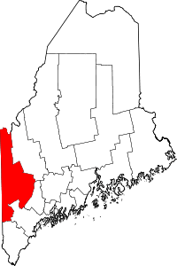
| [3] |
Name on the Register[4] |
Image |
Date listed[5] |
Location |
City or town |
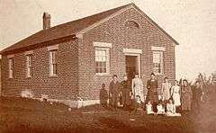
Description |
|---|
| 1 |
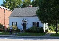
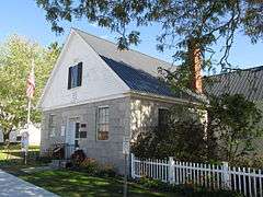
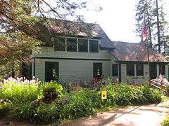
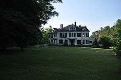
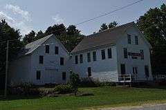
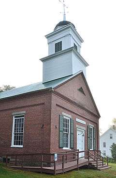
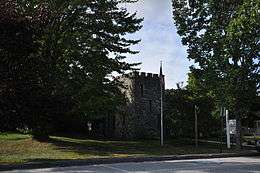
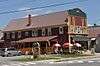
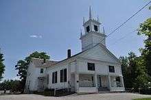
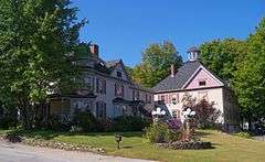
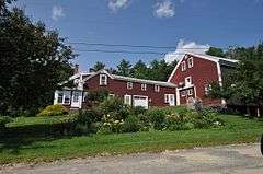
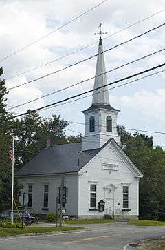
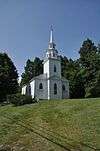
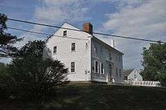
Albany Town House |
|
000000002007-08-07-0000August 7, 2007
(#07000793) |
Junction of State Routes 5 and 35
44°19′27″N 70°46′10″W / 44.324167°N 70.769444°W / 44.324167; -70.769444 (Albany Town House) |
Albany Township |
|
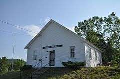
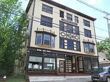
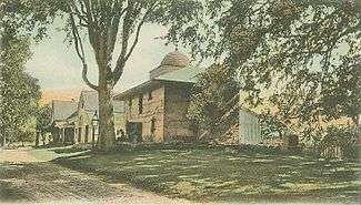
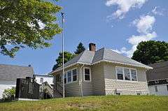
| 2 |
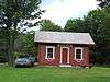
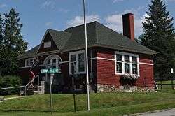
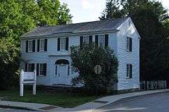
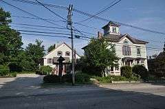
Andover Hook and Ladder Company Building |
|
000000002001-01-11-0000January 11, 2001
(#00001631) |
39 Elm St.
44°38′10″N 70°44′59″W / 44.636111°N 70.749722°W / 44.636111; -70.749722 (Andover Hook and Ladder Company Building) |
Andover |
|
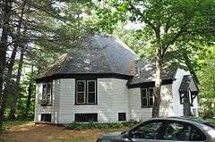
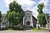
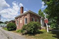
| 3 |
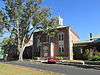
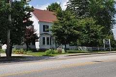
Andover Public Library |
|
000000001981-01-27-0000January 27, 1981
(#81000103) |
Church St.
44°37′54″N 70°45′07″W / 44.631667°N 70.751944°W / 44.631667; -70.751944 (Andover Public Library) |
Andover |
|
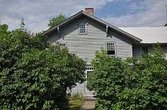
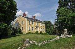
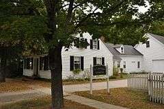
| 4 |
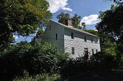
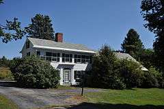
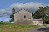
Barrows-Steadman Homestead |
|
000000001982-04-12-0000April 12, 1982
(#82000771) |
NE corner of Main and Stuart St.
44°01′04″N 70°58′47″W / 44.017778°N 70.979722°W / 44.017778; -70.979722 (Barrows-Steadman Homestead) |
Fryeburg |
|
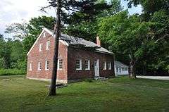
| 5 |
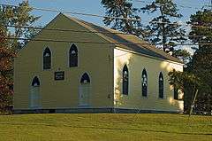
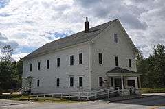
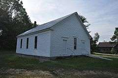
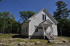
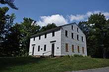
Bell Hill Meetinghouse |
|
000000002003-07-10-0000July 10, 2003
(#03000620) |
191 Bell Hill Rd.
44°05′17″N 70°33′36″W / 44.088056°N 70.56°W / 44.088056; -70.56 (Bell Hill Meetinghouse) |
Otisfield |
|
| 6 |
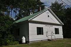
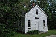
Bell Hill School |
|
000000002003-07-10-0000July 10, 2003
(#03000619) |
185 Bell Hill Rd.
44°05′15″N 70°33′35″W / 44.0875°N 70.559722°W / 44.0875; -70.559722 (Bell Hill School) |
Otisfield |
|
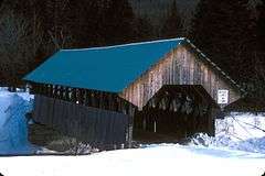
| 7 |
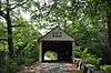
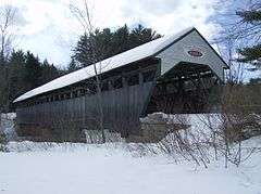
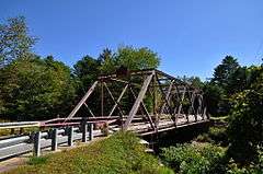
Bennett Bridge |
|
000000001970-02-16-0000February 16, 1970
(#70000055) |
1.5 miles (2.4 km) south of Wilsons Mills off State Route 16, over the Magalloway River
44°55′04″N 71°02′21″W / 44.917778°N 71.039167°W / 44.917778; -71.039167 (Bennett Bridge) |
Wilsons Mills |
|
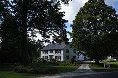
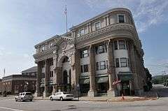
| 8 |
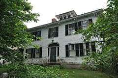
Nathaniel and Elizabeth Bennett House |
|
000000001996-06-07-0000June 7, 1996
(#96000652) |
Western side of Crockett Ridge Rd., 1.4 miles (2.3 km) north of its junction with State Route 117
44°13′57″N 70°34′31″W / 44.2325°N 70.575278°W / 44.2325; -70.575278 (Nathaniel and Elizabeth Bennett House) |
Norway |
|
| 9 |
Brickett Place |
|
000000001982-07-28-0000July 28, 1982
(#82000772) |
State Route 113
44°16′03″N 71°00′18″W / 44.2675°N 71.005°W / 44.2675; -71.005 (Brickett Place) |
Stow |
|
| 10 |
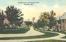
Broad Street Historic District |
|
000000001977-12-28-0000December 28, 1977
(#77000078) |
Broad St. and the Common; also along Church and Park Sts.
44°24′07″N 70°47′23″W / 44.401944°N 70.789722°W / 44.401944; -70.789722 (Broad Street Historic District) |
Bethel |
Second set of addresses represents a boundary increase
|
| 11 |
Center Meeting House and Common |
|
000000001997-06-20-0000June 20, 1997
(#97000606) |
476 Main St.
44°08′18″N 70°28′18″W / 44.138333°N 70.471667°W / 44.138333; -70.471667 (Center Meeting House and Common) |
Oxford |
|
| 12 |
Squire Chase House |
|
000000001979-05-07-0000May 7, 1979
(#79000158) |
Main St., SW of junction with Bridgton Rd.
44°01′15″N 70°58′34″W / 44.020833°N 70.976111°W / 44.020833; -70.976111 (Squire Chase House) |
Fryeburg |
|
| 13 |
Church of the New Jerusalem |
|
000000001986-06-13-0000June 13, 1986
(#86001274) |
4 Oxford St.
44°00′56″N 70°58′51″W / 44.015556°N 70.980833°W / 44.015556; -70.980833 (Church of the New Jerusalem) |
Fryeburg |
|
| 14 |
Churchill Bridge |
|
000000001994-03-17-0000March 17, 1994
(#94000180) |
Mountain Rd. across Bicknell Brook, 1 mile (1.6 km) west of its junction with Sodom Rd.
44°14′44″N 70°23′10″W / 44.245556°N 70.386111°W / 44.245556; -70.386111 (Churchill Bridge) |
Buckfield |
|
| 15 |
Cole Block |
|
000000001998-04-01-0000April 1, 1998
(#98000310) |
19 Main St.
44°24′26″N 70°47′33″W / 44.407222°N 70.7925°W / 44.407222; -70.7925 (Cole Block) |
Bethel |
|
| 16 |
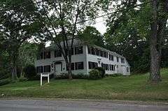
Deacon Hutchins House |
|
000000001979-07-10-0000July 10, 1979
(#79000159) |
Northwest of Rumford on State Route 5
44°32′47″N 70°41′42″W / 44.546389°N 70.695°W / 44.546389; -70.695 (Deacon Hutchins House) |
Rumford |
|
| 17 |
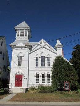
Deering Memorial United Methodist Church |
|
000000002008-01-24-0000January 24, 2008
(#07001444) |
39 Main St.
44°13′23″N 70°30′55″W / 44.223056°N 70.515278°W / 44.223056; -70.515278 (Deering Memorial United Methodist Church) |
Paris |
Sidney Badgley and William H. Nicklas, architects (1911).
|
| 18 |
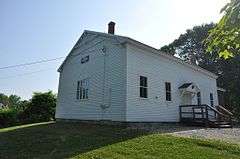
District No. 1 Schoolhouse |
|
000000001984-07-19-0000July 19, 1984
(#84001466) |
515 Main St.
44°00′54″N 70°58′57″W / 44.015°N 70.9825°W / 44.015; -70.9825 (District No. 1 Schoolhouse) |
Fryeburg |
Now the library.
|
| 19 |
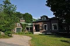
Dreamhome |
|
000000001996-09-27-0000September 27, 1996
(#96001037) |
Western side of Lake Christopher, 0.45 miles (0.72 km) north of Hill Rd.
44°22′16″N 70°39′10″W / 44.371111°N 70.652778°W / 44.371111; -70.652778 (Dreamhome) |
Bryant Pond |
|
| 20 |
Eastman Hill Rural Historic District |
|
000000001993-06-08-0000June 8, 1993
(#93000477) |
Eastman Hill Rd. east of Center Lovell
44°10′17″N 70°52′17″W / 44.171389°N 70.871389°W / 44.171389; -70.871389 (Eastman Hill Rural Historic District) |
Center Lovell |
|
| 21 |
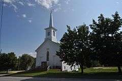
First Universalist Society of West Sumner |
|
000000002002-08-09-0000August 9, 2002
(#02000850) |
1114 Main St.
44°21′58″N 70°27′40″W / 44.366111°N 70.461111°W / 44.366111; -70.461111 (First Universalist Society of West Sumner) |
Sumner |
|
| 22 |
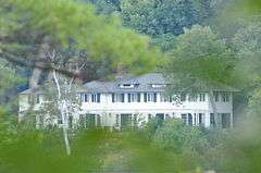
Forest Lodge |
|
000000002008-12-30-0000December 30, 2008
(#08001257) |
Carry Rd., about 1.9 miles (3.1 km) west of Middle Dam
44°46′00″N 70°57′01″W / 44.7667°N 70.9503°W / 44.7667; -70.9503 (Forest Lodge) |
Upton |
|
| 23 |
Foster Family Home |
|
000000001994-11-09-0000November 9, 1994
(#94001247) |
Western side of Sunday River Rd., 1.5 miles (2.4 km) northwest of its junction with Skiway Rd.
44°29′28″N 70°50′35″W / 44.4911°N 70.8431°W / 44.4911; -70.8431 (Foster Family Home) |
Newry |
|
| 24 |
Fryeburg Registry of Deeds |
|
000000001987-12-30-0000December 30, 1987
(#87002196) |
Main St., next to the library
44°00′53″N 70°58′59″W / 44.014722°N 70.983056°W / 44.014722; -70.983056 (Fryeburg Registry of Deeds) |
Fryeburg |
|
| 25 |
Fryeburg Town House, Former |
|
000000001992-10-02-0000October 2, 1992
(#92001295) |
Eastern side of State Route 5, 0.1 miles (0.16 km) north of its junction with Woodlawn Ave. (now Corn Shop Rd.)
44°04′14″N 70°56′43″W / 44.070556°N 70.945278°W / 44.070556; -70.945278 (Fryeburg Town House, Former) |
Fryeburg Center |
|
| 26 |
Gehring Clinic |
|
000000001976-08-02-0000August 2, 1976
(#76000105) |
Off State Route 5
44°23′58″N 70°47′16″W / 44.399444°N 70.787778°W / 44.399444; -70.787778 (Gehring Clinic) |
Bethel |
|
| 27 |
Gilead Railroad Station, Former |
|
000000001992-03-26-0000March 26, 1992
(#92000272) |
Back St and Bridge St, just off Route 2, Gilead
44°23′40″N 70°58′21″W / 44.394427°N 70.972615°W / 44.394427; -70.972615 (Gilead Railroad Station, Former) |
Gilead |
Moved in Jan 2011 from Auburn back to Gilead[6]
|
| 28 |
Greenwood Cattle Pound |
|
000000002007-08-07-0000August 7, 2007
(#07000794) |
Greenwood Rd., 0.33 miles (0.53 km) north of State Route 219
44°19′21″N 70°39′18″W / 44.3225°N 70.655°W / 44.3225; -70.655 (Greenwood Cattle Pound) |
Greenwood |
|
| 29 |
Greenwood Town Hall, Former |
|
000000002001-01-11-0000January 11, 2001
(#00001634) |
270 Main St.
44°24′04″N 70°42′22″W / 44.401111°N 70.706111°W / 44.401111; -70.706111 (Greenwood Town Hall, Former) |
Locke Mills |
|
| 30 |
Hall House |
|
000000002002-10-31-0000October 31, 2002
(#02001271) |
10 Kilborn St.
44°24′25″N 70°47′09″W / 44.406944°N 70.785833°W / 44.406944; -70.785833 (Hall House) |
Bethel |
|
| 31 |
Enoch Hall House |
|
000000001993-12-23-0000December 23, 1993
(#93001431) |
Western side of Bean Rd., 0.5 miles (0.80 km) southeast of its junction with State Route 117
44°16′57″N 70°20′38″W / 44.2825°N 70.343889°W / 44.2825; -70.343889 (Enoch Hall House) |
Buckfield |
|
| 32 |
Hemlock Bridge |
|
000000001970-02-16-0000February 16, 1970
(#70000056) |
Northeast of Fryeburg Center, over the Old Course Saco River
44°04′46″N 70°54′13″W / 44.079444°N 70.903611°W / 44.079444; -70.903611 (Hemlock Bridge) |
Fryeburg Center |
|
| 33 |
Hershey Plow Company Building |
|
000000001990-06-14-0000June 14, 1990
(#90000922) |
Hill St. near Stony Brook
44°13′21″N 70°30′25″W / 44.2225°N 70.506944°W / 44.2225; -70.506944 (Hershey Plow Company Building) |
South Paris |
|
| 34 |
Hubbard-Cotton Store |
|
000000001990-06-14-0000June 14, 1990
(#90000923) |
State Routes 5/113 across the Saco River from their junction with State Route 117
43°52′28″N 70°48′19″W / 43.874444°N 70.805278°W / 43.874444; -70.805278 (Hubbard-Cotton Store) |
Hiram |
|
| 35 |
Moses Hutchins House |
|
000000002003-04-22-0000April 22, 2003
(#03000290) |
Junction of State Route 6 and Old Stage Rd.
44°08′51″N 70°53′02″W / 44.1475°N 70.883889°W / 44.1475; -70.883889 (Moses Hutchins House) |
Lovell |
|
| 36 |
J&O Irish Store |
|
000000001983-12-29-0000December 29, 1983
(#83003666) |
State Route 140
44°22′22″N 70°20′52″W / 44.372778°N 70.347778°W / 44.372778; -70.347778 (J&O Irish Store) |
Hartford |
Now a local history museum.
|
| 37 |
Zadoc Long Free Library |
|
000000001994-06-24-0000June 24, 1994
(#94000636) |
Southern side of State Route 117 at its junction with State Route 140
44°17′22″N 70°21′55″W / 44.289444°N 70.365278°W / 44.289444; -70.365278 (Zadoc Long Free Library) |
Buckfield |
John Calvin Stevens, architect (1900-01).
|
| 38 |
Lovejoy Bridge |
|
000000001970-02-16-0000February 16, 1970
(#70000057) |
Over the Ellis River
44°35′37″N 70°44′02″W / 44.593611°N 70.733889°W / 44.593611; -70.733889 (Lovejoy Bridge) |
South Andover |
|
| 39 |
Lovell Meeting House |
|
000000002014-06-27-0000June 27, 2014
(#14000360) |
1133 Main St.
44°11′03″N 70°53′25″W / 44.1841°N 70.8903°W / 44.1841; -70.8903 (Lovell Meeting House) |
Lovell |
|
| 40 |
Lovell Village Church |
|
000000001986-06-20-0000June 20, 1986
(#86001337) |
Church St.
44°07′40″N 70°53′36″W / 44.127778°N 70.893333°W / 44.127778; -70.893333 (Lovell Village Church) |
Lovell |
Ammi Cutter, architect (1851).
|
| 41 |
Lower Meeting House and East Bethel Cemetery |
|
000000002013-06-25-0000June 25, 2013
(#13000440) |
1797 Intervale Road
44°27′53″N 70°43′17″W / 44.46472°N 70.72145°W / 44.46472; -70.72145 (Lower Meeting House and East Bethel Cemetery) |
Bethel |
|
| 42 |
Lower Sunday River School |
|
000000001978-05-23-0000May 23, 1978
(#78000189) |
Southwest of Newry on Sunday River Rd.
44°28′20″N 70°49′57″W / 44.472222°N 70.8325°W / 44.472222; -70.8325 (Lower Sunday River School) |
Newry |
|
| 43 |
Main Street Historic District |
|
000000001991-03-22-0000March 22, 1991
(#91000324) |
Main Street from Portland St. to about Swans Falls Rd.
44°01′15″N 70°58′35″W / 44.020833°N 70.976389°W / 44.020833; -70.976389 (Main Street Historic District) |
Fryeburg |
|
| 44 |
Maine Archaeological Survey site 21.26 |
Upload image |
000000001997-09-05-0000September 5, 1997
(#97000915) |
Address restricted
|
Lovell |
|
| 45 |
Arthur L. Mann Memorial Library |
|
000000001989-01-05-0000January 5, 1989
(#88003016) |
Main St.
44°19′30″N 70°34′27″W / 44.325°N 70.574167°W / 44.325; -70.574167 (Arthur L. Mann Memorial Library) |
West Paris |
|
| 46 |
Dr. Moses Mason House |
|
000000001972-10-17-0000October 17, 1972
(#72000110) |
Broad St.
44°24′18″N 70°47′32″W / 44.405°N 70.792222°W / 44.405; -70.792222 (Dr. Moses Mason House) |
Bethel |
Bethel Historical Society property.
|
| 47 |
McLaughlin House and Garden |
|
000000002000-10-27-0000October 27, 2000
(#00001202) |
97 Main St.
44°13′08″N 70°31′03″W / 44.218889°N 70.5175°W / 44.218889; -70.5175 (McLaughlin House and Garden) |
South Paris |
|
| 48 |
McWain-Hall House |
|
000000001987-03-25-0000March 25, 1987
(#87000416) |
McWain Hill Rd.
44°11′14″N 70°40′10″W / 44.187222°N 70.669444°W / 44.187222; -70.669444 (McWain-Hall House) |
Waterford |
|
| 49 |
Mechanic Institute |
|
000000001980-05-13-0000May 13, 1980
(#80000241) |
44-56 Congress St.
44°32′46″N 70°32′45″W / 44.546111°N 70.545833°W / 44.546111; -70.545833 (Mechanic Institute) |
Rumford |
|
| 50 |
Merrill-Poor House |
|
000000001976-05-17-0000May 17, 1976
(#76000106) |
Northeast of Andover on State Route 120
44°38′09″N 70°44′19″W / 44.635833°N 70.738611°W / 44.635833; -70.738611 (Merrill-Poor House) |
Andover |
|
| 51 |
Middle Intervale Meeting House and Common |
|
000000001998-06-26-0000June 26, 1998
(#98000721) |
757 Intervale Rd.
44°27′51″N 70°47′11″W / 44.464167°N 70.786389°W / 44.464167; -70.786389 (Middle Intervale Meeting House and Common) |
Bethel |
|
| 52 |
Municipal Building |
|
000000001980-05-13-0000May 13, 1980
(#80000242) |
Congress St.
44°32′48″N 70°32′47″W / 44.546667°N 70.546389°W / 44.546667; -70.546389 (Municipal Building) |
Rumford |
|
| 53 |
North Waterford Congregational Church |
|
000000001986-06-13-0000June 13, 1986
(#86001275) |
Off State Route 35
44°16′57″N 70°46′24″W / 44.2825°N 70.773333°W / 44.2825; -70.773333 (North Waterford Congregational Church) |
North Waterford |
|
| 54 |
Norway Historic District |
|
000000001988-07-21-0000July 21, 1988
(#88000391) |
Roughly bounded by Pearl St., Danforth St. and Greenleaf Ave., Pennesseewassee Stream, and Main and Whitman Sts.
44°12′49″N 70°32′31″W / 44.213611°N 70.541944°W / 44.213611; -70.541944 (Norway Historic District) |
Norway |
|
| 55 |
The Nutting Homestead |
|
000000001974-12-03-0000December 3, 1974
(#74000163) |
South of Otisfield off State Route 121
44°04′14″N 70°32′37″W / 44.070556°N 70.543611°W / 44.070556; -70.543611 (The Nutting Homestead) |
Otisfield |
|
| 56 |
Osgood Family House |
|
000000001990-04-05-0000April 5, 1990
(#90000576) |
Main St.
44°00′42″N 70°59′15″W / 44.011667°N 70.9875°W / 44.011667; -70.9875 (Osgood Family House) |
Fryeburg |
|
| 57 |
Otisfield Town House (Former) |
|
000000002005-02-15-0000February 15, 2005
(#05000055) |
53 Bell Hill Rd.
44°04′54″N 70°33′14″W / 44.081667°N 70.553889°W / 44.081667; -70.553889 (Otisfield Town House (Former)) |
Otisfield |
|
| 58 |
Oxford Congregational Church and Cemetery |
|
000000001994-06-24-0000June 24, 1994
(#94000637) |
Eastern side of King St., 0.2 miles (0.32 km) north of its junction with State Route 121
44°08′02″N 70°29′30″W / 44.133889°N 70.491667°W / 44.133889; -70.491667 (Oxford Congregational Church and Cemetery) |
Oxford |
|
| 59 |
Paris Hill Historic District |
|
000000001973-06-19-0000June 19, 1973
(#73000243) |
Main St. and Hannibal Hamlin Dr., east to Mt. Mica and Christian Ridge Rds.
44°15′44″N 70°30′07″W / 44.262222°N 70.501944°W / 44.262222; -70.501944 (Paris Hill Historic District) |
Paris Hill |
|
| 60 |
Paris Public Library |
|
000000001989-01-05-0000January 5, 1989
(#88003015) |
3 Main St.
44°13′24″N 70°30′53″W / 44.223333°N 70.514722°W / 44.223333; -70.514722 (Paris Public Library) |
South Paris |
John Calvin Stevens, architect.
|
| 61 |
Marion Parsons House |
|
000000001987-01-23-0000January 23, 1987
(#86002432) |
179 Main St.
44°00′51″N 70°59′01″W / 44.014167°N 70.983611°W / 44.014167; -70.983611 (Marion Parsons House) |
Fryeburg |
|
| 62 |
Peabody Tavern |
|
000000001976-12-13-0000December 13, 1976
(#76000107) |
East of Gilead on U.S. Route 2
44°23′55″N 70°56′07″W / 44.398611°N 70.935278°W / 44.398611; -70.935278 (Peabody Tavern) |
Gilead |
|
| 63 |
John M. Philbrook House |
|
000000001995-12-14-0000December 14, 1995
(#95001465) |
32 Main St.
44°24′20″N 70°47′27″W / 44.405556°N 70.790833°W / 44.405556; -70.790833 (John M. Philbrook House) |
Bethel |
Now the Victoria Inn
|
| 64 |
Samuel D. Philbrook House |
|
000000001995-03-10-0000March 10, 1995
(#95000216) |
162 Main St.
44°24′35″N 70°47′21″W / 44.409722°N 70.789167°W / 44.409722; -70.789167 (Samuel D. Philbrook House) |
Bethel |
|
| 65 |
Porter Old Meetinghouse |
|
000000001973-04-02-0000April 2, 1973
(#73000267) |
North of Porter off State Route 25
43°49′05″N 70°56′50″W / 43.818056°N 70.947222°W / 43.818056; -70.947222 (Porter Old Meetinghouse) |
Porter |
|
| 66 |
Porter-Parsonfield Bridge |
|
000000001970-02-16-0000February 16, 1970
(#70000058) |
0.5 miles (0.80 km) south of Porter over the Ossipee River
43°47′30″N 70°56′18″W / 43.791667°N 70.938333°W / 43.791667; -70.938333 (Porter-Parsonfield Bridge) |
Porter |
Extends into York County
|
| 67 |
E.C. and M.I. Record Homestead |
|
000000002011-08-24-0000August 24, 2011
(#11000582) |
8 Bean Rd.
44°17′11″N 70°20′49″W / 44.286389°N 70.346944°W / 44.286389; -70.346944 (E.C. and M.I. Record Homestead) |
Buckfield |
|
| 68 |
Rivercroft Farm |
|
000000002008-07-16-0000July 16, 2008
(#08000668) |
55, 59, and 60 River St.
44°01′05″N 70°59′32″W / 44.018056°N 70.992222°W / 44.018056; -70.992222 (Rivercroft Farm) |
Fryeburg |
|
| 69 |
Robinson-Parsons Farm |
|
000000001982-02-04-0000February 4, 1982
(#82000773) |
Town Farm Brook Rd.
44°11′28″N 70°29′59″W / 44.191111°N 70.499722°W / 44.191111; -70.499722 (Robinson-Parsons Farm) |
Paris |
|
| 70 |
Rumford Falls I-IV Site |
Upload image |
000000001992-11-14-0000November 14, 1992
(#92001513) |
Address Restricted
|
South Rumford |
|
| 71 |
Rumford Falls Power Company Building |
|
000000001980-05-13-0000May 13, 1980
(#80000243) |
59 Congress St.
44°32′41″N 70°32′47″W / 44.544722°N 70.546389°W / 44.544722; -70.546389 (Rumford Falls Power Company Building) |
Rumford |
|
| 72 |
Rumford Falls V Site |
Upload image |
000000001992-11-14-0000November 14, 1992
(#92001509) |
Address Restricted
|
South Rumford |
|
| 73 |
Rumford Point Congregational Church |
|
000000001985-06-20-0000June 20, 1985
(#85001259) |
Junction of U.S. Route 2 and State Route 5
44°30′03″N 70°40′18″W / 44.500833°N 70.671667°W / 44.500833; -70.671667 (Rumford Point Congregational Church) |
Rumford |
Jonathan Adams Bartlett, architect (1865).
|
| 74 |
Rumford Public Library |
|
000000001989-01-05-0000January 5, 1989
(#88003023) |
Rumford Ave.
44°32′49″N 70°32′58″W / 44.546944°N 70.549444°W / 44.546944; -70.549444 (Rumford Public Library) |
Rumford |
John Calvin Stevens, architect (1903).
|
| 75 |
Ryefield Bridge |
|
000000001999-09-24-0000September 24, 1999
(#99001193) |
West Andrew Hill Road over the Crooked River
44°08′34″N 70°35′43″W / 44.142778°N 70.595278°W / 44.142778; -70.595278 (Ryefield Bridge) |
Otisfield |
Extends into Harrison in Cumberland County
|
| 76 |
Levi Sargent House |
Upload image |
000000001987-03-13-0000March 13, 1987
(#87000419) |
Otisfield Gore Rd.
44°08′58″N 70°33′52″W / 44.149444°N 70.564444°W / 44.149444; -70.564444 (Levi Sargent House) |
Otisfield |
|
| 77 |
Soldiers Memorial Library |
|
000000002008-10-16-0000October 16, 2008
(#08000992) |
85 Main St.
43°52′56″N 70°47′52″W / 43.88217°N 70.79772°W / 43.88217; -70.79772 (Soldiers Memorial Library) |
Hiram |
|
| 78 |
Stearns Hill Farm |
|
000000002009-02-11-0000February 11, 2009
(#09000014) |
90 Stearns Hill Rd.
44°18′17″N 70°31′14″W / 44.3048°N 70.5205°W / 44.3048; -70.5205 (Stearns Hill Farm) |
West Paris |
|
| 79 |
Elisha F. Stone House |
|
000000001983-04-28-0000April 28, 1983
(#83000466) |
Gothic St.
44°13′29″N 70°30′54″W / 44.224722°N 70.515°W / 44.224722; -70.515 (Elisha F. Stone House) |
South Paris |
|
| 80 |
Strathglass Building |
|
000000001980-05-13-0000May 13, 1980
(#80000244) |
33 Hartford St.
44°32′46″N 70°32′45″W / 44.546111°N 70.545833°W / 44.546111; -70.545833 (Strathglass Building) |
Rumford |
|
| 81 |
Strathglass Park District |
|
000000001974-10-18-0000October 18, 1974
(#74000181) |
Bounded by Lincoln Ave., Hancock St., Maine Ave., and York St.
44°33′03″N 70°33′06″W / 44.550833°N 70.551667°W / 44.550833; -70.551667 (Strathglass Park District) |
Rumford |
|
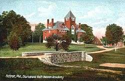
| 82 |
Sturtevant Hall |
|
000000001977-09-19-0000September 19, 1977
(#77000079) |
State Route 119
44°12′02″N 70°24′34″W / 44.200556°N 70.409444°W / 44.200556; -70.409444 (Sturtevant Hall) |
Hebron |
John Calvin Stevens, architect (1891).
|
| 83 |
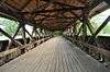
Sunday River Bridge |
|
000000001970-02-16-0000February 16, 1970
(#70000059) |
West of Newry, over the Sunday River
44°29′31″N 70°50′36″W / 44.491944°N 70.843333°W / 44.491944; -70.843333 (Sunday River Bridge) |
Newry |
Also known locally as the Artist's Bridge.
|
| 84 |
Town of Rumford Site |
Upload image |
000000001992-11-14-0000November 14, 1992
(#92001507) |
Address Restricted
|
Rumford |
|
| 85 |
Union Church |
|
000000001980-06-22-0000June 22, 1980
(#80000245) |
Off State Route 140
44°17′40″N 70°22′13″W / 44.294444°N 70.370278°W / 44.294444; -70.370278 (Union Church) |
Buckfield |
|
| 86 |
Upton Grange No. 404 (Former) |
|
000000002000-10-12-0000October 12, 2000
(#00001206) |
Junction of State Route 26 and Mill Rd.
44°41′40″N 71°00′43″W / 44.694444°N 71.011944°W / 44.694444; -71.011944 (Upton Grange No. 404 (Former)) |
Upton |
|
| 87 |
Vail Site |
Upload image |
000000001980-01-23-0000January 23, 1980
(#80000246) |
Address Restricted
|
Parkertown Township |
|
| 88 |
Wadsworth Hall |
|
000000001974-01-21-0000January 21, 1974
(#74000182) |
South of Hiram
43°51′48″N 70°48′47″W / 43.863333°N 70.813056°W / 43.863333; -70.813056 (Wadsworth Hall) |
Hiram |
|
| 89 |
David Warren House |
|
000000001983-04-28-0000April 28, 1983
(#83000467) |
Off State Route 140
44°19′26″N 70°21′04″W / 44.323889°N 70.351111°W / 44.323889; -70.351111 (David Warren House) |
Hartford |
|
| 90 |
Waterford Historic District |
|
000000001980-04-24-0000April 24, 1980
(#80000247) |
State Routes 35 and 37
Boundary increase (listed 000000002011-08-23-0000August 23, 2011, refnum 11000583): 30 Valley Rd
44°10′54″N 70°43′01″W / 44.181667°N 70.716944°W / 44.181667; -70.716944 (Waterford Historic District) |
Waterford |
|
| 91 |
John Watson House |
|
000000001974-12-31-0000December 31, 1974
(#74000183) |
1 mile (1.6 km) northwest of Hiram on Benny Babb Hill Road
43°53′51″N 70°48′53″W / 43.8975°N 70.814722°W / 43.8975; -70.814722 (John Watson House) |
Hiram |
|
| 92 |
West Paris Lodge No. 15, I.O.O.F. |
|
000000002012-01-27-0000January 27, 2012
(#11001058) |
221 Main St.
44°19′33″N 70°34′21″W / 44.325819°N 70.572628°W / 44.325819; -70.572628 (West Paris Lodge No. 15, I.O.O.F.) |
West Paris |
|
| 93 |
Whitman Memorial Library |
|
000000001995-01-12-0000January 12, 1995
(#94001549) |
1 mile (1.6 km) southwest of the junction of State Routes 26 and 232
44°22′46″N 70°38′39″W / 44.379444°N 70.644167°W / 44.379444; -70.644167 (Whitman Memorial Library) |
Bryant Pond |
|
| 94 |
Benjamin Wiley House |
|
000000001980-11-10-0000November 10, 1980
(#80000248) |
Southeast of North Fryeburg on Fish St.
44°06′18″N 70°57′44″W / 44.105°N 70.962222°W / 44.105; -70.962222 (Benjamin Wiley House) |
North Fryeburg |
|