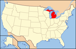
National Register of Historic Places listings in Bay County, Michigan
The following is a list of Registered Historic Places in Bay County, Michigan.
- This National Park Service list is complete through NPS recent listings posted December 16, 2016.[1]
| [2] | Name on the Register[3] | Image | Date listed[4] | Location | City or town | Description |
|---|---|---|---|---|---|---|
| 1 | Bay City Downtown Historic District | 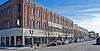 |
(#85002338) |
Roughly bounded by Saginaw River, Second and Adam Sts. and Center Ave. 43°36′00″N 83°53′18″W / 43.6°N 83.888333°W |
Bay City | |
| 2 | Bay City Masonic Temple |  |
(#16000216) |
700 N. Madison Ave. 43°35′49″N 83°53′04″W / 43.596956°N 83.884408°W |
Bay City | |
| 3 | Bay County Building | 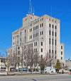 |
(#82002825) |
515 Center Ave. 43°35′54″N 83°53′06″W / 43.598333°N 83.885°W |
Bay City | |
| 4 | Center Avenue Neighborhood Residential District | 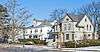 |
(#82002826) |
Roughly bounded by Green and N. Madison Aves, 5th and 6th Sts. 43°35′48″N 83°52′14″W / 43.596667°N 83.870556°W |
Bay City | |
| 5 | City Hall | 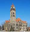 |
(#75000936) |
301 Washington St. 43°35′36″N 83°53′21″W / 43.593333°N 83.889167°W |
Bay City | |
| 6 | James Clements Airport Administration Building | 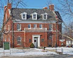 |
(#82000494) |
614 S. River Rd. 43°32′52″N 83°53′31″W / 43.547778°N 83.891944°W |
Bay City | |
| 7 | USS Edson (DD-946) | 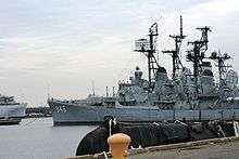 |
(#90000333) |
Saginaw River 43°36′50″N 83°52′10″W / 43.613953°N 83.869405°W |
Bay City | |
| 8 | Elm Lawn Cemetery | 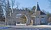 |
(#06000404) |
300 Ridge Rd. 43°35′19″N 83°51′29″W / 43.588611°N 83.858056°W |
Bay City | |
| 9 | Fletcher Site | 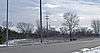 |
(#71001018) |
Address Restricted |
Bay City | |
| 10 | Mercy Hospital and Elizabeth McDowell Bialy Memorial House | |
(#80001848) |
15th and Water Sts. 43°35′11″N 83°53′34″W / 43.586389°N 83.892778°W |
Bay City | |
| 11 | Midland Street Commercial District |  |
(#82002827) |
Roughly bounded by John, Vermont, Catherine and Litchfield Sts. 43°36′06″N 83°53′57″W / 43.601667°N 83.899167°W |
Bay City | |
| 12 | Odd Fellows Valley Lodge No. 189 Building | 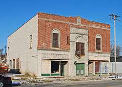 |
(#10000474) |
1900 Broadway Ave. 43°34′11″N 83°53′38″W / 43.569722°N 83.893889°W |
Bay City | |
| 13 | Pere Marquette Railroad Depot, Bay City Station |  |
(#82002828) |
919 Boutell Pl. 43°36′00″N 83°53′06″W / 43.6°N 83.885°W |
Bay City | |
| 14 | Sage Library | 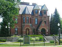 |
(#79001149) |
100 E. Midland St. 43°36′06″N 83°54′17″W / 43.601667°N 83.904722°W |
Bay City | |
| 15 | Saginaw River Light Station | 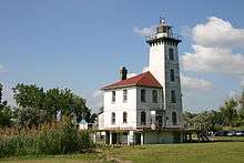 |
(#84001373) |
Coast Guard St. 43°38′08″N 83°51′01″W / 43.635556°N 83.850278°W |
Bay City | |
| 16 | Tromble House | 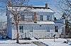 |
(#73000943) |
Veterans Memorial Park 43°35′28″N 83°53′59″W / 43.591111°N 83.899722°W |
Bay City |
Former listings
| [2] | Name on the Register | Image | Date listed | Date removed | Location | City or town | Summary |
|---|---|---|---|---|---|---|---|
| 1 | Bay City Bascule Bridge | 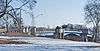 |
(#99001465) | M-13/M-84 over East Channel of Saginaw River 43°34′46″N 83°53′59″W / 43.579444°N 83.899722°W |
Bay City |
See also
| Wikimedia Commons has media related to National Register of Historic Places in Bay County, Michigan. |
- List of Registered Historic Places in Michigan
- List of Michigan State Historic Sites in Bay County, Michigan
References
- ↑ "National Register of Historic Places: Weekly List Actions". National Park Service, United States Department of the Interior. Retrieved on December 16, 2016.
- 1 2 Numbers represent an ordering by significant words. Various colorings, defined here, differentiate National Historic Landmarks and historic districts from other NRHP buildings, structures, sites or objects.
- ↑ National Park Service (2008-04-24). "National Register Information System". National Register of Historic Places. National Park Service.
- ↑ The eight-digit number below each date is the number assigned to each location in the National Register Information System database, which can be viewed by clicking the number.
| Lists by county |
|   |
|---|---|---|
| Other lists |
| |
| Topics | |
|---|---|
| Lists by states |
|
| Lists by insular areas | |
| Lists by associated states | |
| Other areas | |
| |
This article is issued from Wikipedia - version of the 5/22/2016. The text is available under the Creative Commons Attribution/Share Alike but additional terms may apply for the media files.