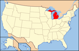
National Register of Historic Places listings in Branch County, Michigan
The following is a list of Registered Historic Places in Branch County, Michigan.
- This National Park Service list is complete through NPS recent listings posted December 16, 2016.[1]
| [2] | Name on the Register[3] | Image | Date listed[4] | Location | City or town | Description |
|---|---|---|---|---|---|---|
| 1 | Ezra E. and Florence (Holmes) Beardsley House | Upload image | (#15000157) |
1063 Holmes Rd 41°51′39″N 85°14′08″W / 41.860702°N 85.235505°W |
Bronson Township | |
| 2 | Coldwater Downtown Historic District |  |
(#90001124) |
W. Chicago St. from Division to Clay Sts. 41°56′28″N 85°00′14″W / 41.941111°N 85.003889°W |
Coldwater | |
| 3 | Benedict Doll House | Upload image | (#90001238) |
665 W. Chicago St. 41°56′08″N 85°01′42″W / 41.935556°N 85.028333°W |
Coldwater | |
| 4 | East Chicago Street Historic District | Upload image | (#75000937) |
Chicago St. from Wright St. to Division St. including parks 41°56′21″N 84°59′40″W / 41.939167°N 84.994444°W |
Coldwater | Boundary increase I (added 1990-08-06): Roughly, Pearl St. between Hudson and Lincoln Sts. Boundary increase II (added 1990-08-06): Roughly, Church St. from Jefferson to Daugherty Sts., Hull St. from Morse St. to Park Pl., and Park from Church to Hull |
| 5 | First Presbyterian Church | .jpg) |
(#86002111) |
52 Marshall St. 41°56′32″N 85°00′01″W / 41.942222°N 85.000278°W |
Coldwater | |
| 6 | Abram C. Fisk House | Upload image | (#89002306) |
867 E. Chicago Rd. 41°56′06″N 84°57′52″W / 41.935°N 84.964444°W |
Coldwater | |
| 7 | Lanphere-Pratt House | Upload image | (#90001237) |
90 Division St. 41°56′16″N 85°00′08″W / 41.937778°N 85.002222°W |
Coldwater | |
| 8 | Marshall Street Historic District | Upload image | (#90001123) |
Roughly bounded by Taylor, Hull, N. Hudson, Montgomery and Clay Sts. 41°56′44″N 85°00′07″W / 41.945556°N 85.001944°W |
Coldwater | |
| 9 | South Monroe Street Historic District | Upload image | (#90001121) |
89-175 and 90-146 S. Monroe St. and 17 Park Ave. 41°56′13″N 85°00′14″W / 41.936944°N 85.003889°W |
Coldwater | |
| 10 | Stancer-Road-North Coldwater River Bridge |  |
(#99001608) |
Stancer Rd. over N. Coldwater R. 42°01′17″N 85°05′27″W / 42.021389°N 85.090833°W |
Union Township | |
| 11 | US-12-Coldwater River Bridge | Upload image | (#99001609) |
Old US 12 over Coldwater Bridge 41°56′40″N 85°01′52″W / 41.944444°N 85.031111°W |
Coldwater | |
| 12 | West Pearl Street Historic District | Upload image | (#90001122) |
155-225 and 160-208 W. Pearl St. 41°56′26″N 85°00′32″W / 41.940556°N 85.008889°W |
Coldwater | |
| 13 | Wing House | Upload image | (#75000938) |
27 S. Jefferson St. 41°56′20″N 84°59′51″W / 41.938889°N 84.9975°W |
Coldwater |
See also
| Wikimedia Commons has media related to National Register of Historic Places in Branch County, Michigan. |
- List of Registered Historic Places in Michigan
- List of Michigan State Historic Sites in Branch County, Michigan
References
- ↑ "National Register of Historic Places: Weekly List Actions". National Park Service, United States Department of the Interior. Retrieved on December 16, 2016.
- ↑ Numbers represent an ordering by significant words. Various colorings, defined here, differentiate National Historic Landmarks and historic districts from other NRHP buildings, structures, sites or objects.
- ↑ National Park Service (2008-04-24). "National Register Information System". National Register of Historic Places. National Park Service.
- ↑ The eight-digit number below each date is the number assigned to each location in the National Register Information System database, which can be viewed by clicking the number.
This article is issued from Wikipedia - version of the 5/16/2016. The text is available under the Creative Commons Attribution/Share Alike but additional terms may apply for the media files.

