National Register of Historic Places listings in Jo Daviess County, Illinois

Location of Jo Daviess County in Illinois
This is a list of the National Register of Historic Places listings in Jo Daviess County, Illinois.
This is intended to be a complete list of the properties and districts on the National Register of Historic Places in Jo Daviess County, Illinois, United States. Latitude and longitude coordinates are provided for many National Register properties and districts; these locations may be seen together in a map.[1]
There are 17 properties and districts listed on the National Register in the county.
- This National Park Service list is complete through NPS recent listings posted December 16, 2016.[2]
Current listings
| [3] |
Name on the Register |
Image |
Date listed[4] |
Location |
City or town |
Description |
|---|
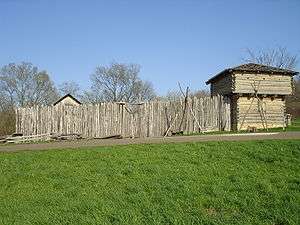
| 1 |
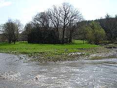
Apple River Fort Site |
|
000000001997-11-07-0000November 7, 1997
(#97001332) |
0.25 miles east-southeast of the junction of Mrytle and Illinois Sts.
42°19′05″N 90°12′51″W / 42.318056°N 90.214167°W / 42.318056; -90.214167 (Apple River Fort Site) |
Elizabeth |
|
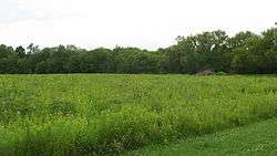
| 2 |
John Chapman Village Site |
|
000000002009-12-10-0000December 10, 2009
(#09001058) |
Western side of Illinois Route 84, south of Hanover[5]
42°14′33″N 90°16′03″W / 42.24250°N 90.26750°W / 42.24250; -90.26750 (John Chapman Village Site) |
Hanover |
|
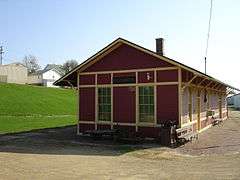
| 3 |
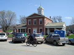
Chicago Great Western Railroad Depot |
|
000000001996-02-16-0000February 16, 1996
(#96000098) |
Myrtle St. between N. Madison and Vine Sts.
42°19′01″N 90°13′21″W / 42.316944°N 90.2225°W / 42.316944; -90.2225 (Chicago Great Western Railroad Depot) |
Elizabeth |
|
| 4 |
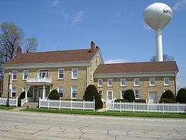
East Dubuque School |
|
000000001982-11-12-0000November 12, 1982
(#82000396) |
Montgomery Ave.
42°29′38″N 90°38′29″W / 42.493889°N 90.641389°W / 42.493889; -90.641389 (East Dubuque School) |
East Dubuque |
|
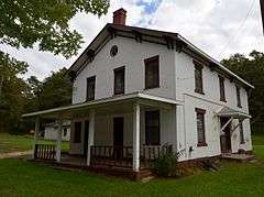
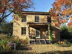
| 5 |
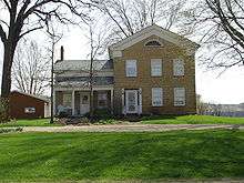
Henry N. Frentess Farmstead |
|
000000002011-02-04-0000February 4, 2011
(#10001202) |
19140 U.S. Route 20 W.
42°28′20″N 90°36′30″W / 42.472222°N 90.608333°W / 42.472222; -90.608333 (Henry N. Frentess Farmstead) |
East Dubuque |
|
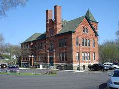
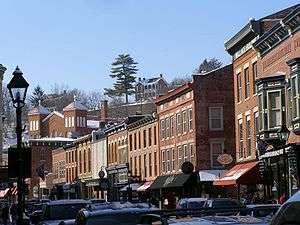
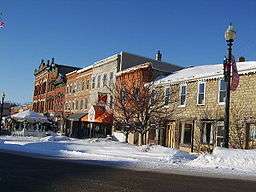
| 6 |
Galena Historic District |
|
000000001969-10-18-0000October 18, 1969
(#69000056) |
Roughly bounded by Davis Creek and 4th, 5th, Adams, Field, Wann, N. Dodge, Fulton, N. Hickory, Hill, Ridge, and Spring Sts.
42°25′06″N 90°25′40″W / 42.418333°N 90.427778°W / 42.418333; -90.427778 (Galena Historic District) |
Galena |
Boundary increase and decrease October 23, 2013.
|
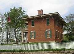
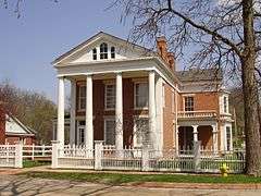
| 7 |
Ulysses S. Grant House |
|
000000001966-10-15-0000October 15, 1966
(#66000322) |
511 Bouthillier St.
42°24′40″N 90°25′27″W / 42.411111°N 90.424167°W / 42.411111; -90.424167 (Ulysses S. Grant House) |
Galena |
|
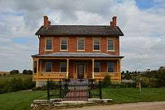
| 8 |
Henry W. Miller House |
|
000000002010-10-13-0000October 13, 2010
(#10000836) |
11672 W. Norris Ln.
42°26′48″N 90°27′36″W / 42.446667°N 90.46°W / 42.446667; -90.46 (Henry W. Miller House) |
Galena |
|
| 9 |
Millville Town Site |
|
000000002003-03-03-0000March 3, 2003
(#03000066) |
Apple River Canyon State Park, 8663 E. Canyon Rd.
42°26′36″N 90°03′07″W / 42.443333°N 90.051944°W / 42.443333; -90.051944 (Millville Town Site) |
Apple River |
|
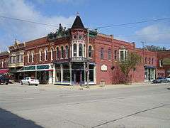
| 10 |
Old Market House |
|
000000001973-07-16-0000July 16, 1973
(#73000707) |
Market Square-Commerce St.
42°24′56″N 90°25′38″W / 42.415556°N 90.427222°W / 42.415556; -90.427222 (Old Market House) |
Galena |
|
| 11 |
Old Stone Hotel |
|
000000001975-04-16-0000April 16, 1975
(#75000665) |
110 W. Main St.
42°29′50″N 89°59′28″W / 42.497222°N 89.991111°W / 42.497222; -89.991111 (Old Stone Hotel) |
Warren |
|
| 12 |
Scales Mound Historic District |
|
000000001990-09-05-0000September 5, 1990
(#90001199) |
Roughly bounded by the village limits
42°28′55″N 90°15′10″W / 42.481944°N 90.252778°W / 42.481944; -90.252778 (Scales Mound Historic District) |
Scales Mound |
|
| 13 |
Townsend House |
|
000000002005-05-17-0000May 17, 2005
(#05000111) |
117 N. Canyon Park Rd.
42°22′26″N 90°03′03″W / 42.373889°N 90.050833°W / 42.373889; -90.050833 (Townsend House) |
Stockton |
|
| 14 |
Warren Commercial Historic District |
|
000000001995-11-07-0000November 7, 1995
(#95001241) |
102-165 E. Main St., 204-210 E. Bunett, 102-108 S. Railroad
42°29′45″N 89°59′15″W / 42.495833°N 89.9875°W / 42.495833; -89.9875 (Warren Commercial Historic District) |
Warren |
|
| 15 |
Elihu Benjamin Washburne House |
|
000000001973-07-05-0000July 5, 1973
(#73000708) |
908 3rd St.
42°24′50″N 90°25′54″W / 42.413889°N 90.431667°W / 42.413889; -90.431667 (Elihu Benjamin Washburne House) |
Galena |
|
| 16 |
Charles Wenner House |
|
000000001984-08-22-0000August 22, 1984
(#84001073) |
Rocky Rd.
42°27′40″N 90°24′39″W / 42.461111°N 90.410833°W / 42.461111; -90.410833 (Charles Wenner House) |
Galena |
|
| 17 |
W.E. White Building |
|
000000001997-11-07-0000November 7, 1997
(#97001339) |
100 N. Main St.
42°21′00″N 90°00′24″W / 42.35°N 90.006667°W / 42.35; -90.006667 (W.E. White Building) |
Stockton |
|
See also
References
- ↑ The latitude and longitude information provided in this table was derived originally from the National Register Information System, which has been found to be fairly accurate for about 99% of listings. For about 1% of NRIS original coordinates, experience has shown that one or both coordinates are typos or otherwise extremely far off; some corrections may have been made. A more subtle problem causes many locations to be off by up to 150 yards, depending on location in the country: most NRIS coordinates were derived from tracing out latitude and longitudes off of USGS topographical quadrant maps created under the North American Datum of 1927, which differs from the current, highly accurate WGS84 GPS system used by most on-line maps. Chicago is about right, but NRIS longitudes in Washington are higher by about 4.5 seconds, and are lower by about 2.0 seconds in Maine. Latitudes differ by about 1.0 second in Florida. Some locations in this table may have been corrected to current GPS standards.
- ↑ "National Register of Historic Places: Weekly List Actions". National Park Service, United States Department of the Interior. Retrieved on December 16, 2016.
- ↑ Numbers represent an ordering by significant words. Various colorings, defined here, differentiate National Historic Landmarks and historic districts from other NRHP buildings, structures, sites or objects.
- ↑ The eight-digit number below each date is the number assigned to each location in the National Register Information System database, which can be viewed by clicking the number.
- ↑ "Grant Propoosal: Wapello Land & Water Reserve Habitat Restoration Project". Illinois Department of Natural Resources, 2006, 2/18.
|
|---|
|
| Topics | |
|---|
|
| Lists by states | |
|---|
|
| Lists by insular areas | |
|---|
|
| Lists by associated states | |
|---|
|
| Other areas | |
|---|
|
-
 Portal Portal
-
 WikiProject WikiProject
|