Catasauqua, Pennsylvania
| Borough of Catasauqua | |
| Borough | |
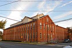 Dery Silk Mill in the Biery's Port Historic District | |
| Country | United States |
|---|---|
| State | Pennsylvania |
| County | Lehigh |
| Elevation | 279 ft (85.0 m) |
| Coordinates | 40°39′11″N 75°28′03″W / 40.65306°N 75.46750°WCoordinates: 40°39′11″N 75°28′03″W / 40.65306°N 75.46750°W |
| Area | 1.3 sq mi (3.4 km2) |
| - land | 1.3 sq mi (3 km2) |
| - water | 0.0 sq mi (0 km2), 0% |
| Population | 6,588 (2000) |
| Density | 5,205.7/sq mi (2,009.9/km2) |
| Mayor | Barbara Schlegel |
| Timezone | EST (UTC-5) |
| - summer (DST) | EDT (UTC-4) |
| ZIP code | 18032 |
| Area code | 610 and 484 |
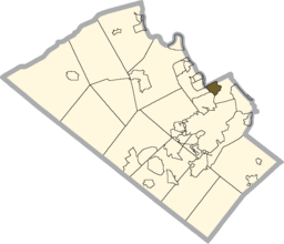 Location of Catasauqua in Lehigh County
| |
 Location of Catasauqua in Pennsylvania
| |
 Location of Pennsylvania in the United States
| |
| Website: http://www.catasauqua.org | |
Catasauqua is a borough in Lehigh County, Pennsylvania, settled in 1805 and chartered as a borough in 1853. Catasauqua is a suburb of Allentown, Pennsylvania in the Lehigh Valley region of the state. Catasauqua is included in the Allentown-Bethlehem-Easton, PA-NJ Metropolitan Statistical Area, which is also included in the New York City-Newark, New Jersey, NY-NJ-CT-PA Combined Statistical Area.
Historically, manufacturing was Catasauqua's principal industry, and, in 1839, it was the location of the first manufactured anthracite iron in the nation. Catasauqua's population in 1910 was 5,250. The population was 6,588 at the 2000 census. The word Catasauqua is shortened to "Catty" in local dialect when speaking of the place.
Borough officials
- Vince Smith - Borough President
- Jessica Kroope - Council Vice-President
- Brian K. McKittrick - Council Member
- Deb Mellish - Council Member
- Brian Bartholomew - Council Member
- Christine Weaver - Council Member
- Eugene Schlegel - Council Member
- Barbara Schlegel - Mayor
- Douglas Kish - Police Chief
- Richard Hertzog Jr - Fire Chief
Geography
Catasauqua is located at 40°39′11″N 75°28′3″W / 40.65306°N 75.46750°W (40.652995, -75.467627).[1] Nearby large communities include Allentown three miles (5 km) to the south and Bethlehem seven miles (11 km) to the east.
According to the United States Census Bureau, the borough has a total area of 1.3 square miles (3.4 km2), of which, 1.3 square miles (3.4 km2) of it is land and 0.04 square miles (0.10 km2 or 2.31%) of it is water. The Catasauqua Creek flows through the town. The Lehigh River runs along the southwest edge of Catasauqua.
Neighboring municipalities
- Hanover Township, Lehigh County, Pennsylvania
- North Catasauqua
- Whitehall Township, Lehigh County, Pennsylvania
- Northampton, Pennsylvania
- Allentown, Pennsylvania
- Allen Township, Northampton County, Pennsylvania
- Bethlehem, Pennsylvania
- Coplay
- Hokendauqua
Demographics
| Historical population | |||
|---|---|---|---|
| Census | Pop. | %± | |
| 1860 | 1,932 | — | |
| 1870 | 2,853 | 47.7% | |
| 1880 | 3,065 | 7.4% | |
| 1890 | 3,704 | 20.8% | |
| 1900 | 3,963 | 7.0% | |
| 1910 | 5,250 | 32.5% | |
| 1920 | 4,714 | −10.2% | |
| 1930 | 4,851 | 2.9% | |
| 1940 | 4,764 | −1.8% | |
| 1950 | 4,923 | 3.3% | |
| 1960 | 5,062 | 2.8% | |
| 1970 | 5,702 | 12.6% | |
| 1980 | 6,711 | 17.7% | |
| 1990 | 6,662 | −0.7% | |
| 2000 | 6,588 | −1.1% | |
| 2010 | 6,436 | −2.3% | |
| Est. 2015 | 6,525 | [2] | 1.4% |
| Sources:[3][4][5] | |||
As of the census[4] of 2000, there were 6,588 people, 2,616 households, and 1,750 families residing in the borough. The population density was 5,205.7 people per square mile (2,002.9/km2). There were 2,747 housing units at an average density of 2,170.6 per square mile (835.1/km2). The racial makeup of the borough was 95.60% White, 1.18% African American, 0.33% Native American, 0.59% Asian, 0.02% Pacific Islander, 1.08% from other races, and 1.20% from two or more races. Hispanic or Latino of any race were 3.54% of the population.
There were 2,616 households out of which 33.6% had children under the age of 18 living with them, 49.5% were married couples living together, 12.1% had a female householder with no husband present, and 33.1% were non-families. 27.6% of all households were made up of individuals and 10.8% had someone living alone who was 65 years of age or older. The average household size was 2.50 and the average family size was 3.04.
In the borough the age distribution of the population shows 25.0% under the age of 18, 7.7% from 18 to 24, 32.1% from 25 to 44, 22.3% from 45 to 64, and 12.9% who were 65 years of age or older. The median age was 36 years. For every 100 females there were 94.1 males. For every 100 females age 18 and over, there were 91.1 males.
The median income for a household in the borough was $42,432, and the median income for a family was $48,589. Males had a median income of $32,320 versus $45,730 for females. The per capita income for the borough was $18,906. About 5.4% of families and 8.0% of the population were below the poverty line, including 11.7% of those under age 18 and 11.2% of those age 65 or over.
History
George Taylor, signer of the Declaration of Independence, built a Georgian stone house in 1768 in what is now the borough of Catasauqua. Today, the George Taylor House is a National Historic Landmark, a showpiece of the community's rich historical heritage.
In 1840, the anthracite iron industry was founded in what is now known as Catasauqua, originally Biery's Port, making it a birthplace of the Industrial Revolution in the United States.[6] Welsh immigrant David Thomas relocated to the area and opened the Crane Iron Works. Remembered as "the father of Catasauqua," Thomas initially named the community Craneville, after his former employer in Wales.
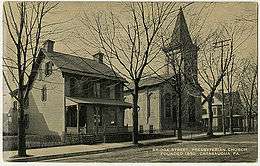
The wealthy, generous Thomases were responsible for many sweeping changes to the prosperity of the community. David Thomas founded the Presbyterian Church of Catasauqua, in which residents still worship today, and his wife Elizabeth donated money and land to found the Welsh Congregational Church, which no longer exists. Thomas organized Catasauqua's first fire company, installed its first public water system, and served as its first burgess.
In 1854, the town was formally titled Catasauqua (pronounced "Cat-uh-SAW-kwuh"), from the Lenni Lenape language, meaning "dry ground" or "thirsty ground."
Catasauqua is home to two different neighborhoods listed on the National Register of Historic Places. One is Biery's Port, located along the Lehigh River and named for an early family of prominence; the other is known as "the mansion district," and comprises Victorian homes once owned by wealthy residents.
By 1900, Catasauqua boasted 5,000 residents, and had the highest percentage of self-made millionaires of any town in the United States.
In 1917, while many of the young men of the town served in World War I, Catasauqua became the first community in the United States to raise $1 million in war bonds, earning it the nickname "The Million Dollar Town".
Catasauqua observed its 150th anniversary of incorporation in 2004. In July 2014, the town also celebrated its 100th anniversary of the old home week celebration in 1914. The original old home week marked the 75th anniversary of the Lehigh Valley Crane Iron Works
Notable people
- Celebrated World War II P-38 fighter pilot and Triple Ace of the 39th Fighter Squadron, 35th Fighter Group, Thomas Lynch. Native of Catasauqua and graduate of Catasauqua High School.
- The Fuller Family of Catasauqua, Mayflower descendants, Civil War veterans, and business leaders (Chauncey Day Fuller and Sarah (Abbott) Fuller; George W. Fuller; James Wheeler Fuller, I and Clarissa (Miller) Fuller; James Wheeler Fuller, II; James Wheeler Fuller, III; Orange Fuller; Orlando Fuller, et al.).
- Buck Freeman, professional baseball player, 1891-1907. Played with Washington Senators. Born in Catasauqua.[7]
- Pat Kelly, professional baseball player, New York Yankees, 1991-97. Catasauqua High School graduate.
- Bert Kuczynski, pitcher for the Philadelphia Athletics, 1943, and tight end in the NFL for the Detroit Lions, 1943, and Philadelphia Eagles, 1946. Taught and coached at Catasauqua High School.
- Larry Miller, Class of 1964, Basketball Star for University of North Carolina during the 1960s and played professionally in the ABA from 1968-1975 as a member of the Los Angeles Stars, Carolina Cougars, San Diego Conquistadors, Virginia Squires, and Utah Stars.
- Jonathan Linton played professional football for the Buffalo Bills.
- Anthony Recker currently plays professional baseball for the New York Mets.
Public education
The Borough is served by the Catasauqua Area School District. The school district has 3 schools: Sheckler Elementary (grades k-4), Catasauqua Middle School (grades 5-8), and Catasauqua High School (grades 9-12). The district also serves parts of Hanover Township, Lehigh County, Pennsylvania and North Catasauqua
References
- ↑ "US Gazetteer files: 2010, 2000, and 1990". United States Census Bureau. 2011-02-12. Retrieved 2011-04-23.
- ↑ "Annual Estimates of the Resident Population for Incorporated Places: April 1, 2010 to July 1, 2015". Retrieved July 2, 2016.
- ↑ "Census of Population and Housing". U.S. Census Bureau. Archived from the original on 11 May 2015. Retrieved 11 December 2013.
- 1 2 "American FactFinder". United States Census Bureau. Archived from the original on 2013-09-11. Retrieved 2008-01-31.
- ↑ "Incorporated Places and Minor Civil Divisions Datasets: Subcounty Resident Population Estimates: April 1, 2010 to July 1, 2012". Population Estimates. U.S. Census Bureau. Archived from the original on 17 June 2013. Retrieved 11 December 2013.
- ↑ Savidge, Mariella (April 15, 2002). "Historical group finds new base". Allentown, Pennsylvania: The Morning Call. Retrieved September 15, 2010.
- ↑ Reichler, Joseph L., ed. (1979) [1969]. The Baseball Encyclopedia (4th ed.). New York: Macmillan Publishing. ISBN 0-02-578970-8.
Further reading
- Catasauqua and North Catasauqua (a book on Catasauqua, Pennsylvania) (ISBN 0-7385-1103-X).
External links
- Borough website
- Company F, 47th Regiment, Pennsylvania Volunteer Infantry (a Civil War regiment formed in Catasauqua)
- Historic Catasauqua Preservation Association
 |
Hokendauqua | North Catasauqua | Allen Township | |
| West Catasauqua | |
Lehigh Valley International Airport | ||
| ||||
| | ||||
| Fullerton | Hanover Township | Hanover Township |
Municipalities and communities of Lehigh County, Pennsylvania, United States | ||
|---|---|---|
| Cities | 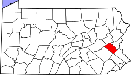 | |
| Boroughs | ||
| Townships | ||
| CDPs | ||
| Unincorporated communities |
| |
| Footnotes | ‡This populated place also has portions in an adjacent county or counties | |