Pennington County, Minnesota
| Pennington County, Minnesota | |
|---|---|
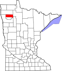 Location in the U.S. state of Minnesota | |
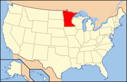 Minnesota's location in the U.S. | |
| Founded | November 23, 1910[1] |
| Named for | Edmund Pennington, a longtime railroad operator |
| Seat | Thief River Falls |
| Largest city | Thief River Falls |
| Area | |
| • Total | 618 sq mi (1,601 km2) |
| • Land | 617 sq mi (1,598 km2) |
| • Water | 1.7 sq mi (4 km2), 0.3% |
| Population (est.) | |
| • (2015) | 14,219 |
| • Density | 23/sq mi (9/km²) |
| Congressional district | 7th |
| Time zone | Central: UTC-6/-5 |
| Website |
co |
Pennington County is a county located in the U.S. state of Minnesota. As of the 2010 census, the population was 13,930.[2] Its county seat is Thief River Falls.[3] The county was formed on November 23, 1910, from sections of Red Lake County. It was named after Edmund Pennington, vice president of the Minneapolis, St. Paul and Sault Ste. Marie Railway.[4]
Geography
According to the U.S. Census Bureau, the county has a total area of 618 square miles (1,600 km2), of which 617 square miles (1,600 km2) is land and 1.7 square miles (4.4 km2) (0.3%) is water.[5] Pennington is one of 17 Minnesota savanna region counties with more savanna soils than either prairie or forest soils.


Major highways
 U.S. Highway 59
 Minnesota State Highway 1
 Minnesota State Highway 32
 Minnesota State Highway 219
- Pennington County 3: Major connector between Pennington County and Grand Forks. Connects with Polk County 21.
- Pennington County 17: Connects Thief River Falls to the Airport.
- Pennington County 10: Major gravel route, also known as Pembina Trail.
- Pennington County 16: US-59 Truck Bypass of Thief River Falls, connects US-59 / MN-1 on the west side of town to MN-32 on the south side of town.
- Pennington County 27 & 28: Designated and designed for heavy truck traffic connecting US-2 to Roseau County and Marshall County.
Adjacent counties
- Marshall County (north)
- Beltrami County (east)
- Clearwater County (southeast)
- Red Lake County (south)
- Polk County (west)
Demographics
| Historical population | |||
|---|---|---|---|
| Census | Pop. | %± | |
| 1910 | 9,376 | — | |
| 1920 | 12,091 | 29.0% | |
| 1930 | 10,487 | −13.3% | |
| 1940 | 12,913 | 23.1% | |
| 1950 | 12,965 | 0.4% | |
| 1960 | 12,468 | −3.8% | |
| 1970 | 13,266 | 6.4% | |
| 1980 | 15,258 | 15.0% | |
| 1990 | 13,306 | −12.8% | |
| 2000 | 13,584 | 2.1% | |
| 2010 | 13,930 | 2.5% | |
| Est. 2015 | 14,219 | [7] | 2.1% |
| U.S. Decennial Census[8] 1790-1960[9] 1900-1990[10] 1990-2000[11] 2010-2015[2] | |||

As of the census of 2000,[12] there were 13,584 people, 5,525 households, and 3,552 families residing in the county. The population density was 22 people per square mile (9/km²). There were 6,033 housing units at an average density of 10 per square mile (4/km²). The racial makeup of the county was 97.02% White, 0.21% Black or African American, 0.82% Native American, 0.59% Asian, 0.04% Pacific Islander, 0.51% from other races, and 0.81% from two or more races. 1.24% of the population were Hispanic or Latino of any race. 49.0% were of Norwegian, 15.4% German and 7.2% Swedish ancestry.
There were 5,525 households out of which 30.60% had children under the age of 18 living with them, 51.70% were married couples living together, 9.10% had a female householder with no husband present, and 35.70% were non-families. 29.50% of all households were made up of individuals and 12.60% had someone living alone who was 65 years of age or older. The average household size was 2.38 and the average family size was 2.95.
In the county the population was spread out with 24.50% under the age of 18, 10.30% from 18 to 24, 26.50% from 25 to 44, 22.90% from 45 to 64, and 15.80% who were 65 years of age or older. The median age was 38 years. For every 100 females there were 97.50 males. For every 100 females age 18 and over, there were 94.60 males.
The median income for a household in the county was $34,216, and the median income for a family was $43,936. Males had a median income of $30,771 versus $21,078 for females. The per capita income for the county was $17,346. About 7.70% of families and 11.10% of the population were below the poverty line, including 10.70% of those under age 18 and 14.80% of those age 65 or over.
Communities
Cities
- Goodridge
- St. Hilaire
- Thief River Falls (county seat)
Townships
- Black River Township
- Bray Township
- Clover Leaf Township
- Deer Park Township
- Goodridge Township
- Hickory Township
- Highlanding Township
- Kratka Township
- Mayfield Township
- Norden Township
- North Township
- Numedal Township
- Polk Centre Township
- Reiner Township
- River Falls Township
- Rocksbury Township
- Sanders Township
- Silverton Township
- Smiley Township
- Star Township
- Wyandotte Township
Unincorporated communities
- Carpenters Corner
- Dakota Junction
- Erie
- Hazel
- Highlanding
- Kratka
- Mavie
- River Valley
- Siverton
See also
References
- ↑ "Minnesota Place Names". Minnesota Historical Society. Retrieved March 18, 2014.
- 1 2 "State & County QuickFacts". United States Census Bureau. Retrieved September 1, 2013.
- ↑ "Find a County". National Association of Counties. Retrieved 2011-06-07.
- ↑ Upham, Warren (1920). Minnesota Geographic Names: Their Origin and Historic Significance. Minnesota Historical Society. p. 406.
- ↑ "2010 Census Gazetteer Files". United States Census Bureau. August 22, 2012. Retrieved October 24, 2014.
- ↑ Nelson, Steven (2011). Savanna Soils of Minnesota. Minnesota: Self. pp. 57 - 60. ISBN 978-0-615-50320-2.
- ↑ "County Totals Dataset: Population, Population Change and Estimated Components of Population Change: April 1, 2010 to July 1, 2015". Retrieved July 2, 2016.
- ↑ "U.S. Decennial Census". United States Census Bureau. Retrieved October 24, 2014.
- ↑ "Historical Census Browser". University of Virginia Library. Retrieved October 24, 2014.
- ↑ "Population of Counties by Decennial Census: 1900 to 1990". United States Census Bureau. Retrieved October 24, 2014.
- ↑ "Census 2000 PHC-T-4. Ranking Tables for Counties: 1990 and 2000" (PDF). United States Census Bureau. Retrieved October 24, 2014.
- ↑ "American FactFinder". United States Census Bureau. Retrieved 2008-01-31.
 |
Marshall County | | ||
| Polk County | |
Beltrami County | ||
| ||||
| | ||||
| Red Lake County | Clearwater County |
Municipalities and communities of Pennington County, Minnesota, United States | ||
|---|---|---|
| Cities | | |
| Townships | ||
| Unincorporated communities | ||
| Indian reservation | ||
| Footnotes | ‡This populated place also has portions in an adjacent county or counties | |
Coordinates: 48°04′N 96°02′W / 48.07°N 96.04°W