Ramsey County, Minnesota
| Ramsey County, Minnesota | ||
|---|---|---|
 | ||
| ||
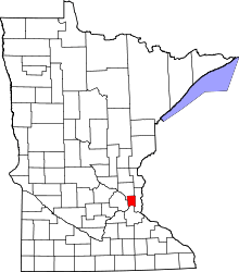 Location in the U.S. state of Minnesota | ||
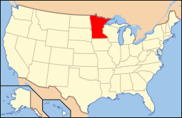 Minnesota's location in the U.S. | ||
| Founded | October 27, 1849[1] | |
| Named for | Alexander Ramsey | |
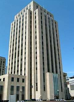
| Seat | Saint Paul | |
| Largest city | Saint Paul | |
| Area | ||
| • Total | 170 sq mi (440 km2) | |
| • Land | 152 sq mi (394 km2) | |
| • Water | 18 sq mi (47 km2), 11% | |
| Population (est.) | ||
| • (2015) | 538,133 | |
| • Density | 3,342/sq mi (1,290/km²) | |
| Congressional district | 4th | |
| Time zone | Central: UTC-6/-5 | |
| Website |
www | |
Ramsey County is a county located in the U.S. state of Minnesota. As of the 2010 census, the population was 508,640,[2] making it the second-most populous county in Minnesota. Its county seat is St. Paul,[3] which is also Minnesota's state capital. The county was founded in 1849 and is named for Alexander Ramsey (W), the first governor of the Minnesota Territory.[4]
Ramsey County is included in the Minneapolis–Saint Paul-Bloomington, MN-WI Metropolitan Statistical Area. It is the smallest and most densely populated county in Minnesota, as well as one of the most densely populated counties in the United States.[5]
Government and politics
| Year | Democratic | Republican |
|---|---|---|
| 2016 | 65.7% 176,929 | 26.3% 70,778 |
| 2012 | 66.6% 184,936 | 31.2% 86,799 |
| 2008 | 66.0% 182,974 | 32.1% 88,942 |
| 2004 | 63.0% 171,846 | 35.6% 97,096 |
| 2000 | 56.7% 138,470 | 35.9% 87,669 |
| 1996 | 58.7% 133,878 | 29.3% 66,954 |
| 1992 | 52.0% 130,932 | 27.1% 68,206 |
| 1988 | 61.2% 143,767 | 37.8% 88,736 |
| 1984 | 59.1% 141,623 | 40.0% 95,667 |
| 1980 | 53.6% 124,774 | 33.9% 78,860 |
| 1976 | 58.6% 133,682 | 37.9% 86,480 |
| 1972 | 51.6% 108,392 | 45.6% 95,716 |
| 1968 | 62.6% 122,568 | 32.7% 64,068 |
| 1964 | 69.9% 133,948 | 29.7% 56,898 |
| 1960 | 58.1% 108,464 | 41.5% 77,408 |
County Sheriff
The Ramsey County Sheriff is the top law enforcement official in Ramsey County. The Ramsey County Sheriff is elected for a four-year term via an election running concurrent with the federal mid-term elections.
The current sheriff is Matt Bostrom, who was elected Sheriff in 2010 by winning over four-term incumbent Bob Fletcher by a 14% margin.
Providing safety in Ramsey County is a collaborative effort across multiple agencies. The Ramsey County Sheriff's office provides a number of unique services across the county as mandated by law. This includes detention for court and other court services. This also includes safety, rescue and law enforcement on the waterways.
Proactively, the Sheriff's office provides multiple safety classes and coordinates community volunteer efforts.
The sheriff's office provides patrol and investigation for communities without local police forces and is available as backup for all communities. An emergency 911 call will send the appropriate agency according to the caller's location and law enforcement availability.

| Community | Law Enforcement | Fire Protection | Ambulance |
|---|---|---|---|
| Arden Hills | Ramsey County Sheriff | Lake Johanna Fire | Allina Medical Transport |
| Falcon Heights | Saint Anthony Police | Falcon Heights Fire | Saint Paul Fire |
| Gem Lake | Ramsey County Sheriff | White Bear Lake Fire | White Bear Lake Fire |
| Lauderdale | Saint Anthony Police | Falcon Heights Fire | Saint Paul Fire |
| Little Canada | Ramsey County Sheriff | Little Canada Fire & Rescue | Allina Medical Transport |
| Maplewood | Maplewood Police | Maplewood Fire | Maplewood Fire |
| Minnesota State Fairgrounds | Minnesota State Fair Police | Saint Paul Fire | Saint Paul Fire |
| Mounds View | Mounds View Police | SBM Fire | Allina Medical Transport |
| New Brighton | New Brighton Police Division | New Brighton Fire Division | Allina Medical Transport |
| North Oaks | Ramsey County Sheriff | Lake Johanna Fire | Allina Medical Transport |
| North Saint Paul | North Saint Paul Police | North Saint Paul Fire | Lakeview Emergency Medical |
| Roseville | Roseville Police | Roseville Fire | Allina Medical Transport |
| Saint Anthony | Saint Anthony Police | Saint Anthony Fire | Allina Medical Transport |
| Saint Paul | Saint Paul Police | Saint Paul Fire | Saint Paul Fire |
| Shoreview | Ramsey County Sheriff | Lake Johanna Fire | Allina Medical Transport |
| University of Minnesota-St. Paul | University Police | Saint Paul Fire | Saint Paul Fire |
| Vadnais Heights | Ramsey County Sheriff | Vadnais Heights Fire | Allina Medical Transport |
| White Bear Lake | White Bear Lake Police | White Bear Lake Fire | White Bear Lake Fire |
| White Bear Township | Ramsey County Sheriff | White Bear Lake Fire | White Bear Lake Fire |
County Attorney
The Ramsey County Attorney prosecutes felony crimes that occur within the jurisdiction of Ramsey County. The current County Attorney is John Choi, who was elected in 2010.
County Commissioners
The county commission elects a chair who presides at meetings. Commissioners as of September 2015
| District | Commissioner | In office since | Current term expires on December 31 of |
|---|---|---|---|
| 1st | Blake Huffman | 2013 | 2016 |
| 2nd | Mary Jo McGuire | 2013 | 2016 |
| 3rd | Janice Rettman | 1997 | 2018 |
| 4th | Toni Carter | 2005 | 2018 |
| 5th | Rafael Ortega | 1995 | 2018 |
| 6th | Jim McDonough | 2000 | 2018 |
| 7th | Victoria Reinhardt (Chair) | 1997 | 2016 |
Geography
According to the U.S. Census Bureau, the county has a total area of 170 square miles (440 km2), of which 152 square miles (390 km2) is land and 18 square miles (47 km2) (11%) is water.[8] It is the smallest county by area in Minnesota. It has been considered completely urbanized since the 1990 United States Census.[9]
Major highways
.svg.png) Interstate 35E
Interstate 35E.svg.png) Interstate 35W
Interstate 35W.svg.png) Interstate 94
Interstate 94.svg.png) Interstate 694
Interstate 694 U.S. Highway 10
 U.S. Highway 52
 U.S. Highway 61
 Minnesota State Highway 5
 Minnesota State Highway 13
 Minnesota State Highway 36
 Minnesota State Highway 51
 Minnesota State Highway 96
 Minnesota State Highway 120
 Minnesota State Highway 149
 Minnesota State Highway 156
 Minnesota State Highway 280
.svg.png) County Road 30 (Larpenteur Avenue)
County Road 30 (Larpenteur Avenue).svg.png) County Road 34 (University Avenue)
County Road 34 (University Avenue).svg.png)
 County Road 36/37 (Shepard Road/Warner Road)
County Road 36/37 (Shepard Road/Warner Road)- Other county roads
Adjacent counties
- Anoka County (north)
- Washington County (east)
- Dakota County (south)
- Hennepin County (west)
National protected area
Demographics
| Historical population | |||
|---|---|---|---|
| Census | Pop. | %± | |
| 1850 | 2,227 | — | |
| 1860 | 12,150 | 445.6% | |
| 1870 | 23,085 | 90.0% | |
| 1880 | 45,890 | 98.8% | |
| 1890 | 139,796 | 204.6% | |
| 1900 | 170,554 | 22.0% | |
| 1910 | 223,675 | 31.1% | |
| 1920 | 244,554 | 9.3% | |
| 1930 | 286,721 | 17.2% | |
| 1940 | 309,935 | 8.1% | |
| 1950 | 355,332 | 14.6% | |
| 1960 | 422,525 | 18.9% | |
| 1970 | 476,255 | 12.7% | |
| 1980 | 459,784 | −3.5% | |
| 1990 | 485,765 | 5.7% | |
| 2000 | 511,035 | 5.2% | |
| 2010 | 508,640 | −0.5% | |
| Est. 2015 | 538,133 | [10] | 5.8% |
| U.S. Decennial Census[11] 1790-1960[12] 1900-1990[13] 1990-2000[14] 2010-2015[2] | |||

As of the census of 2000, there were 511,035 people, 201,236 households, and 119,936 families residing in the county. The population density was 3,281 people per square mile (1,267/km²). There were 206,448 housing units at an average density of 1,325 per square mile (512/km²). The racial makeup of the county was 77.37% White, 7.61% Black or African American, 0.83% Native American, 8.77% Asian, 0.06% Pacific Islander, 2.45% from other races, and 2.90% from two or more races. 5.28% of the population were Hispanic or Latino of any race.
In terms of people who specified European ancestry in the 2005-2007 American Community Survey, the county was 31.2% German, 14.3% Irish, 11.3% Norwegian, 9.5% Swedish, 7.2% English, and 5.9% French and/or French Canadian. There is also a visible community of people of Sub-Saharan African ancestry, representing 2.9% of Ramsey County's population.
There were 201,236 households out of which 29.80% had children under the age of 18 living with them, 44.00% were married couples living together, 11.90% had a female householder with no husband present, and 40.40% were non-families. 32.00% of all households were made up of individuals and 9.50% had someone living alone who was 65 years of age or older. The average household size was 2.45 and the average family size was 3.16.
In the county the population was spread out with 25.60% under the age of 18, 11.30% from 18 to 24, 30.70% from 25 to 44, 20.70% from 45 to 64, and 11.60% who were 65 years of age or older. The median age was 34 years. For every 100 females there were 93.00 males. For every 100 females age 18 and over, there were 89.20 males.
The median income for a household in the county was $45,722, and the median income for a family was $57,747. (These figures had risen to $53,141 and $71,485, respectively, as of 2008.) Males had a median income of $39,806 versus $30,814 for females. The per capita income for the county was $23,536. About 7.40% of families and 10.60% of the population were below the poverty line, including 15.70% of those under age 18 and 6.80% of those age 65 or over.
Communities
Cities
- Arden Hills
- Blaine (partial)
- Falcon Heights
- Gem Lake
- Lauderdale
- Little Canada
- Maplewood
- Mounds View
- New Brighton
- North Oaks
- North St. Paul
- Roseville
- Shoreview
- St. Anthony (partial)
- St. Paul (county seat)
- Spring Lake Park (partial)
- Vadnais Heights
- White Bear Lake (partial)
Township
Unincorporated communities
Records
Ramsey County records are available for research use. They include school records, district and municipal court files, Board of Commissioners records, County Auditor records, Court of Common Pleas, probate court records, Saint Paul City Council records, and agency histories.
See also
- Ramsey County Library
- National Register of Historic Places listings in Ramsey County, Minnesota
- Ramsey County Sheriff Matt Bostrom
References
- ↑ "Minnesota Place Names". Minnesota Historical Society. Retrieved March 19, 2014.
- 1 2 "State & County QuickFacts". United States Census Bureau. Retrieved September 1, 2013.
- ↑ "Find a County". National Association of Counties. Retrieved 2011-06-07.
- ↑ Chicago and North Western Railway Company (1908). A History of the Origin of the Place Names Connected with the Chicago & North Western and Chicago, St. Paul, Minneapolis & Omaha Railways. p. 163.
- ↑ "Ramsey County". Metro MSP. Minneapolis Regional Chamber Development Foundation. 2008. Retrieved 2011-02-23.
- ↑ Dave Leip's Atlas of U.S. Presidential Elections
- ↑ Nelson, Steven (2011). Savanna Soils of Minnesota. Minnesota: Self. pp. 61 - 64. ISBN 978-0-615-50320-2.
- ↑ "2010 Census Gazetteer Files". United States Census Bureau. August 22, 2012. Retrieved October 24, 2014.
- ↑ "Ramsey County Public Works: A System of Thoroughfares, Highways, Streets and Other Public Ways". Ramsey County. Retrieved January 25, 2011.
- ↑ "County Totals Dataset: Population, Population Change and Estimated Components of Population Change: April 1, 2010 to July 1, 2015". Retrieved July 2, 2016.
- ↑ "U.S. Decennial Census". United States Census Bureau. Archived from the original on May 11, 2015. Retrieved October 24, 2014.
- ↑ "Historical Census Browser". University of Virginia Library. Retrieved October 24, 2014.
- ↑ "Population of Counties by Decennial Census: 1900 to 1990". United States Census Bureau. Retrieved October 24, 2014.
- ↑ "Census 2000 PHC-T-4. Ranking Tables for Counties: 1990 and 2000" (PDF). United States Census Bureau. Retrieved October 24, 2014.
External links
 |
Anoka County | | ||
| Hennepin County | |
Washington County | ||
| ||||
| | ||||
| Dakota County |
Municipalities and communities of Ramsey County, Minnesota, United States | ||
|---|---|---|
| Cities | | |
| Township | ||
| Unincorporated communities | ||
| Footnotes | ‡This populated place also has portions in an adjacent county or counties | |
Coordinates: 45°01′N 93°06′W / 45.02°N 93.10°W