Pope County, Minnesota
| Pope County, Minnesota | |
|---|---|
 | |
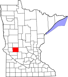 Location in the U.S. state of Minnesota | |
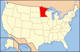 Minnesota's location in the U.S. | |
| Founded |
February 20, 1862 (created) 1866 (organized)[1] |
| Named for | John Pope |
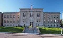
| Seat | Glenwood |
| Largest city | Glenwood |
| Area | |
| • Total | 717 sq mi (1,857 km2) |
| • Land | 670 sq mi (1,735 km2) |
| • Water | 47 sq mi (122 km2), 6.6% |
| Population (est.) | |
| • (2015) | 11,041 |
| • Density | 16/sq mi (6/km²) |
| Congressional district | 7th |
| Time zone | Central: UTC-6/-5 |
| Website |
www |
Pope County is a county located in the U.S. state of Minnesota. As of the 2010 census, the population was 10,995.[2] Its county seat is Glenwood.[3] The county was formed in 1862 and organized in 1866.
History
Pope County was identified by the state legislature in 1862, and named for John Pope, a General in the Union Army who had earlier worked as a surveyor in the area.[4]
Pope County was the location of several protests against the CU Powerline in the 1970s.[5]
Geography
According to the U.S. Census Bureau, the county has a total area of 717 square miles (1,860 km2), of which 670 square miles (1,700 km2) is land and 47 square miles (120 km2) (6.6%) is water.[6]
Major highways
 Minnesota State Highway 9
 Minnesota State Highway 28
 Minnesota State Highway 29
 Minnesota State Highway 55
 Minnesota State Highway 104
 Minnesota State Highway 114
Adjacent counties
- Douglas County (north)
- Stearns County (east)
- Kandiyohi County (southeast)
- Swift County (south)
- Stevens County (west)
- Grant County (northwest)
Demographics
| Historical population | |||
|---|---|---|---|
| Census | Pop. | %± | |
| 1870 | 2,691 | — | |
| 1880 | 5,874 | 118.3% | |
| 1890 | 10,032 | 70.8% | |
| 1900 | 12,577 | 25.4% | |
| 1910 | 12,746 | 1.3% | |
| 1920 | 13,631 | 6.9% | |
| 1930 | 13,085 | −4.0% | |
| 1940 | 13,544 | 3.5% | |
| 1950 | 12,862 | −5.0% | |
| 1960 | 11,914 | −7.4% | |
| 1970 | 11,107 | −6.8% | |
| 1980 | 11,657 | 5.0% | |
| 1990 | 10,745 | −7.8% | |
| 2000 | 11,236 | 4.6% | |
| 2010 | 10,995 | −2.1% | |
| Est. 2015 | 11,041 | [8] | 0.4% |
| U.S. Decennial Census[9] 1790-1960[10] 1900-1990[11] 1990-2000[12] 2010-2015[2] | |||

As of the census of 2000,[13] there were 11,236 people, 4,513 households, and 3,064 families residing in the county. The population density was 17 people per square mile (6/km²). There were 5,827 housing units at an average density of 9 per square mile (3/km²). The racial makeup of the county was 98.85% White, 0.20% Black or African American, 0.18% Native American, 0.08% Asian, 0.01% Pacific Islander, 0.18% from other races, and 0.50% from two or more races. 0.51% of the population were Hispanic or Latino of any race. 38.8% were of Norwegian and 31.6% German ancestry.
There were 4,513 households out of which 29.70% had children under the age of 18 living with them, 59.00% were married couples living together, 5.90% had a female householder with no husband present, and 32.10% were non-families. 28.70% of all households were made up of individuals and 16.10% had someone living alone who was 65 years of age or older. The average household size was 2.42 and the average family size was 2.99.
In the county the population was spread out with 24.80% under the age of 18, 6.70% from 18 to 24, 23.10% from 25 to 44, 23.80% from 45 to 64, and 21.50% who were 65 years of age or older. The median age was 42 years. For every 100 females there were 96.90 males. For every 100 females age 18 and over, there were 92.90 males.
The median income for a household in the county was $35,633, and the median income for a family was $42,818. Males had a median income of $30,452 versus $20,511 for females. The per capita income for the county was $19,032. About 5.80% of families and 8.80% of the population were below the poverty line, including 9.40% of those under age 18 and 12.10% of those age 65 or over.
Communities
Cities
Townships
- Bangor Township
- Barsness Township
- Ben Wade Township
- Blue Mounds Township
- Chippewa Falls Township
- Gilchrist Township
- Glenwood Township
- Grove Lake Township
- Hoff Township
- Lake Johanna Township
- Langhei Township
- Leven Township
- Minnewaska Township
- New Prairie Township
- Nora Township
- Reno Township
- Rolling Forks Township
- Walden Township
- Westport Township
- White Bear Lake Township
Ghost town
See also
References
- ↑ "Minnesota Place Names". Minnesota Historical Society. Retrieved March 19, 2014.
- 1 2 "State & County QuickFacts". United States Census Bureau. Retrieved September 1, 2013.
- ↑ "Find a County". National Association of Counties. Retrieved 2011-06-07.
- ↑ Upham, Warren (1920). Minnesota Geographic Names: Their Origin and Historic Significance. Minnesota Historical Society. p. 430.
- ↑ CU project controversy
- ↑ "2010 Census Gazetteer Files". United States Census Bureau. August 22, 2012. Retrieved October 24, 2014.
- ↑ Nelson, Steven (2011). Savanna Soils of Minnesota. Minnesota: Self. pp. 65 - 67. ISBN 978-0-615-50320-2.
- ↑ "County Totals Dataset: Population, Population Change and Estimated Components of Population Change: April 1, 2010 to July 1, 2015". Retrieved July 2, 2016.
- ↑ "U.S. Decennial Census". United States Census Bureau. Retrieved October 24, 2014.
- ↑ "Historical Census Browser". University of Virginia Library. Retrieved October 24, 2014.
- ↑ "Population of Counties by Decennial Census: 1900 to 1990". United States Census Bureau. Retrieved October 24, 2014.
- ↑ "Census 2000 PHC-T-4. Ranking Tables for Counties: 1990 and 2000" (PDF). United States Census Bureau. Retrieved October 24, 2014.
- ↑ "American FactFinder". United States Census Bureau. Retrieved 2008-01-31.
External links
- Pope County government’s website
- Pope County Historical Society
- Pope County GenWeb Project Helping people find their roots in Pope County. Part of the MNGenWeb and USGenWeb Projects.
 |
Grant County | Douglas County | | |
| Stevens County | |
Stearns County | ||
| ||||
| | ||||
| Swift County | Kandiyohi County |
Municipalities and communities of Pope County, Minnesota, United States | ||
|---|---|---|
| Cities | | |
| Townships | ||
| Unincorporated communities | ||
| Ghost town | ||
| Footnotes | ‡This populated place also has portions in an adjacent county or counties | |
Coordinates: 45°35′N 95°27′W / 45.59°N 95.45°W