River Noe
- Not to be confused with the River Noe which flows into Loch Etive, Scotland
| River Noe | |
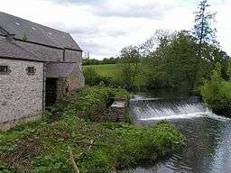 Watermill on the River Noe, Brough-on-Noe. The waterwheel survives (just visible in the dark entrance in this picture), though it is no longer in use. | |
| Country | England |
|---|---|
| Counties | Derbyshire |
| Tributaries | |
| - left | Grinds Brook, Lady Booth Brook, Jaggers Clough |
| - right | Whitemoor Sitch, Peakshole Water, Bradwell Brook |
| Source | |
| - location | Edale Head, Kinder Scout, Derbyshire |
| - coordinates | 53°22′55″N 1°52′44″W / 53.38182°N 1.87901°W |
| Mouth | |
| - location | Bamford, Derbyshire |
| - coordinates | 53°20′21″N 1°41′39″W / 53.33929°N 1.69424°WCoordinates: 53°20′21″N 1°41′39″W / 53.33929°N 1.69424°W |
| Length | 19 km (12 mi) adjusted length[1][2] |
| Basin | 73 km2 (28 sq mi) [1] |
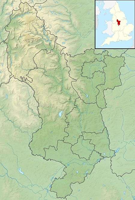 Confluence with Derwent shown in Derbyshire | |
| Wikimedia Commons: River Noe | |
| Progression : Noe—Derwent—Trent—Humber | |
The River Noe is a tributary of the River Derwent in Derbyshire, England. It flows approximately 12 miles (19 km) from its source, the confluence of two streams running off Kinder Scout in the Peak District, east through Edale and then southeast through the village of Hope.
The river flows into the River Derwent a kilometre south of Bamford. The entire length of the river is closely followed by the Hope Valley (Manchester to Sheffield) railway line.
The portion of the river downstream of Hope, along with the valley of the River Noe's main tributary, Peakshole Water, is known as the Hope Valley.[3]
Like many rivers in Derbyshire, the Noe was used historically to power water mills, originally these were mainly corn mills but during the industrial revolution some were rebuilt for other uses.
One example of this was the cotton mill at Edale; built in the late 18th century it shares a common design with other mills of the period, including multiple floors with large windows and a shallow pitched roof. There was also a corn and saw mill at Hope, driven by an 11 ft water wheel.[4]
At Brough there were a number of mills that used the Noe, including a lace-thread doubling mill, a cotton mill and the corn mill (pictured). The corn mill is notable in that water powered milling came to an end in 1954, when the flow of the Noe was reduced by the upstream diversion scheme. This was constructed to provide additional inflows for Ladybower Reservoir by the Derwent Valley Water Board.[4]
See also
References
- 1 2 "WFD Surface Water Classification Status and Objectives 2012 csv files". Environment-agency.gov.uk. 20 February 2013. Retrieved 20 February 2013.
- ↑ Ordnance Survey, 1:25,000 Scale Colour Raster map
- ↑ Hope Walk, Derbyshire-peakdistrict.co.uk, accessed 25 November 2008
- 1 2 "Archaeology Mills Index". Derbyshire Heritage. Retrieved 3 Mar 2013.
| Unitary authorities | |
|---|---|
| Boroughs or districts | |
| Major settlements |
|
| Rivers | |
| Topics | |