Amber Valley
| Borough of Amber Valley | |
|---|---|
| Borough | |
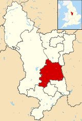 Shown within Derbyshire | |
| Sovereign state | United Kingdom |
| Constituent country | England |
| Region | East Midlands |
| Ceremonial county | Derbyshire |
| Admin. HQ | Ripley |
| Government | |
| • Type | Amber Valley Borough Council |
| • Leadership: | Leader & Cabinet |
| • MPs: |
Nigel Mills, Pauline Latham, Patrick McLoughlin |
| Area | |
| • Total | 102.5 sq mi (265.4 km2) |
| Area rank | 152nd |
| Population (mid-2014 est.) | |
| • Total | 123,942 |
| • Rank | Ranked 177th |
| • Density | 1,200/sq mi (470/km2) |
| Time zone | Greenwich Mean Time (UTC+0) |
| • Summer (DST) | British Summer Time (UTC+1) |
| ONS code | 17UB (ONS) E07000032 (GSS) |
| Ethnicity |
97.8% White 0.9% S.Asian[1] |
| Website | ambervalley.gov.uk |
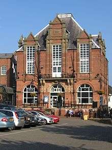
Amber Valley is a local government district and borough in Derbyshire, England. It takes its name from the River Amber and covers a semi-rural area with a number of small towns whose economy was formerly based on coal mining and engineering. The parliamentary constituency of Amber Valley covers a similar area. The Local Authority population at the 2011 Census was 122,309.[2]
The village of Crich and the Amber Valley area were the setting for the ITV drama series Peak Practice.
Politics
Elections to the borough council are held in three out of every four years, with one third of the 45 seats on the council being elected at each election. The council has been controlled by the Conservative party since they gained control from the Labour party at the 2000 election except for a single year after the 2014 election. As of the 2015 election the council returned to Conservative party control and is currently composed of the following councillors:-
| Year | Conservative | Labour |
|---|---|---|
| 2016 | 23 | 22 |
Towns of Amber Valley
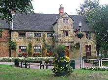
Main villages of Amber Valley
- Ambergate
- Codnor
- Crich
- Denby
- Duffield
- Heage
- Holbrook
- Horsley
- Kedleston
- Kilburn
- Lea & Holloway
- Mackworth
- Milford
- Quarndon
- Somercotes
- Swanwick
The district was formed on 1 April 1974 by the merger of the urban districts of Alfreton, Belper, Heanor and Ripley Rural District and Belper Rural District. The district was granted borough status in 1988.
Parishes
- Aldercar and Langley Mill, Alderwasley, Alfreton
- Belper
- Codnor, Crich
- Denby, Dethick, Lea and Holloway, Duffield
- Hazelwood, Heanor and Loscoe, Holbrook, Horsley, Horsley Woodhouse
- Idridgehay, Alton and Ashleyhay, Ironville
- Kedleston, Kilburn, Kirk Langley
- Mackworth, Mapperley
- Pentrich
- Quarndon
- Ravensdale Park, Riddings, Ripley
- Shipley, Shottle and Postern, Smalley, Somercotes, South Wingfield, Swanwick
- Turnditch and Windley
- Weston Underwood
See also
References
- ↑ Lead View Table
- ↑ "Local Authority population 2011". Neighbourhood Statistics. Office for National Statistics. Retrieved 23 March 2016.
- ↑ Alfreton House, Geograph picture, accessed September 2009
External links
- Amber Valley Borough Council website
- Amber Sound FM
- Visit Amber Valley
- Amber Valley Centre for Voluntary Services
- Amber Valley Info Web Site
| Unitary authorities | |
|---|---|
| Boroughs or districts | |
| Major settlements |
|
| Rivers | |
| Topics | |
Districts of the East Midlands | ||
|---|---|---|
| Derbyshire |  | |
| Leicestershire | ||
| Lincolnshire | ||
| Nottinghamshire | ||
| Northamptonshire | ||
| Rutland | ||
Coordinates: 53°00′N 1°24′W / 53.00°N 1.40°W