Alfreton
| Alfreton | |
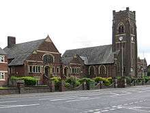
 Alfreton High Street |
|
 Alfreton |
|
| Population | 22,302 |
|---|---|
| OS grid reference | SK414558 |
| District | Amber Valley |
| Shire county | Derbyshire |
| Region | East Midlands |
| Country | England |
| Sovereign state | United Kingdom |
| Post town | ALFRETON |
| Postcode district | DE55 |
| Dialling code | 01773 |
| Police | Derbyshire |
| Fire | Derbyshire |
| Ambulance | East Midlands |
| EU Parliament | East Midlands |
| UK Parliament | Amber Valley |
|
|
Coordinates: 53°05′49″N 1°22′48″W / 53.097°N 1.380°W
Alfreton is a town and civil parish in Amber Valley, Derbyshire, England, adjoining the Bolsover and North East Derbyshire districts. It was formerly a Norman Manor and later an Urban District. The population of the Alfreton parish was 7,971 at the 2011 Census.[1] The villages of Ironville, Riddings, Somercotes and Swanwick were historically part of the Manor and Urban District, and the population including these was 24,476 in 2001.
History
Alfreton is said to have been founded by King Alfred and to have derived its name from him.[2] The placename appears in different forms throughout the ages, such as 'Elstretune' in Domesday, but the earliest appears to be in AD1004 in the will of Wulfric Spott, the founder of Burton Abbey. Amongst his bequests was 'Aelfredingtune', or 'Alfred's farmstead', which is believed to relate to Alfreton. However there is no evidence that this Alfred was the aforementioned king.
To the south-west near Pentrich was a Roman fortlet on the major road known as Ryknield Street. Another Roman road known as Lilley Street ran from there to the southern end of Alfreton, suggesting that settlement in the area predated the time of King Alfred by several centuries.
The initial settlement was centred at the top of the modern King Street hill, where the original market place developed. On the hilltop there was also an ancient meeting hall (the 'Moot Hall') until 1914, and several inns became established over the centuries, some of which survive today. To the west was a manor house, and the nearby Church of St. Martin, parts of which date back to 1200. The manor of Alfreton spread over lands to the south and east, including the parishes of Somercotes, Swanwick, Riddings and Ironville. The first Lord of the Manor was Earl Roger de Busli, who delegated the position to Baron Ralf Ingram. The position was passed down variously through heredity, gift and sale over the centuries up until William Palmer-Morewood, the last Lord of Alfreton, who died in 1957.
The economy during the medieval period was centred on agriculture. However, the presence of readily accessible and extensive deposits of coal and ironstone in the area meant that mining and iron-working grew in importance. In some parts of the manor coal seams were so close to the surface they were often ploughed up, and numerous small workings developed. Pits developed throughout the Manor, with those in Swanwick and Alfreton being the most productive. Alfreton colliery was sited to the north-east of the town. Rope-making was allied to this industry, and the locality became famous for the quality of its ropes. In the 18th century Alfreton was the chief coal-mining centre in Derbyshire, and the third-largest town in the county. The pits closed in the late 1960s and their sites have been reclaimed for other development.
Local iron working began in the low-lying land to the south of the current town in the vicinity of the A61, where a dam was made to power a water mill. This would have been quite a small operation, along with another at Lower Birchwood, and it was not until the 18th century that iron working was expanded into major enterprises, centred on Riddings and Butterley in the south and south-east of the manor.
The growth of these industries formed the basis of the area's prosperity, and attracted huge numbers of workers in the 19th century, rapidly swelling the local population. The extensive brick terraced housing in the area dates to this period, and brick-making and tile-making were significant local industries. Boot-making and repairing, and tanning of leather, were also substantial employers due to the need for footwear for these heavy industries. According to Census figures, in 1801 the population of the area that would become the Urban District stood at 2,301, rising to 21,232 in 1931. It has remained within about 3,000 of that number ever since.
After the closure of the pits and Riddings Ironworks in the 1960s, local employment shifted to factory, retail and service-based enterprises, many of which grew up on industrial estates occupying formerly despoiled colliery lands. Initially only a few major employers were present, such as Aertex and English Rose, but this was to change with the development of several industrial estates to the east of the town.
The development of transport in the area followed much the same pattern as elsewhere in England, with roads being vastly improved by turnpiking from the late 18th century onwards. Turnpike Acts affecting the area were obtained in 1759, 1764 (amended in 1790 and 1812), 1786 and 1802. These provided Alfreton with good road links to Derby, Nottingham, Mansfield, Chesterfield and the High Peak. The town became a coaching centre, which accounts for the inordinate number of inns that were formerly in the vicinity of the market place. A legal requirement on turnpike companies to provide milestones resulted in a local curiosity, a cast-iron marker on the town cross-roads with the notation 'Alfreton 0 Miles'. Around the same time as turnpikes were introduced the coal and iron industries benefited from the building of canals in the southern and eastern parts of the area. The Cromford Canal was built in 1793, and had a 3,000-yard long tunnel. In the 19th century, coaching and canal transport were rendered increasingly obsolete by railways built to the east of the town and along the eastern and southern boundaries of the former manor. The canals fell into disuse, and road and rail transport burgeoned. Rail underwent a temporary decline in the 1960s due to the Beeching cuts, which included the Alfreton station, which was re-opened in the 1970s.
Alfreton Hall was the successor to the original manor house, and was built c.1750, with an additional wing added c.1850; it is now a conference centre and restaurant. Alfreton House just off the High Street dates from c.1650 and is now occupied by the Town Council. The former George Inn at the top of King Street dates back to the 18th century, and was used as the meeting place for the local Turnpike Trust and local Assizes. On the west side of the southern approach to Alfreton is a small and distinctive stone-roofed building known as the 'House of Confinement'. This was built in the 1820s and was the local jail. There are also several churches, the oldest of which is St. Martin's at the west end of the town, part of which dates back to 1200. Beyond the town but within the ancient Manor are Carnfield Hall (15th century, now a private residence and events venue), Riddings House (now a nursing home), Swanwick Hall (c.1690, now a school), Swanwick Old Hall (1675, private residence), The Hayes (c.1860, now a conference centre), Newlands House (19th century, now flats) and the Jessop Monument (1854) at Ironville.
Economy
The main industry of Alfreton was historically coal mining but after the mines closed in the 1960s it changed to light industry, warehousing, retailing and the service sector. A substantial proportion of local jobs are in the latter, such as health, education and leisure. A significant but declining proportion of the area is still agricultural. Alfreton town is a busy urban centre with a number of national chain stores, along with independents and charity shops, but is dominated by a large branch of Tesco. There are several banks, building societies, estate agents and other services. There is an indoor market, library, two post offices, a job centre and numerous pubs and food outlets. There is a health centre, a leisure centre, swimming pool and park at the west end of the town, and a golf course outside the town to the west.
The chocolate company Thorntons is based in Alfreton.
Transport
The area has a heavily used and extensive road network, in particular the arterial A61 and A38, the latter linking to the nearby junction 28 of the M1 motorway. The town grew as a centre for bus transport throughout the 20th century and still has extensive bus services. Alfreton's railway station, sited to the north-east of the town, was closed in the 1960s as part of the Beeching Axe, but on 7 May 1973 a station was opened on the same site called Alfreton and Mansfield Parkway. When Mansfield regained its own station as part of the Robin Hood Line re-openings, the name was changed to Alfreton. Services run to London St Pancras in the morning and evening peaks with an hourly service also running to Liverpool and Norwich. A new hourly service has also been introduced and serves the Leeds to Nottingham route.
Geography
Alfreton is located at 53°06′00″N 01°23′00″W / 53.10000°N 1.38333°W (53.1000, -1.3833)1.
 |
Bakewell | Clay Cross, Chesterfield, Sheffield | Mansfield | |
| Matlock | |
South Normanton, Pinxton, Sutton in Ashfield, | ||
| ||||
| | ||||
| Belper, Derby | Ripley, Derbyshire | Heanor, Nottingham |
Politics
Alfreton is part of the Amber Valley constituency, the MP is Nigel Mills (Conservative). The local council for Alfreton is Amber Valley Borough Council.
Education
The local secondary school is Alfreton Grange Arts College[3] (ages 11–18) on Grange Street. Prior to September 2008 the school was known as Mortimer Wilson School for many decades.
There are two infant schools for children aged 4–6, Copthorne Infant School and Croft Infant School. Leys Junior School, on Flowery Leys Lane, and Woodbridge Junior school, which shares the Alfreton Grange site on Grange Street, provide for children aged 7–11.
Sport
The local football club is Alfreton Town, who play in the National League North division.
Alfreton Cricket Club currently play in the Derbyshire Premier League and run four senior teams on Saturdays. They play on the picturesque Alfreton Park.[4]
Alfreton has an active cycling club, organising a full programme of Audax events. They meet at Rodgers Lane car park on Sundays and Tuesdays at 9.00am and Wednesday evenings at 6.30pm. Beginners rides run through the summer months on Thursday evenings.
Professional wrestling shows were often shown in Alfreton, with the likes of British legends as Big Daddy, Jackie Pallo and Blackjack Mulligan performing.
There is also a snooker club situated on High Street, as well as Alfreton Golf Club on Wingfield Road close to the cricket club.
Alfreton Leisure Centre was re-opened in May 2008. The centre offers brand-new top-class equipment, including a 60-station gym, sauna, dance studio, swimming pool, badminton and squash courts.
Alfreton is home to 1401 (Alfreton and Ripley) Squadron of the Air Training Corps.
Alfreton's rugby club (Amber Valley Rugby Club) is based at Somercotes, and as of 2010/11 season play in RFU Midlands 3 East (North).
Notable residents
- Benjamin Outram, civil engineer was born here in 1764.[5]
- Robert Watchorn emigrated to America through Castle Garden. He served as the US Commissioner of Immigration at Ellis Island, between 1905 and 1909. He later worked as vice president of the Union Oil Company. Robert Watchorn was a benefactor of Alfreton after the first world war. In 1927, the Watchorn Memorial Primitive Church was founded and later a school, a manse and cottages, all in memory of his mother. A sports ground and pavilion were given in remembrance of his son. He also had the Lincoln Library built, now a Masonic Hall.[6]
 Watchorn School and Church
 - James Young patented a process to obtain oil from coal whilst working in Alfreton in 1848.
- Tom Fox received an MBE for his outstanding contribution to the youth in the Amber Valley area. He joined Derbyshire County Council in 1972 and started working at Alfreton's Polygon Youth Centre. Although he retired from his youth worker job in 2006, he still helps out one night a week. The emphasis of the award was for his work with children with special needs.[7]
- Sally Pepper who presents the weather on the BBC's local evening news programme East Midlands Today.
- Norman Whitehead[8] (1915–1983) was born and painted actively in the area during the 1930s.
- William Mugliston (died 1788), born locally, was an eighteenth-century poet. His works are now largely forgotten, but reference to him can be found in an early history of Alfreton held at the Derbyshire County Archives in Matlock, Derbyshire. His most notable work is "A Contemplative Walk with the Author's Wife and Children in the Park of George Moorewood Esq at Alfreton" (c 1782). He was featured in the Lady's Magazine' (sic). Other works include "The Cruelty of Removing the Poor".
References
- ↑ "Neighbourhood Statistics". Office for National Statistics. Retrieved 8 October 2014.
- ↑ Bateman, C., 1812, A Descriptive & Historical Account of Alfreton
- ↑ Alfreton Grange Arts College, Retrieved September 2009
- ↑ Play-Cricket the ECB Cricket Network
- ↑ Schofield, R.B., (2000) Benjamin Outram, Cardiff: Merton Priory Press
- ↑ "Discover Derbyshire - Alfreton". Denis Eardley. Archived from the original on 22 November 2010. Retrieved 27 December 2010.
- ↑ "www.chad.co.uk/news". Retrieved 30 March 2012.
- ↑ http://www.normanwhitehead.com/
External links
| Wikimedia Commons has media related to Alfreton. |
| Wikivoyage has a travel guide for Alfreton. |
- Alfreton in the Domesday Book
- Alfreton weather
- Amber Valley Borough Council
- BBC Guide
- Alfreton Local History Website
| Unitary authorities | |
|---|---|
| Boroughs or districts | |
| Major settlements |
|
| Rivers | |
| Topics | |