Saint-Aubin-Fosse-Louvain
| Saint-Aubin-Fosse-Louvain | |
|---|---|
|
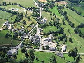
An aerial view of Saint-Aubin-Fosse-Louvain | |
 Saint-Aubin-Fosse-Louvain | |
|
Location within Pays de la Loire region  Saint-Aubin-Fosse-Louvain | |
| Coordinates: 48°27′54″N 0°49′48″W / 48.465°N 0.83°WCoordinates: 48°27′54″N 0°49′48″W / 48.465°N 0.83°W | |
| Country | France |
| Region | Pays de la Loire |
| Department | Mayenne |
| Arrondissement | Mayenne |
| Canton | Gorron |
| Intercommunality | Bocage Mayennais |
| Government | |
| • Mayor (2001–2008) | Jacques Louvigné |
| Area1 | 14.37 km2 (5.55 sq mi) |
| Population (1999)2 | 252 |
| • Density | 18/km2 (45/sq mi) |
| Time zone | CET (UTC+1) |
| • Summer (DST) | CEST (UTC+2) |
| INSEE/Postal code | 53199 / 53120 |
| Elevation |
153–207 m (502–679 ft) (avg. 160 m or 520 ft) |
|
1 French Land Register data, which excludes lakes, ponds, glaciers > 1 km² (0.386 sq mi or 247 acres) and river estuaries. 2 Population without double counting: residents of multiple communes (e.g., students and military personnel) only counted once. | |
Saint-Aubin-Fosse-Louvain is a commune in the Mayenne department in north-western France.
See also
References
| Wikimedia Commons has media related to Saint-Aubin-Fosse-Louvain. |
This article is issued from Wikipedia - version of the 2/12/2016. The text is available under the Creative Commons Attribution/Share Alike but additional terms may apply for the media files.