Bouchamps-lès-Craon
| Bouchamps-lès-Craon | |
|---|---|
|
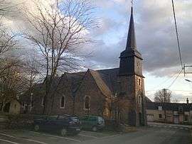
The church in Bouchamps-lès-Craon | |
 Bouchamps-lès-Craon | |
|
Location within Pays de la Loire region  Bouchamps-lès-Craon | |
| Coordinates: 47°48′56″N 0°59′28″W / 47.8156°N 0.9911°WCoordinates: 47°48′56″N 0°59′28″W / 47.8156°N 0.9911°W | |
| Country | France |
| Region | Pays de la Loire |
| Department | Mayenne |
| Arrondissement | Château-Gontier |
| Canton | Craon |
| Government | |
| • Mayor (2008–2014) | Roland Morineau |
| Area1 | 18.15 km2 (7.01 sq mi) |
| Population (2009)2 | 566 |
| • Density | 31/km2 (81/sq mi) |
| Time zone | CET (UTC+1) |
| • Summer (DST) | CEST (UTC+2) |
| INSEE/Postal code | 53035 / 53800 |
| Elevation |
31–104 m (102–341 ft) (avg. 106 m or 348 ft) |
|
1 French Land Register data, which excludes lakes, ponds, glaciers > 1 km² (0.386 sq mi or 247 acres) and river estuaries. 2 Population without double counting: residents of multiple communes (e.g., students and military personnel) only counted once. | |
Bouchamps-lès-Craon is a commune in the Mayenne department in northwestern France.
Geography
The Oudon River forms most of the commune's eastern border.
Population
| Historical population | ||
|---|---|---|
| Year | Pop. | ±% |
| 1962 | 536 | — |
| 1968 | 525 | −2.1% |
| 1975 | 528 | +0.6% |
| 1982 | 518 | −1.9% |
| 1990 | 507 | −2.1% |
| 1999 | 514 | +1.4% |
| 2006 | 552 | +7.4% |
| 2009 | 566 | +2.5% |
See also
References
| Wikimedia Commons has media related to Bouchamps-lès-Craon. |
This article is issued from Wikipedia - version of the 9/17/2015. The text is available under the Creative Commons Attribution/Share Alike but additional terms may apply for the media files.