Épineux-le-Seguin
| Épineux-le-Seguin | |
|---|---|
|
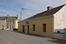
The town hall | |
 Épineux-le-Seguin | |
|
Location within Pays de la Loire region  Épineux-le-Seguin | |
| Coordinates: 47°56′34″N 0°21′34″W / 47.9428°N .35944°WCoordinates: 47°56′34″N 0°21′34″W / 47.9428°N .35944°W | |
| Country | France |
| Region | Pays de la Loire |
| Department | Mayenne |
| Arrondissement | Laval |
| Canton | Meslay-du-Maine |
| Government | |
| • Mayor (2001–2008) | Georges Jouy |
| Area1 | 9.48 km2 (3.66 sq mi) |
| Population (2006)2 | 163 |
| • Density | 17/km2 (45/sq mi) |
| Time zone | CET (UTC+1) |
| • Summer (DST) | CEST (UTC+2) |
| INSEE/Postal code | 53095 / 53340 |
| Elevation |
37–91 m (121–299 ft) (avg. 92 m or 302 ft) |
|
1 French Land Register data, which excludes lakes, ponds, glaciers > 1 km² (0.386 sq mi or 247 acres) and river estuaries. 2 Population without double counting: residents of multiple communes (e.g., students and military personnel) only counted once. | |
Épineux-le-Seguin is a commune in the Mayenne department in north-western France.
See also
| Wikimedia Commons has media related to Épineux-le-Seguin. |
This article is issued from Wikipedia - version of the 11/1/2014. The text is available under the Creative Commons Attribution/Share Alike but additional terms may apply for the media files.