Bannes, Mayenne
| Bannes | |
|---|---|
|
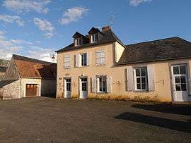
The town hall in Bannes | |
 Bannes | |
|
Location within Pays de la Loire region  Bannes | |
| Coordinates: 47°58′57″N 0°21′01″W / 47.9825°N 0.3503°WCoordinates: 47°58′57″N 0°21′01″W / 47.9825°N 0.3503°W | |
| Country | France |
| Region | Pays de la Loire |
| Department | Mayenne |
| Arrondissement | Laval |
| Canton | Meslay-du-Maine |
| Government | |
| • Mayor (2008–2014) | Christian Lavoué |
| Area1 | 8.32 km2 (3.21 sq mi) |
| Population (2009)2 | 137 |
| • Density | 16/km2 (43/sq mi) |
| Time zone | CET (UTC+1) |
| • Summer (DST) | CEST (UTC+2) |
| INSEE/Postal code | 53019 / 53340 |
| Elevation |
58–102 m (190–335 ft) (avg. 80 m or 260 ft) |
|
1 French Land Register data, which excludes lakes, ponds, glaciers > 1 km² (0.386 sq mi or 247 acres) and river estuaries. 2 Population without double counting: residents of multiple communes (e.g., students and military personnel) only counted once. | |
Bannes is a commune in the Mayenne department in northwestern France.
Population
| Historical population | ||
|---|---|---|
| Year | Pop. | ±% |
| 1793 | 285 | — |
| 1800 | 256 | −10.2% |
| 1806 | 283 | +10.5% |
| 1821 | 296 | +4.6% |
| 1831 | 401 | +35.5% |
| 1836 | 407 | +1.5% |
| 1841 | 416 | +2.2% |
| 1846 | 391 | −6.0% |
| 1851 | 370 | −5.4% |
| 1856 | 321 | −13.2% |
| 1861 | 304 | −5.3% |
| 1866 | 305 | +0.3% |
| 1872 | 292 | −4.3% |
| 1876 | 292 | +0.0% |
| 1881 | 267 | −8.6% |
| 1886 | 265 | −0.7% |
| 1891 | 263 | −0.8% |
| 1896 | 244 | −7.2% |
| 1901 | 224 | −8.2% |
| 1906 | 237 | +5.8% |
| 1911 | 236 | −0.4% |
| 1921 | 223 | −5.5% |
| 1926 | 198 | −11.2% |
| 1931 | 177 | −10.6% |
| 1936 | 197 | +11.3% |
| 1946 | 195 | −1.0% |
| 1954 | 213 | +9.2% |
| 1962 | 205 | −3.8% |
| 1968 | 185 | −9.8% |
| 1975 | 164 | −11.4% |
| 1982 | 142 | −13.4% |
| 1990 | 131 | −7.7% |
| 1999 | 118 | −9.9% |
| 2006 | 134 | +13.6% |
| 2009 | 137 | +2.2% |
See also
References
| Wikimedia Commons has media related to Bannes (Mayenne). |
This article is issued from Wikipedia - version of the 2/14/2015. The text is available under the Creative Commons Attribution/Share Alike but additional terms may apply for the media files.