Ahuillé
| Ahuillé | |
|---|---|
|
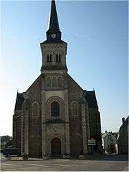
The Church of the Assumption, in Ahuillé | |
 Ahuillé | |
|
Location within Pays de la Loire region  Ahuillé | |
| Coordinates: 48°01′14″N 0°52′10″W / 48.0206°N 0.8694°WCoordinates: 48°01′14″N 0°52′10″W / 48.0206°N 0.8694°W | |
| Country | France |
| Region | Pays de la Loire |
| Department | Mayenne |
| Arrondissement | Laval |
| Canton | Saint-Berthevin |
| Government | |
| • Mayor (2008–2014) | Pierre-Marie Ledauphin |
| Area1 | 28.97 km2 (11.19 sq mi) |
| Population (2009)2 | 1,804 |
| • Density | 62/km2 (160/sq mi) |
| Time zone | CET (UTC+1) |
| • Summer (DST) | CEST (UTC+2) |
| INSEE/Postal code | 53001 / 53940 |
| Elevation |
63–130 m (207–427 ft) (avg. 85 m or 279 ft) |
|
1 French Land Register data, which excludes lakes, ponds, glaciers > 1 km² (0.386 sq mi or 247 acres) and river estuaries. 2 Population without double counting: residents of multiple communes (e.g., students and military personnel) only counted once. | |
Ahuillé is a commune in the Mayenne department in northwestern France.
Population
| Historical population | ||
|---|---|---|
| Year | Pop. | ±% |
| 1962 | 902 | — |
| 1968 | 841 | −6.8% |
| 1975 | 885 | +5.2% |
| 1982 | 1,454 | +64.3% |
| 1990 | 1,399 | −3.8% |
| 1999 | 1,379 | −1.4% |
| 2009 | 1,804 | +30.8% |
See also
References
| Wikimedia Commons has media related to Ahuillé. |
This article is issued from Wikipedia - version of the 9/16/2015. The text is available under the Creative Commons Attribution/Share Alike but additional terms may apply for the media files.