Sataf
| Sataf | |
|---|---|
|
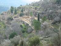
Remains of Sataf village | |
 Sataf | |
| Arabic | صطاف |
| Name meaning | from a personal name[1] |
| Subdistrict | Jerusalem |
| Coordinates | 31°46′8.76″N 35°7′38.28″E / 31.7691000°N 35.1273000°ECoordinates: 31°46′8.76″N 35°7′38.28″E / 31.7691000°N 35.1273000°E |
| Palestine grid | 162/130 |
| Population | 540 (1945) |
| Area | 3,775 dunams |
| Date of depopulation | July 13–14, 1948[2] |
| Cause(s) of depopulation | Military assault by Yishuv forces |
Sataf (Arabic: صطاف, Hebrew: סטף) is a tourist site showcasing ancient agricultural techniques used in the Jerusalem Mountains. Before 1948 it was a Palestinian Arab village in the Jerusalem Subdistrict depopulated during the 1948 Arab–Israeli War. It is located 10 km west of Jerusalem, with Sorek Valley (Arabic: Wadi as-Sarar) bordering to the east.
Two springs, Ein Sataf and Ein Bikura flow from the site into the riverbed below.
A monastery located across the valley from Sataf, i.e. south of Wadi as-Sarar, known by local Arabs as Ein el-Habis (the "Spring of the Hermitage"), is officially called Monastery of St. John in the Wilderness.
History
Chalcolithic period
Remains of a 4,000 BCE Chalcolithic village were discovered at the site. The related traces of agricultural activities number among the oldest in the region.[3]
Byzantine period
Most ancient remains date to the Byzantine period.[3]
Mamluk period
The first written mention of the site is from the Mamluk era.[3]
Ottoman period
In the late Ottoman period, in 1863, Victor Guérin described a village of one hundred and eighty people. He further noted that their houses were standing on the slopes of a mountain, and that the mountainside was covered by successive terraces.[4] An Ottoman village list from about 1870 counted 38 houses and a population of 115, whereby only men were counted.[5]
In 1883, the Palestine Exploration Fund's Survey of Western Palestine described Setaf as "a village of moderate size, of stone houses, perched on the steep side of a valley. It has a spring lower down, on the north."[6]
British Mandate period
By the 1922 census of Palestine conducted by the British Mandate authorities, Sataf had a population of 329; 321 Muslims and 8 Christians.[7] All the Christians were Roman Catholic.[8] The 1931 census lists 381 inhabitants; 379 Muslim and 2 Christian, in a total of 101 houses.[9]
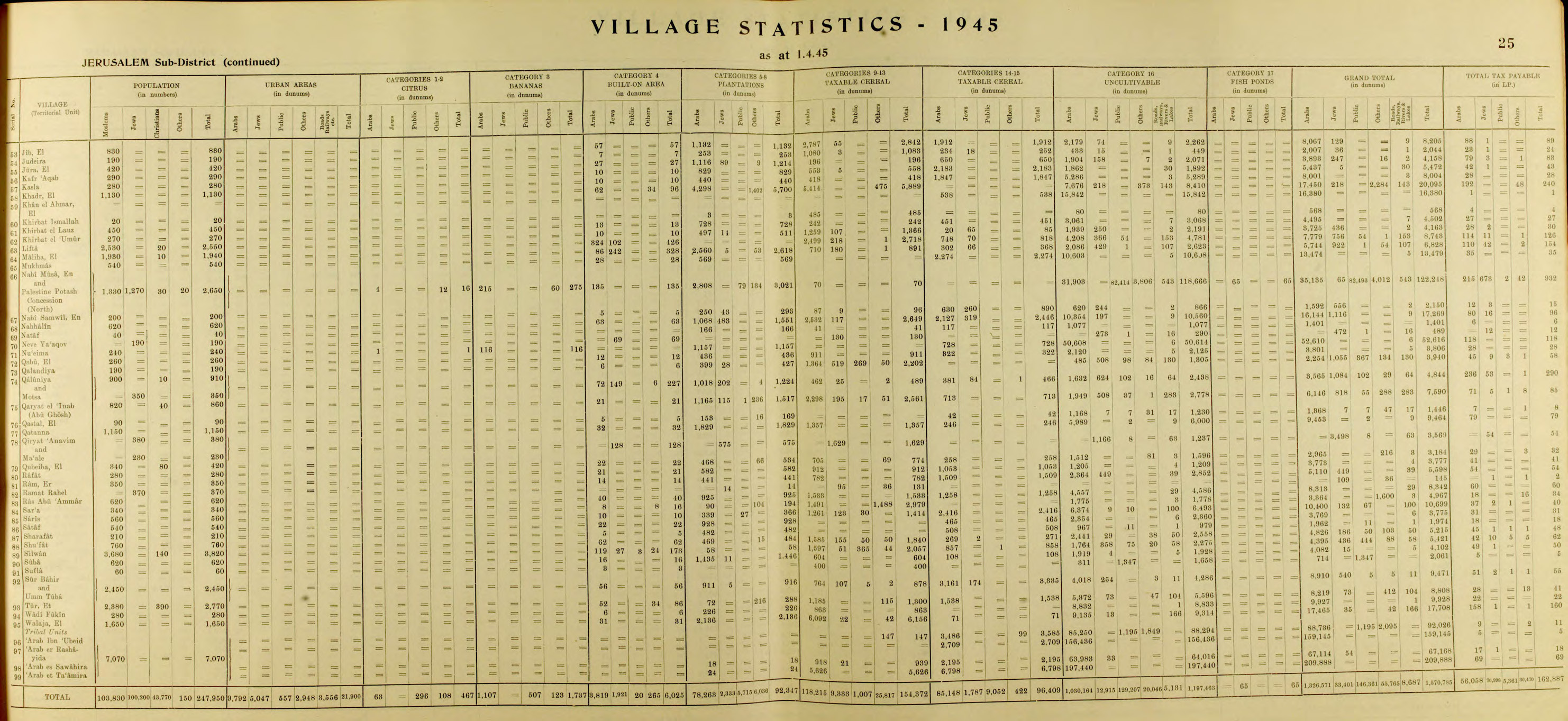
In 1945 the population of Sataf was 540, all Muslims,[10] and the total land area was 3,775 dunams, according to an official land and population survey.[11] Of this, 928 dunams were plantations and irrigable land, 465 for cereals,[12] while 22 dunams were built-up land.[13]
1948 War and aftermath
On July 13–14, 1948 the Arab village was depopulated by the Har'el Brigade, during Operation Dani.[14] Sataf and the surrounding area became part of the newly created State of Israel.
A short time after the 1948 War, a small group of Jewish immigrants from North Africa settled for a few months in the village area. Subsequently the IDF's Unit 101 and paratroopers used it for training purposes.[3] In the 1980s the Jewish National Fund began the restoration of ancient agricultural terraces, and the area around the springs has been turned into a tourist site. A forest around the site was also planted by the Jewish National Fund.[15]
In 1992, Sataf was described as follows: "Many half-destroyed walls still stand, and some still have arched doorways. The walls of a few houses with collapsed roofs are almost intact....The area around the village spring, which is located to the east next to the ruins of a rectangular stone house, has been turned into an Israeli tourist site. A Jewish family has settled on the west side of the village, and have fenced in some of the village area."[14]
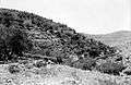 The Jabal Across from Sataf. Photo taken on September 1, 1945.
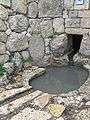 Ein Sataf, 2009
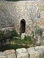 Ein Bikura, 2009
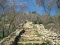 Sataf Reconstruction
 Agriculture in Sataf, 2009
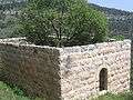 Remains of Sataf village
References
- ↑ Palmer, 1881, p. 326
- ↑ Morris, 2004, p. xx, village #354. Also gives cause of depopulation
- 1 2 3 4 Ancient Agriculture: Sataf - A Reconstruction
- ↑ Guérin, 1869, pp. 3-4
- ↑ Socin, 1879, p. 160
- ↑ Conder and Kitchener, 1883, SWP III, p. 22
- ↑ Barron, 1923, Table VII, Sub-district of Jerusalem, p. 14
- ↑ Barron, 1923, Table XVI, p. 45
- ↑ Mills, 1932, p. 43
- ↑ Department of Statistics, 1945, p. 25
- ↑ Government of Palestine, Department of Statistics. Village Statistics, April, 1945. Quoted in Hadawi, 1970, p. 58
- ↑ Government of Palestine, Department of Statistics. Village Statistics, April, 1945. Quoted in Hadawi, 1970, p. 104
- ↑ Government of Palestine, Department of Statistics. Village Statistics, April, 1945. Quoted in Hadawi, 1970, p. 154
- 1 2 Khalidi, 1992, p. 317
- ↑ Sataf from the Khalil Sakakini Cultural Center
Bibliography
| Wikimedia Commons has media related to Sataf. |
- Barron, J. B., ed. (1923). Palestine: Report and General Abstracts of the Census of 1922. Government of Palestine.
- Canaan, Tawfiq (1927). Mohammedan Saints and Sanctuaries in Palestine. London: Luzac & Co. (p. 96)
- Conder, Claude Reignier; Kitchener, H. H. (1883). The Survey of Western Palestine: Memoirs of the Topography, Orography, Hydrography, and Archaeology. 3. London: Committee of the Palestine Exploration Fund.
- Department of Statistics (1945). Village Statistics, April, 1945. Government of Palestine.
- Guérin, Victor (1869). Description Géographique Historique et Archéologique de la Palestine (in French). 1: Judee, pt. 2. Paris: L'Imprimerie Nationale.
- Hadawi, Sami (1970). Village Statistics of 1945: A Classification of Land and Area ownership in Palestine. Palestine Liberation Organization Research Center.
- Khalidi, Walid (1992). All That Remains: The Palestinian Villages Occupied and Depopulated by Israel in 1948. Washington D.C.: Institute for Palestine Studies. ISBN 0-88728-224-5. ISBN 0-88728-224-5.
- Mills, E., ed. (1932). Census of Palestine 1931. Population of Villages, Towns and Administrative Areas. Jerusalem: Government of Palestine.
- Morris, Benny (2004). The Birth of the Palestinian Refugee Problem Revisited. Cambridge University Press. ISBN 978-0-521-00967-6.
- Palmer, E. H. (1881). The Survey of Western Palestine: Arabic and English Name Lists Collected During the Survey by Lieutenants Conder and Kitchener, R. E. Transliterated and Explained by E.H. Palmer. Committee of the Palestine Exploration Fund.
- Socin, A. (1879). "Alphabetisches Verzeichniss von Ortschaften des Paschalik Jerusalem". Zeitschrift des Deutschen Palästina-Vereins. 2: 135–163.
External links
- Welcome To Sataf in Palestineremembered.com
- Sataf, from Zochrot
- Survey of Western Palestine, Map 17: IAA, Wikimedia commons
- Map, 1946