Sathamba
| Sathamba | |
|---|---|
| village | |
|
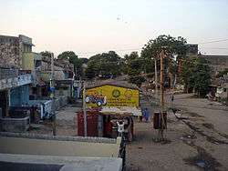
Vav faliya, Azad Chowk | |
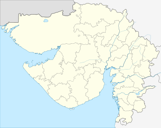 Sathamba  Sathamba Location in Gujarat, India | |
| Coordinates: 23°10′09″N 73°19′36″E / 23.1691251°N 73.3266163°ECoordinates: 23°10′09″N 73°19′36″E / 23.1691251°N 73.3266163°E | |
| Country |
|
| State | Gujarat |
| District | Aravali |
| Population | |
| • Total | 15,000 |
| Languages | |
| • Official | Gujarati, Hindi |
| Time zone | IST (UTC+5:30) |
| PIN | 383340 |
| Telephone code | 02779-28xxxx |
| Vehicle registration | GJ-9 |
| Nearest city | Ahmedabad |
| Lok Sabha constituency | Sabarkantha |
| Vidhan Sabha constituency | Bayad |
| Website |
gujaratindia |
Sathamba (Hindi साथम्बा) is a town located in Aravali district of the Indian state of Gujarat and the seat of a former petty Rajput princely state. It has a population of approximately 15,000.
History
| Princely state |
|---|
| Individual residencies |
| Agencies |
|
| Lists |
|
The petty Hindu state, ruled by Thakore (Saheb)s of the Rajput Solanki dynasty, had a population of 5,360 in 1892 on 47 km2.
Under the British raj it was a fifth class state in the colonial Mahi Kantha Agency. It ceased to exist on 10th June 1948 by accession to newly independent India, the Privy Purse being fixed at 18,800 Rupees.
Places of interest
The village has a stepwell and a memorial stone with an inscription dated to 1269 AD (Samvat 1325).[1]
Economy
The major source of income for families is agriculture. There is also work in the quarry & stone crushing businesses surrounding the village, which comprise more than 30 companies. As of 2007, the previously well-known cotton ginning and pressing factory of the village was struggling as a consequence of a series of annual droughts.
See also
- Satamba, in Maharashtra
References
- ↑ Gazetteer of the Bombay Presidency: Cutch, Palanpur, and Mahi Kantha. Government Central Press. 1880. p. 442.
External links
- Indian princely States on www.uq.net.auas archived on web.archive.org Historical aspect of Sathamba
- IndianRajputs, with coat of arms and genealogy