Stover, Missouri
| Stover | |
|---|---|
| City | |
 Stover Location within the state of Missouri | |
| Coordinates: 38°26′32″N 92°59′24″W / 38.44222°N 92.99000°WCoordinates: 38°26′32″N 92°59′24″W / 38.44222°N 92.99000°W | |
| Country | United States |
| State | Missouri |
| County | Morgan |
| Area[1] | |
| • Total | 0.89 sq mi (2.31 km2) |
| • Land | 0.89 sq mi (2.31 km2) |
| • Water | 0 sq mi (0 km2) |
| Population (2010)[2] | |
| • Total | 1,094 |
| • Estimate (2012[3]) | 1,071 |
| • Density | 1,229.2/sq mi (474.6/km2) |
| Time zone | Central (CST) (UTC-6) |
| • Summer (DST) | CST (UTC-5) |
Stover is a city in Morgan County, Missouri, United States. The population was 1,094 at the 2010 census.
Geography
Stover is located at 38°26′32″N 92°59′24″W / 38.44222°N 92.99000°W (38.442199, -92.989936).[4]
According to the United States Census Bureau, the city has a total area of 0.89 square miles (2.31 km2), all of it land.[1]
History
A post office called Stover has been in operation since 1875.[5] The community has the name of John Hubler Stover, a U.S. Representative from Missouri.[6] Stover was laid out at its current site in 1905 when the railroad was extended to that point.[6]
Demographics
| Historical population | |||
|---|---|---|---|
| Census | Pop. | %± | |
| 1910 | 386 | — | |
| 1920 | 447 | 15.8% | |
| 1930 | 517 | 15.7% | |
| 1940 | 584 | 13.0% | |
| 1950 | 693 | 18.7% | |
| 1960 | 757 | 9.2% | |
| 1970 | 849 | 12.2% | |
| 1980 | 1,041 | 22.6% | |
| 1990 | 964 | −7.4% | |
| 2000 | 968 | 0.4% | |
| 2010 | 1,094 | 13.0% | |
| Est. 2015 | 1,074 | [7] | −1.8% |
2010 census
As of the census[2] of 2010, there were 1,094 people, 453 households, and 270 families residing in the city. The population density was 1,229.2 inhabitants per square mile (474.6/km2). There were 532 housing units at an average density of 597.8 per square mile (230.8/km2). The racial makeup of the city was 96.5% White, 0.5% Native American, 0.1% Asian, 0.2% Pacific Islander, 1.5% from other races, and 1.2% from two or more races. Hispanic or Latino of any race were 2.2% of the population.
There were 453 households of which 27.2% had children under the age of 18 living with them, 42.4% were married couples living together, 11.0% had a female householder with no husband present, 6.2% had a male householder with no wife present, and 40.4% were non-families. 33.6% of all households were made up of individuals and 17.7% had someone living alone who was 65 years of age or older. The average household size was 2.32 and the average family size was 2.92.
The median age in the city was 42.1 years. 22.1% of residents were under the age of 18; 10.5% were between the ages of 18 and 24; 20.1% were from 25 to 44; 23.6% were from 45 to 64; and 23.8% were 65 years of age or older. The gender makeup of the city was 47.2% male and 52.8% female.
2000 census
As of the census[9] of 2000, there were 968 people, 419 households, and 274 families residing in the city. The population density was 1,107.1 people per square mile (429.6/km²). There were 498 housing units at an average density of 569.5 per square mile (221.0/km²). The racial makeup of the city was 99% White,and less than 1% African American, Native American, 5% Asian, and from two or more races. Hispanic or Latino..
There were 419 households out of which 26.3% had children under the age of 18 living with them, 53.2% were married couples living together, 8.1% had a female householder with no husband present, and 34.4% were non-families. 31.5% of all households were made up of individuals and 18.6% had someone living alone who was 65 years of age or older. The average household size was 2.21 and the average family size was 2.73.
In the city the population was spread out with 21.7% under the age of 18, 7.6% from 18 to 24, 21.1% from 25 to 44, 22.3% from 45 to 64, and 27.3% who were 65 years of age or older. The median age was 45 years. For every 100 females there were 91.3 males. For every 100 females age 18 and over, there were 86.2 males.
The median income for a household in the city was $26,078, and the median income for a family was $32,333. Males had a median income of $22,969 versus $17,411 for females. The per capita income for the city was $14,978. About 11.3% of families and 15.5% of the population were below the poverty line, including 20.1% of those under age 18 and 18.8% of those age 65 or over.
Climate
Climate is characterized by relatively high temperatures and evenly distributed precipitation throughout the year. The Köppen Climate Classification subtype for this climate is Cfa" (Humid Subtropical Climate).[10]
References
- 1 2 "US Gazetteer files 2010". United States Census Bureau. Retrieved 2012-07-08.
- 1 2 "American FactFinder". United States Census Bureau. Retrieved 2012-07-08.
- ↑ "Population Estimates". United States Census Bureau. Retrieved 2013-05-30.
- ↑ "US Gazetteer files: 2010, 2000, and 1990". United States Census Bureau. 2011-02-12. Retrieved 2011-04-23.
- ↑ "Post Offices". Jim Forte Postal History. Retrieved 19 November 2016.
- 1 2 "Morgan County Place Names, 1928–1945". The State Historical Society of Missouri. Archived from the original on June 24, 2016. Retrieved November 19, 2016.
- ↑ "Annual Estimates of the Resident Population for Incorporated Places: April 1, 2010 to July 1, 2015". Retrieved July 2, 2016.
- ↑ "Census of Population and Housing". Census.gov. Retrieved June 4, 2015.
- ↑ "American FactFinder". United States Census Bureau. Retrieved 2008-01-31.
- ↑ Climate Summary for Stover, Missouri
External links
- Historic maps of Stover in the Sanborn Maps of Missouri Collection at the University of Missouri
Municipalities and communities of Morgan County, Missouri, United States | ||
|---|---|---|
| Cities | 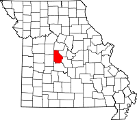 | |
| Villages | ||
| Townships | ||
| Unincorporated communities | ||
| Ghost town | ||
| Footnotes | ‡This populated place also has portions in an adjacent county or counties | |