Versailles, Missouri
| Versailles, Missouri | |
|---|---|
| City | |
|
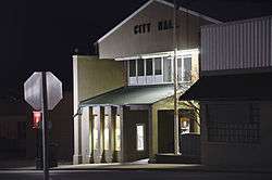
City Hall | |
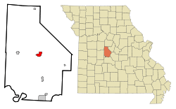 Location of Versailles, Missouri | |
| Coordinates: 38°25′53″N 92°50′40″W / 38.43139°N 92.84444°WCoordinates: 38°25′53″N 92°50′40″W / 38.43139°N 92.84444°W | |
| Country | United States |
| State | Missouri |
| County | Morgan |
| Government | |
| • Mayor | Terry Silvey |
| Area[1] | |
| • Total | 2.33 sq mi (6.03 km2) |
| • Land | 2.33 sq mi (6.03 km2) |
| • Water | 0 sq mi (0 km2) |
| Elevation | 1,033 ft (315 m) |
| Population (2010)[2] | |
| • Total | 2,482 |
| • Estimate (2012[3]) | 2,431 |
| • Density | 1,065.2/sq mi (411.3/km2) |
| Time zone | Central (CST) (UTC-6) |
| • Summer (DST) | CDT (UTC-5) |
| ZIP code | 65084 |
| Area code(s) | 573 |
| FIPS code | 29-75922[4] |
| GNIS feature ID | 0728176[5] |
Versailles is a city in Morgan County, Missouri, United States. The population was 2,482 at the 2010 census. It is the county seat of Morgan County.[6] The name is not pronounced like Versailles, France, but rather as ver-SAILS.
History
Versailles was platted in 1854, and named after the Palace of Versailles, in France.[7] A post office called Versailles has been in operation since 1835.[8]
Geography
According to the United States Census Bureau, the city has a total area of 2.33 square miles (6.03 km2), all of it land.[1]
Demographics
| Historical population | |||
|---|---|---|---|
| Census | Pop. | %± | |
| 1880 | 578 | — | |
| 1890 | 1,211 | 109.5% | |
| 1900 | 1,240 | 2.4% | |
| 1910 | 1,598 | 28.9% | |
| 1920 | 1,651 | 3.3% | |
| 1930 | 1,662 | 0.7% | |
| 1940 | 1,781 | 7.2% | |
| 1950 | 1,929 | 8.3% | |
| 1960 | 2,047 | 6.1% | |
| 1970 | 2,244 | 9.6% | |
| 1980 | 2,406 | 7.2% | |
| 1990 | 2,365 | −1.7% | |
| 2000 | 2,565 | 8.5% | |
| 2010 | 2,482 | −3.2% | |
| Est. 2015 | 2,440 | [9] | −1.7% |
2010 census
As of the census[2] of 2010, there were 2,482 people, 1,034 households, and 590 families residing in the city. The population density was 1,065.2 inhabitants per square mile (411.3/km2). There were 1,201 housing units at an average density of 515.5 per square mile (199.0/km2). The racial makeup of the city was 92.4% White, 2.8% African American, 0.8% Native American, 0.3% Asian, 1.1% from other races, and 2.6% from two or more races. Hispanic or Latino of any race were 3.1% of the population.
There were 1,034 households of which 28.9% had children under the age of 18 living with them, 37.3% were married couples living together, 15.9% had a female householder with no husband present, 3.9% had a male householder with no wife present, and 42.9% were non-families. 38.7% of all households were made up of individuals and 20.7% had someone living alone who was 65 years of age or older. The average household size was 2.22 and the average family size was 2.94.
The median age in the city was 40.9 years. 22.8% of residents were under the age of 18; 8.8% were between the ages of 18 and 24; 23.2% were from 25 to 44; 22.9% were from 45 to 64; and 22.4% were 65 years of age or older. The gender makeup of the city was 47.5% male and 52.5% female.
2000 census
As of the census[4] of 2000, there were 2,565 people, 1,077 households, and 636 families residing in the city. The population density was 1,115.2 people per square mile (430.6/km²). There were 1,195 housing units at an average density of 519.5 per square mile (200.6/km²). The racial makeup of the city was 95.40% White, 2.14% African American, 0.66% Native American, 0.04% Asian, 0.16% from other races, and 1.60% from two or more races. Hispanic or Latino of any race were 1.05% of the population.
There were 1,077 households out of which 29.6% had children under the age of 18 living with them, 44.3% were married couples living together, 12.3% had a female householder with no husband present, and 40.9% were non-families. 36.7% of all households were made up of individuals and 20.7% had someone living alone who was 65 years of age or older. The average household size was 2.25 and the average family size was 2.95.
In the city the population was spread out with 24.7% under the age of 18, 8.4% from 18 to 24, 23.4% from 25 to 44, 18.2% from 45 to 64, and 25.3% who were 65 years of age or older. The median age was 40 years. For every 100 females there were 77.6 males. For every 100 females age 18 and over, there were 70.9 males.
The median income for a household in the city was $23,672, and the median income for a family was $31,088. Males had a median income of $24,054 versus $18,229 for females. The per capita income for the city was $14,200. About 11.4% of families and 16.5% of the population were below the poverty line, including 21.4% of those under age 18 and 10.8% of those age 65 or over.
Notable people
- Bud Walton (co-founder of Wal-Mart)
- Bill Laurie (executive)
- Dwight Bolinger (linguist)
- William E. Morris
- Joseph Franklin Rutherford (Founder of the Jehovah's Witnesses and 2nd President of the Watch Tower Bible & Tract Society)
References
- 1 2 "US Gazetteer files 2010". United States Census Bureau. Archived from the original on January 24, 2012. Retrieved 2012-07-08.
- 1 2 "American FactFinder". United States Census Bureau. Retrieved 2012-07-08.
- ↑ "Population Estimates". United States Census Bureau. Archived from the original on June 17, 2013. Retrieved 2013-05-30.
- 1 2 "American FactFinder". United States Census Bureau. Archived from the original on September 11, 2013. Retrieved 2008-01-31.
- ↑ "US Board on Geographic Names". United States Geological Survey. 2007-10-25. Retrieved 2008-01-31.
- ↑ "Find a County". National Association of Counties. Archived from the original on May 31, 2011. Retrieved 2011-06-07.
- ↑ "Morgan County Place Names, 1928–1945". The State Historical Society of Missouri. Archived from the original on June 24, 2016. Retrieved November 19, 2016.
- ↑ "Post Offices". Jim Forte Postal History. Retrieved 19 November 2016.
- ↑ "Annual Estimates of the Resident Population for Incorporated Places: April 1, 2010 to July 1, 2015". Retrieved July 2, 2016.
- ↑ "Census of Population and Housing". Census.gov. Archived from the original on May 11, 2015. Retrieved June 4, 2015.
External links
- Historic maps of Versailles in the Sanborn Maps of Missouri Collection at the University of Missouri
Municipalities and communities of Morgan County, Missouri, United States | ||
|---|---|---|
| Cities | 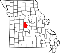 | |
| Villages | ||
| Townships | ||
| Unincorporated communities | ||
| Ghost town | ||
| Footnotes | ‡This populated place also has portions in an adjacent county or counties | |