TR postcode area
Postcode district boundaries: Bing / Google
| Truro postcode area | |
|---|---|
 TR | |
| Postcode area | TR |
| Postcode area name | Truro |
| Post towns | 15 |
| Postcode districts | 28 |
| Postcode sectors | 68 |
| Postcodes (live) | 11,703 |
| Postcodes (total) | 14,358 |
| Statistics as at February 2012[1] | |
The TR postcode area, also known as the Truro postcode area,[2] is a group of 27 postcode districts in England, which are subdivisions of 15 post towns. These postcode districts cover west Cornwall, including Truro, Penzance, Camborne, Falmouth, Hayle, Helston, Marazion, Newquay, Penryn, Perranporth, Redruth, St Agnes, St Columb and St Ives, plus the Isles of Scilly.
Coverage
The approximate coverage of the postcode districts:
Map
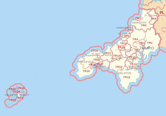
TR postcode area map, showing postcode districts in red and post towns in grey text, with link to nearby PL postcode area.
See also
- Postcode Address File
- List of postcode areas in the United Kingdom
- Extreme points of the United Kingdom
References
- ↑ "ONS Postcode Directory Version Notes" (ZIP). National Statistics Postcode Products. Office for National Statistics. February 2012. Table 2. Retrieved 21 April 2012. Coordinates from mean of unit postcode points, "Code-Point Open". OS OpenData. Ordnance Survey. February 2012. Retrieved 21 April 2012.
- ↑ Royal Mail, Address Management Guide, (2004)
External links
This article is issued from Wikipedia - version of the 7/30/2016. The text is available under the Creative Commons Attribution/Share Alike but additional terms may apply for the media files.