Vyaspur
| Vyaspur व्यासपुर | |
|---|---|
| Village | |
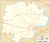 Vyaspur  Vyaspur  Vyaspur Village location on Varanasi district map | |
| Coordinates: 25°23′46″N 83°02′15″E / 25.396021°N 83.037480°ECoordinates: 25°23′46″N 83°02′15″E / 25.396021°N 83.037480°E | |
| Country |
|
| State | Uttar Pradesh |
| Population (2011) | |
| • Total | 536 |
| Languages | |
| • Official | Hindi & Urdu |
| Time zone | IST (UTC+5:30) |
| PIN | 221007 |
| STD | 0542 |
| Vehicle registration | UP65 XXXX |
| Website |
up |
Vyaspur (Hindi: व्यासपुर) is a village in Chiraigaon block of Varanasi district in the Indian state of Uttar Pradesh. It is about 219 kilometers from the state capital Lucknow and 809 kilometers from the national capital Delhi.[1][2][3]
Transportation
Vyaspur can be accessed by road and by Indian railways. Closest railway station is Sarnath. Closest operational airports are Varanasi airport (29 kilometers) and Patna airport (244 kilometers).[4][5]
See also
References
- ↑ "Village coordinates". latlong.net. Retrieved Feb 2015. Check date values in:
|access-date=(help) - ↑ "PIN code". Maps of India. Retrieved Feb 2015. Check date values in:
|access-date=(help) - ↑ "Population & General info". 2011 census. Retrieved Feb 2015. Check date values in:
|access-date=(help) - ↑ "Rail information". indiarailinfo.com. Retrieved Feb 2015. Check date values in:
|access-date=(help) - ↑ "Place information". wikiedit.com. Retrieved Feb 2015. Check date values in:
|access-date=(help)
Villages in Varanasi district | ||
|---|---|---|
| Pindra Tehsil |
| |
| Varanasi Tehsil | ||
India : Uttar Pradesh : Varanasi | ||
| Wikimedia Commons has media related to Vyaspur. |
This article is issued from Wikipedia - version of the 10/2/2016. The text is available under the Creative Commons Attribution/Share Alike but additional terms may apply for the media files.