Westwood, Cincinnati
| Westwood | |
|---|---|
 Westwood is a neighborhood of Cincinnati, Ohio. |
Westwood is an urban-suburban neighborhood of Cincinnati, Ohio.
Westwood is Cincinnati's largest neighborhood.[1] It is located north of Price Hill, west of Fairmount, and southwest of Mount Airy.
History
Westwood was incorporated as a village on 14 September 1868. It was annexed by the City of Cincinnati on 8 May 1896.[2] [3]
Culture
Westwood was originally established as a desirable residential neighborhood, included as part of the expansion to Cincinnati's growing inner-city population during the 19th to mid-20th centuries. Many of Cincinnati's wealthy industrialists built their homes in Westwood, including Procter & Gamble founder James Gamble.
Geography and architecture

Westwood's main thoroughfares (specifically Harrison Avenue and Boudinot Avenue) feature many uniquely large and decorative houses, while surrounding streets include a mixture of apartment homes and housing, as constructed by the large number of German immigrants who settled in the Cincinnati vicinity. The area's growth continued steadily for many decades, becoming a residential haven for many of Cincinnati's blue-collar workers, and leading to additional development in the surrounding neighborhoods. The seamlessly adjacent city of Cheviot, Ohio is also one of the oldest suburban communities in Hamilton County. Even longtime residents have a difficult time determining where Cheviot ends and Westwood begins, or vice versa.
Mount Airy Forest, adjacent immediately to the north, is Cincinnati's largest park (and forest), and is one of the largest municipal parks in the United States, encompassing approximately 1,470 acres (5.9 km2) of semi-thickly wooden hillside and parklike hilltop land. Bracken Woods is an urban park in Westwood containing a nature preserve.
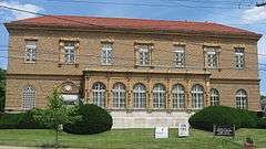
Westwood contains the Westwood Town Center Historic District.
References
- ↑ "Neighborhoods". Cincinnati magazine. Retrieved 25 July 2014.
- ↑ Clarke, S. J. (1912). "Cincinnati, the Queen City, 1788-1912, Volume 2". The S. J. Clarke Publishing Company. p. 528. Retrieved 2013-05-20.
- ↑ Federal Writers' Project (1943). "Cincinnati: A Guide to the Queen City and its Neighbors". The City of Cincinnati, Ohio. p. 570. Retrieved 2014-05-07.
Further reading
- A History of Westwood: community, continuity and change by Lyle Koehler (1944-), professional historian on staff at University of Cincinnati. Commissioned, published and sponsored by Westwood Civic Association, 1981. Noncirculating copy (one of 2) at Public Library of Cincinnati and Hamilton County, Westwood Branch, attn. Kathy Bach, branch manager and neighborhood historian. To be digitized by PLC&HC (2009).
External links
- Westwood Civic Association
- http://www.westwoodcivic.org/about.php
- http://www.hamiltoncountyohio.gov/hcrpc/data_products/census_2000/2000_census_tracts_population_density_table.pdf
- http://www.cincinnati-oh.gov/cdap/downloads/cdap_pdf3573.pdf
- http://www.cincinnatihome.org/neighborhoods/westwood/wstwood_main.asp
- http://www.heritagepursuit.com/Hamilton/HamiltonChapXXX.htm
- http://dynamic.cinci-parks.org/cgi-bin/parks.cgi/park_desc?park_id=95
- http://cincinnati.citysearch.com/profile/11346448/cincinnati_oh/mount_airy_forest.html
Coordinates: 39°08′46″N 84°35′22″W / 39.1461111°N 84.5894444°W
.png)